3-D GEOINT
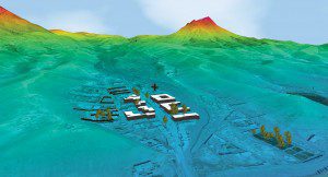
Overwatch's optimized solutions dramatically reduce the time required to produce high-quality 3-D GEOINT products.
Identifying the Problem

Combining Overwatch's feature-extraction technology with distributed processing of the workload dramatically reduces the time required to produce 3-D GEOINT products.
High-resolution 3-D terrain and mission modeling helps decision makers understand the real-world conditions they face. The current process to generate accurate modeling, however, can be too slow and cumbersome to meet the demands for 3-D products. The first stage for any modeling requires generating highly accurate data sets, but it can take days to process satellite imagery and light detection and ranging (LiDAR) point clouds to produce the refined data essential for the modeling foundation. As a result, decision makers often lack both the tools and data needed to visualize these virtual environments in a timely fashion.
Providing the Solution
Overwatch has developed capabilities to speed production of 3-D GEOINT data. The company's proven solutions reduce the time and labor required to generate 3-D products from 2-D and 3-D sources, thereby rapidly creating accurate 3-D databases for simulation and planning. Our respected Feature Analyst and LIDAR Analyst software products form the core technology, as they automate extraction of high-quality ground, tree and building feature elements from satellite imagery and LiDAR sources. To speed the pace of extraction, Overwatch introduced the ability to split the workflow by tiling the image and LiDAR data into smaller components. Additionally, these independent operations can be spread among a series of processing nodes, enabling massively parallel processing to speed results.
Serving a Wide Range of Clients
Overwatch delivers multisource intelligence, geospatial analysis and custom intelligence solutions to the Department of Defense, national agencies and civilian organizations. Our solutions enable analysts to integrate and leverage multiple intelligence sources to improve situational understanding and deliver actionable intelligence to support counter-terrorism, irregular warfare and civil applications such as climate control, ecosystem management and environmental planning.
Ensuring Successful Results
The enhanced solution combining Overwatch's feature-extraction technology with distributed processing of the workload dramatically reduces the time required to produce 3-D GEOINT products. As just one outcome, Overwatch has estimated a 90 percent time savings by using LIDAR Analyst to extract detailed terrain models. This was done by comparing the number of hours required to process 150 square kilometers of LiDAR data across ~16 distributed processing nodes, running the same analysis on a single computer.
Contact Overwatch at [email protected] to learn how we can provide similar solutions for a range of imagery analysis and extraction needs, from environmental assessment and coastal monitoring to tracking urban development.
For more information, visit www.overwatch.com.
© 2012 Overwatch Systems, Ltd. All rights reserved. Feature Analyst and LIDAR Analyst are trademarks of Overwatch Systems, Ltd. Overwatch Systems is a strategic business of Textron Systems Advanced Systems, an operating unit of Textron Systems, a Textron Inc. (NYSE:TXT) company.


