By Heidi Hainsey, U.S. Army Corps of Engineers (www.usace.army.mil), Alexandria, Va.

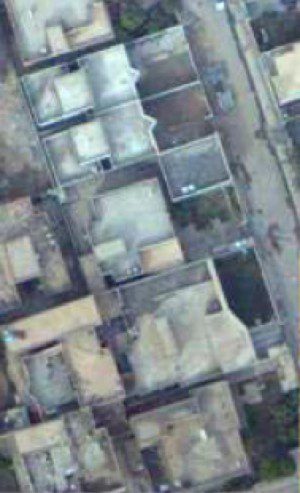
Figure 1. Unclassified Buckeye imagery can be used for mission planning and easily sent to the front-line soldier.
Imagine being thrown into a region of the world that's completely foreign”no recognizable sights or sounds. Also include extreme weather. Now add a hostile force intent on destroying you and your fellow warfighters with everything they have”bullets, mortars and improvised explosive devices. To survive, you must rely on the most current, relevant information about the surrounding area to fully understand what the enemy may be taking for granted: the terrain.
This is what our warfighters deal with daily in countries around the world, but terrain visualization of the battlefield is becoming a true force multiplier. Historically, soldiers have used whatever means available to better understand the surrounding area and how it may be used to their advantage or how the enemy may be able to use it against them.
With the advent of remote sensing, soldiers have gained a significant advantage by viewing and exploiting imagery to better understand their environment. However, remote sensing has become increasingly sophisticated, and information from various sensors can be difficult to get to the warfighters on the front lines. Trying to fill visualization gaps for better decision making is a priority for all services within the military.
Op3D, a Joint Capability Technology Demonstration (JCTD) championed by U.S. Special Operations Command (USSOCOM), managed by the Army Geospatial Center (AGC) and funded by the Office of the Secretary of Defense (OSD) and other Department of Defense (DoD) partners, offers innovative solutions to the terrain visualization challenge. The objective of the Op3D JCTD is to develop and transition capabilities to quickly discover, acquire, manage, generate, disseminate and accurately update 3-D geospatial intelligence (GEOINT) data products from multiple collection systems to the warfighter.
Overcoming Limitations
Today's warfighter has limited exposure to 3-D scene visualization because of limited availability and insufficient software tools to fully exploit them. Myriad DoD organizations and agencies share common gaps in the Collection (Discovery and Retrieval), Processing, Exploitation and Dissemination (CPED) cycle of GEOINT products (see Challenges That Must Be Overcome, page 33).

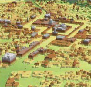
Figure 2. LiDAR can be used in processing applications to create immediate 3-D scene visualizations and products for mission planning and execution.
A JCTD is a two- to three-year program that allows state-of-the-art technologies and emerging capabilities to find their way to the warfighter in a faster, more streamlined manner than traditional methods. Op3D relies on and leverages core technologies developed by programs managed by AGC, the National Geospatial-Intelligence Agency (NGA), and USSOCOM.
Collection technologies from recently fielded organic airborne systems such as AGC's Buckeye sensor (Figure 1), as well as emerging airborne systems, provide key assets and catalysts needed to develop time-sensitive light detection and ranging (LiDAR) data processing workflows, rapid in-theater 3-D data exploitation software tools, 3-D data management and discovery database and software tools, 3-D-enhanced tactical decision aid software tools, and archive and dissemination architectures.
Early Advances
Op3D just finished its first year of development and has capitalized on mature 3-D technologies already available, integrating them into mission planning and rehearsal strategies, as well as inserting them into the military decision-making process. Technology advances include using LiDAR in multiple aspects of data processing prior to dissemination to the warfighter, decreasing the time it takes to create 3-D mission rehearsal databases, and improving the interaction between multiple DoD agencies to communicate and collaborate more effectively. Capabi-lities added in the Op3D program's second year will focus on disseminating 3-D data to the warfighter and exploiting such data.
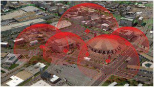
One capability under consideration would give warfighters access to a database that can serve LiDAR point cloud data to use with Web-enabled tactical decision tools (Figure 2). This would give warfighters realistic line of sight and helicopter landing zone products in a short time span. What traditionally took days or weeks to create now will take only a few minutes, and the product will be more accurate.
In traditional military-acquisition processes, new capabilities may take years to be handed over to the users. The benefit of a JCTD”and Op3D in particular”is that capabilities and technologies created will be dynamically updated and inserted into the warfighters' toolset for immediate 3-D GEOINT capability improvement. Op3D's payoffs will be seen in overseas operations, whereby advances in the CPED process will provide the warfighter with time-sensitive, mission-critical 3-D information.
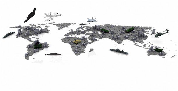
Continental U.S. geospatial production centers also will benefit, as 3-D-based products can be more quickly developed to satisfy a broad range of users and warfighters. These 3-D products will be used for everything from advanced mission planning and rehearsal to training; simulation; experimentation; analysis; after-action reviews; and, most importantly, direct mission support (Figure 3). The ability to reliably provide the warfighter with such 3-D products will increase our effectiveness in fighting the war on terror and save lives by removing the advantage, often held by the enemy, of knowing the terrain wherever our warfighters are operating.
Challenges That Must Be Overcome
With so many sources of geospatial data now available, solutions are needed to ensure 3-D and other geospatial information makes its way quickly and accurately to the warfighter. For this to occur, solutions must be designed to address the following challenges:
- Historically, collecting, processing and generating 3-D products has been labor intensive and time consuming.
- The processes, software and tools for importing, processing, converting and fusing 3-D products aren't available and/or common across product-generation facilities.
- 3-D product offerings generally are focused on a select/small suite of applications and customers.
- Cross-application 3-D product generation isn't supported routinely; conversion is costly and sometimes inaccurate.
- Dissemination typically isn't available or too data intense to rapidly disseminate 3-D products across standard distribution systems.
- There's no standard way to produce, request and acquire 3-D products; warfighters are equipped with limited software tools to exploit available 3-D products.
- There's no centralized management for GEOINT data across the National System for Geospatial Intelligence. This hampers the ability to quickly acquire GEOINT data and produce 3-D scene visualization products.


