BERLIN, Germany “ UP42 today announced that image data and information from the planned LatConnect 60 constellation of mid-inclined orbit remote sensing satellites will be available on the UP42 developer platform for Earth observation data and analytics.
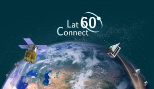
LatConnect 60 constellation will include optical and SAR small satellites.
In early 2022, LatConnect 60 will launch its first two smart small satellites equipped with onboard Artificial Intelligence (AI) for data pre-processing and advanced tip-and-cue functionality. This on-board AI has the possibility to significantly reduce costs for resellers and end users, making enterprise-quality satellite data available to a wider range of small and medium enterprises.
UP42 and LatConnect 60 share the common goal of democratizing access to Earth observation information, said UP42 CEO Sean Wiid. LatConnect 60 is developing remote sensing technology that goes beyond providing raw data to delivering easily accessible insights.
UP42 gives users direct access to extensive Earth observation datasets and advanced processing algorithms “ along with cloud computing power “ to create their own geospatial solutions easily and inexpensively. Users purchase just the data needed to cover their area of interest and then leverage out-of-the-box processing capabilities to analyze the datasets without investment in their own computing infrastructure.
Based in Perth, Australia, LatConnect 60 is positioned at the leading edge of smart satellite development, developing satellites with onboard computers running AI algorithms that will begin processing collected image and data in orbit. This will enable the small satellites to transmit derived information to ground stations faster and more efficiently. Moreover, the onboard analytics can trigger tip-and-cue procedures for the same satellite to capture additional imagery or to task another satellite “ or even a drone in the sky below “ to acquire more data over the area of interest.
The variety of algorithms available on the UP42 platform will provide customers with the opportunity to add even greater value to the image data and information coming from our satellites, said LatConnect 60 CEO and Co-Founder, Venkat Pillay. With our joint focus on delivering satellite data to businesses in a cost-effective and easy-to-understand way LatConnect 60 and UP42 are natural partners. We look forward to collaborating with UP42 in developing new methods of delivering insights directly to end users.
Another significant innovation for the LatConnect 60 constellation will be the mid-inclined satellite orbits, extensively covering areas between 60 degrees north and south latitudes, especially the Earth's equatorial regions. Each satellite will have two to three daily revisits over this often-cloudy region, increasing the likelihood of cloud-free acquisition over a specific area of interest.
We are excited to offer unique LatConnect 60 products for a region of the world underserved by consistent remote sensing coverage, said Wiid.
The first two LatConnect 60 satellites will capture one-meter spatial resolution imagery in seven spectral bands including the visible, near infrared, and red edge. The company expects to launch a total of 16 small satellites by 2025. Several will also carry synthetic aperture radar (SAR) sensors capable of collecting data through clouds and precipitation. Future satellites may be launched at 15- and 30-degree inclination orbits.
We will play a leading role in fulfilling remote sensing needs across Australia, Southeast Asia and the global equatorial region, which has been underserved by satellites such as ours, said LatConnect 60's Pillay. LatConnect 60 data will be ideal for applications ranging from forestry and agriculture to defense and maritime monitoring.
The LatConnect 60 satellite imagery and derived products join a variety of Earth observation information already on the UP42 marketplace, including Pleiades 1A/B, SPOT 6/7, Landsat-8, TerraSar-X, Sentinel-2 and MODIS satellite imagery, HxGN and Getmapping aerial data, Intermap DEMs, exactEarth AIS data, and Meteomatics weather and ocean data.
Leveraging these datasets, users may apply more than 50 geospatial analytics processes, including machine learning algorithms, to automatically find features, count objects, detect change, uncover patterns, classify land use, and derive vegetative indices.
For more information on UP42 Earth observation datasets and processing algorithms, visit www.up42.com.
About UP42
UP42 is changing the way geospatial data is accessed and analyzed. The platform and marketplace bring together multiple sources of data such as satellite imagery, weather data, and more”together with algorithms to identify objects, detect change, and find patterns. Industry leaders use UP42 to inform business decisions and build scalable customer solutions. Know when and where to fertilize crops. Measure air quality and map emissions. Count cars, trucks, planes, and ships. Developers and data scientists across all industries now have access to a platform to build, run, and scale projects in one place. Visit www.up42.com.
UP42 Contact:
Nathan Davis
About LatConnect 60
LatConnect 60 is an Australian company founded in Perth, Western Australia that provides vital insights for our world. LatConnect 60 is launching its own Low Earth Orbit (LEO) smart satellite constellation in 2021 which will have a global service reach. LatConnect 60 serves government and commercial clients by providing greater control, exclusivity and flexibility of critical EO data products and analytics services, in an affordable and accessible manner. It has developed significant patented IP in this domain and is working with leading Australian research and development institutions to deploy its innovative EO analytics capabilities both on-orbit and in the field. For more information, visit www.latconnect60.com.
