We are proud to announce the release of our brand new global imagery basemap !
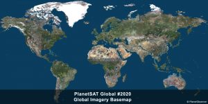
PlanetSAT Global : A worldwide satellite imagery basemap
PlanetSAT is an offer aimed at giving access to global and regional imagery basemaps in order to get detailed geographic information at every scale.
Our global satellite imagery product has an impressive resolution of 10 meters and consists in the best solution for an improved user experience.
PlanetObserver users can benefit from an up-to-date and consistent imagery with all local changes. We are committed to release a new version of our global basemap every year, based on recent and cloudless imagery.
Moreover, the visual experience remains unrivaled thanks to the unique natural color balance and the seamless view of the Earth. This results from our expertise in imagery processing, developped over more than 30 years.
Our users take advantage of a view-ready imagery with no retouching needed. All of our images have already been optimized by our team and are ready-to-use.
PlanetSAT #2020 : Updated data and imagery
We have selected best available multi-source data to process the 2020 version of PlanetSAT Global imagery.
Our latest Sentinel-2 imagery is from the 2017-2019 time frame and captures 30% of all emerged land including all capital cities and largest urban areas across the world and large regions such as Northern Africa, Middle East and Western Europe.
Sentinel-2 is used to update all largest urban areas across the world and all capital cities.
Our most recent Landsat 8 images are from the 2013-2018 time span and have been processed to cover 55% of the continents.
All our 2020 global mosaic is color-corrected, cloudless, optimized and ready-to-use in different professional format which brings great value to our users.
About PlanetObserver
Our main aim is to help Defence, Aviation, Mapping or GIS sectors optimizing and enriching their projects with performing and frequently updated satellite imagery and 3D data.
Our products are ready to use for a large range of applications such as :
- Defense : GEOIT solutions, aircraft simulators, etc.
- Aeronautics and space : Visualization & simulation, Satellite imagery orthorectification, In-flight Entertainment (IFE) solutions, etc.
- Mapping : Web-apps, GIS, etc.
- Media : Weather forecasting, press, etc.
With a constant commitment to R&D and innovation, and mastery of cutting-edge technologies, PlanetObserver is positioned as the supplier and partner of leading companies located in Europe, North America and Asia-Pacific such as Dassault, Thales, Boeing, CEA or New Zealand MetService.
All products are developed internally, backed up by PlanetObserver's know-how in geospatial data processing and more than 30 years of technological expertise.
