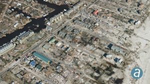
 SimActive Inc. partnered with Midwest Aerial to perform damage assessment of Hurricane Michael. Correlator3D was used to process large-format imagery collected by Midwest over Mexico Beach, Fla. The joint effort resulted in highly precise geospatial data, including a DSM, an orthomosaic and a 3D model.
This is a terrible disaster for the people affected, and we hope they can benefit from geospatial technologies available, said Dr. Philippe Simard, president of SimActive.

