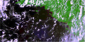
The first raw image from the Proba-V satellite was acquired over France's west coast on May 15, 2013. The image was generated using the three VNIR bands”blue, red and near-infrared (NIR)”superposed, the green being replaced by the NIR.
The European Space Agency's Proba-V is in good health following its recent launch. The satellite's Vegetation imager has been switched on and has captured its first image.
The miniature satellite is designed to map land cover and vegetation growth across the entire planet every two days. The data can be used for alerting authorities to crop failures or monitoring the spread of deserts and deforestation.
Proba-V is flying a lighter but fully functional redesign of the Vegetation imaging instruments previously flown aboard France's full-sized Spot-4 and Spot-5 satellites, which have been observing Earth since 1998. The minisatellite will provide data to the instrument's worldwide user community of scientists and service providers as soon as its orbital commissioning“including cross-checks with Spot-5's Vegetation instrument“is complete.
Image courtesy of European Space Agency.

