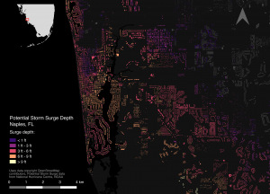
An image highlights the potential storm surge for properties in Naples, Fla., identifying which areas and properties are most at risk by combining OpenStreetMap data and predicted storm surge data.
Hurricane Harvey in Houston, Irma across the Caribbean and Florida, and the earthquake that struck off the southern coast of Mexico have left communities grieving for lost relatives and in need of urgent support to rebuild the vital infrastructure of their towns and cities.
In an effort to make this process move as smoothly and quickly as possible, Brainnwave, an Edinburgh, Scotland-based startup, added all the relevant datasets, sourced by the World-wide Human Geography Data Working Group, to its Marketplace website from where they can be freely downloaded and used.
This will provide a single point of access to vital information needed by humanitarian organizations and charities as well as first-responders and logistics planners on the ground. Available datasets have been sourced from organizations such as the U.S. Geological Survey, the Pacific Disaster Centre, Esri, EU-Copernicus and the United Nations, among others.

