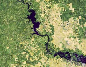
 On Nov. 1, 2018, the Operational Land Imager (OLI) on Landsat 8 captured a false-color view of flooding along the Nueces River in a series of storms that have delivered historic amounts of rain to central Texas. The remnants of the category 3 storm, Hurricane Willa, weakened Texas' dry terrain, pushing in a stream of moisture and rain. The deluge saturated soils, overfilled lakes and reservoirs, and pushed rivers over their banks. One river even flowed backwards. Dallas Fort Worth Airport recorded 39.77 centimeters (15.66 inches) of rain in October 2018, making it the wettest October on record there, according to the National Weather Service.
Image Credit: NASA/Joshua Stevens, using Landsat data from the U.S. Geological Survey and IMERG data from the Global Precipitation Mission (GPM) at NASA/GSFC

