05 January, 2016 ” The Open Geospatial Consortium (OGC) requests public comment on the OGC candidate Discrete Global Grid Systems (DGGS) Core Standard.
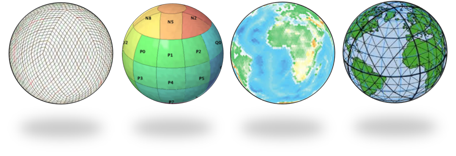
The OGC DGGS candidate standard defines a set of rules for defining highly efficient architectures for spatial data storage and analytics. The goal of DGGS is to enable rapid integration of spatial data without the difficulties of working with legacy coordinate systems. DGGSs represent the Earth as sequences of cell tessellations each with global coverage and with progressively finer spatial resolution. Individual observations can be assigned to a cell corresponding to both the position and size of the phenomenon being observed. DGGS come with a standard set of functional algorithms that enable rapid data analysis of very large numbers of cells.
There is explosive growth in both the variety and the volume of spatial data and processing resources, along with a growing understanding of the tremendous benefit that can be derived from enabling interoperability between them. On the other side of this deluge of spatial content is a growing demand by decision-makers for a participatory environment where content can be accessed directly from diverse contributors and used with other content without reliance on time-consuming and costly geographic transformation processes.
One of the core contributions of a DGGS is geospatial data fusion on demand. In a multiple provider environment, fusion is only possible with an information system architecture based upon open standards. The candidate OGC DGGS Core Standard enables interoperability within and between different Discrete Global Grid Systems and it promotes reusability, knowledge exchange, and choices.
The documents for the candidate OGC Discrete Global Grid Systems (DGGS) Core Standard are available for review and comment at (www.opengeospatial.org/standards/requests/143). Comments are due by 04 February, 2016.
The OGC® is an international geospatial standards consortium of more than 515 companies, government agencies, research organizations, and universities participating in a consensus process to develop publicly available standards. OGC standards support interoperable solutions that “geo-enable” the Web, wireless and location-based services and mainstream IT. Visit the OGC website at www.opengeospatial.org/.
