BELLEVUE, Wash. “ EagleView, a leading technology provider of aerial imagery, data analytics, and GIS solutions for government, construction, and insurance has received its first post-event images following Hurricane Zeta. As soon as weather conditions permitted, EagleView's fixed-wing aircraft were in the air capturing ultra-high-resolution Revealâ„¢ aerial imagery at Property Level, which ranges between 0.8-3 inches ground sample distance (GSD) depending on environmental factors.
EagleView imagery is an essential tool for first responders, insurance carriers, and construction contractors. EagleView provides rapid access to post-event property information such as roof damage, flooding and fallen trees, without having to send people into potentially dangerous areas. Leading up to Hurricane Zeta's landfall on Wednesday, October 28, EagleView began staging multiple aircraft and planning areas of interest to ensure rapid image capture.
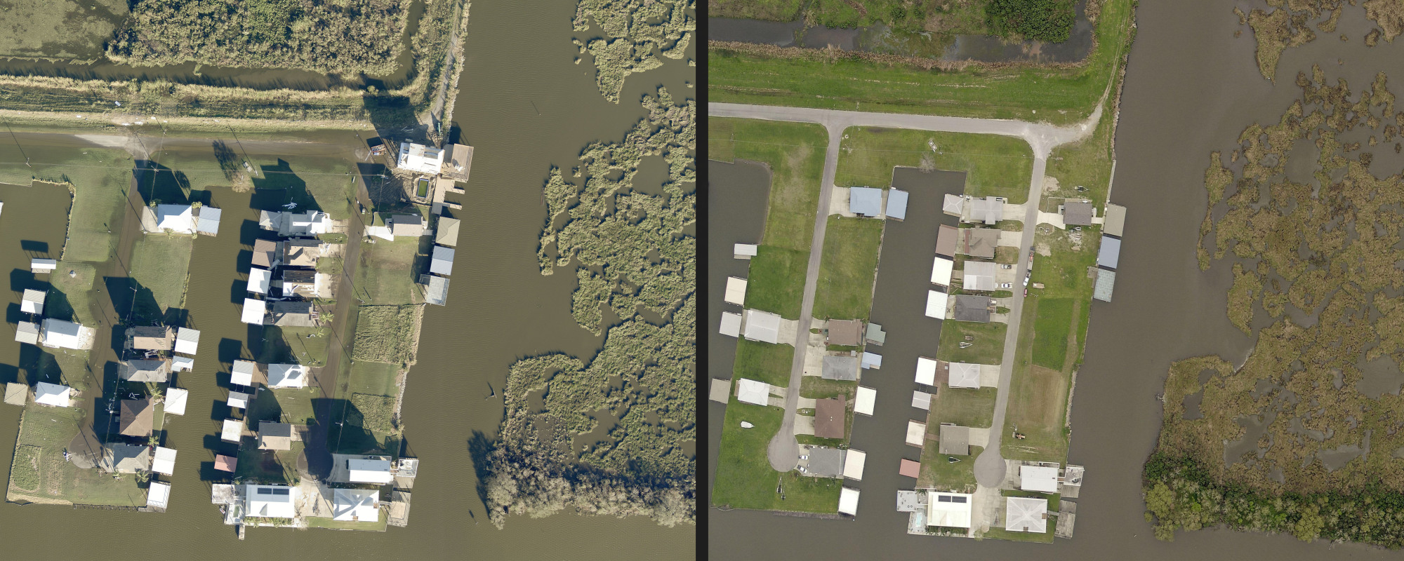
Note the extensive flooding on the left-hand side.

Blue tarps on the left-hand side indicate damaged roofs.

