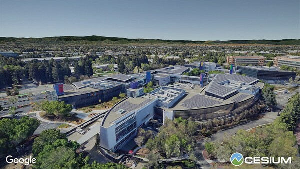
PHILADELPHIA – Philadelphia-based 3D geospatial company, Cesium, has partnered with Google Maps Platform on the experimental release of Photorealistic 3D Tiles, available through their Map Tiles API. Photorealistic 3D Tiles, announced at Google I/O, use the Open Geospatial Consortium’s 3D Tiles community standard pioneered by Cesium.
“We believe today is a new inflection point, where Photorealistic 3D Tiles will spark innovation across the community and enable developers to build never-before-seen applications and experiences,” said Cesium CEO Patrick Cozzi.
The Map Tiles API serves Photorealistic 3D Tiles to an open ecosystem of 3D Tiles-enabled runtimes including CesiumJS, Unreal Engine, Unity, and NVIDIA Omniverse. The experimental release is the result of two years of collaboration between Google and Cesium.
Additional tools announced at Google I/O that leverage Photorealistic 3D Tiles include:
- Google’s Geospatial Creator in Unity – A new workflow within ARCore Extensions for AR Foundation SDK that allows users to visualize the real world with Photorealistic 3D Tiles and Cesium for Unity.
- Google’s Geospatial Creator in Adobe Aero, which enables the loading of Photorealistic 3D Tiles in a location of choice to anchor AR objects to the real world.
Cesium has released sample code and tutorials to help the community get started with Photorealistic 3D Tiles. Developers can also use Cesium ion to combine their own 3D geospatial data with Photorealistic 3D Tiles to build immersive metaverse experiences and applications.
About Cesium – 3D Geospatial for the Metaverse
Cesium is the open 3D geospatial platform for the metaverse. Cesium created 3D Tiles, the open standard for streaming massive 3D geospatial data. With open source offerings like Cesium for Unreal, Cesium for Unity, and Cesium for Omniverse, we’re empowering creators to build digitized worlds with real-world data at scale.
SOURCE Cesium


