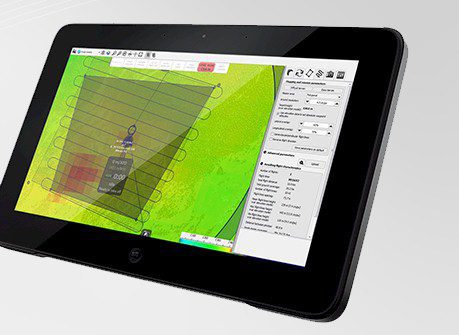
Multiple drones mapping remote areas autonomously is no longer science fiction. The most advanced version of senseFly's ground control software puts years of research into users' hands.
Multiple drones mapping remote areas autonomously is no longer science fiction. The most advanced version of senseFly's ground control software puts years of research into users' hands.
Toronto, Oct. 1, 2013—Avenza Systems Inc., producers of MAPublisher® cartographic software for Adobe® Illustrator® and Geographic Imager® geospatial tools for Adobe Photoshop®, announced the long-awaited launch of the PDF Maps app on the Google Play Store. ...
Hallowell, Maine, Oct. 1, 2013—Blue Marble Geographics is pleased to announce the release of Global Energy Mapper version 15. The release of this powerful GIS software for energy professionals offers many new features and improved installation procedures. The latest...
Lemmer, The Netherlands, Oct. 7, 2013—Geo-matching.com, the product comparison website for devices used in geomatics, hydrography and related industries, is pleased to announce the addition of a new category for Unmanned Aerial Systems. The types of Unmanned Aerial...
Toronto, Oct. 7, 2013—Optech, the world leader in the development, manufacture and support of advanced lidar and camera survey instruments, is pleased to announce the latest addition to its innovative line of airborne laser terrain mappers (ALTM), the Optech Orion...
GREENBELT, Md., Oct. 1, 2013—Orbit Logic announced today that its SpyMeSat iPhone app is now available on the Apple App Store. The SpyMeSat app provides notifications when imaging satellites are overhead and may be taking your picture. A dynamic map shows orbit...
Ramat Gan, Israel, Oct. 6, 2013—VisionMap and SOMAG AG Jena are pleased to announce the compatibility of SOMAG’s VSM 500 Gyro Stabilization Mount with VisionMap’s A3 family of digital mapping cameras. Specifically designed for the A3 family, SOMAG’s...
TORONTO, Oct. 1, 2013—The MAPublisher team of instructional experts will be in San Francisco again this year offering hands-on instructive sessions on the use of this powerful cartographic software package. Realize the full potential of MAPublisher taught by one of...
DAYTON, Ohio, Oct. 1, 2013—The Advanced Technical Intelligence Center (ATIC) in Dayton, Ohio announced that the 2013 Dayton Intelligence Symposium will be held in their Conference Center on October 23, 2013. The confirmed speakers for this year’s event include: ·...
MISSOULA, MONT., Oct. 2, 2013–GCS has announced that Location Analytics will be the next topic in its Geospatial Big Data webinar series. “Leveraging Location Analytics: Delivering Spatial Algorithms and Functions†will feature live demonstrations showing how...
