Kassel, Germany, July 2, 2014—The Mexican company SkyBótica and the German drone manufacturer Aibotix have created detailed 3D models of the library and stadium of the National Autonomous University of Mexico (UNAM). The point clouds with a resolution of up to 5 mm...
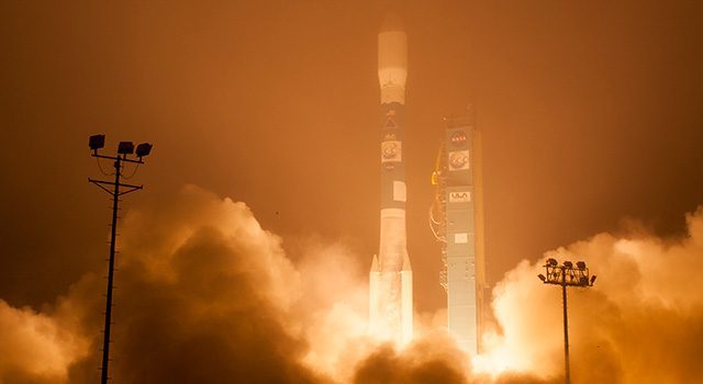
NASA Launches Long-Awaited Carbon Mission
The Orbiting Carbon Observatory-2 satellite aims to pinpoint atmospheric carbon dioxide, the leading human-produced greenhouse gas responsible for warming our world.
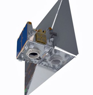
Satellite Sail Could Mitigate Orbital Debris Problem
At the end of its mission, the descent of Surrey Satellite Technology Ltd.’s TechDemoSat-1 satellite will be assisted by a specialized de-orbit sail just one-thousandth of an inch thick.

Skycatch Aims to Offer Drones for Hire
Skycatch, like Google's recently purchased satellite venture, is seeking ways to make high-resolution, easily accessible aerial imagery a part of how the everyday world works.
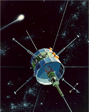
‘Citizen Scientists’ Take Control of Abandoned NASA Satellite
With NASA's blessing and following a successful crowd-funding campaign, a group of citizen scientists have taken control of an abandoned NASA satellite with plans to put it back to work.
CoreLogic Releases New Natural Catastrophe Platform and Risk Models
IRVINE, Calif., July 2, 2014—CoreLogic® (NYSE: CLGX), a leading global property information, analytics and data-enabled services provider, today released a new version of its EQECAT™ natural catastrophe modeling platform which contains three new proprietary risk...
Esri Mapping Platform Secured for Federal Agency’s Use
Redlands, Calif., June 25, 2014—The Esri ArcGIS Online platform is now authorized and accredited by the United States Department of Agriculture (USDA) as a secure platform for delivering cloud-based geospatial services. Following a rigorous assessment, the agency...
Headwall Announces Fully Integrated Nano-Hyperspec Sensor Payload for Small Hand-Launched UAVs
Fitchburg, Mass., June 23, 2014—In extending technological leadership within the remote sensing market, Headwall announced availability of its new Nano-Hyperspec sensor for commercial UAV deployment. The low-cost hyperspectral sensor operates in the VNIR...
Leica Launches GeoMoS Now! Web-Based Application with Real-Time Access for Informed Decision Making
Norcross, Ga., June 26, 2014—Leica Geosystems launches Leica GeoMoS Now!, a new web-based application that is part of the Leica Geosystems monitoring solution and enables on-the-go visualization and analysis of structural and ground movement monitoring data. Large...
OGC Calls for Participation in a CityGML Data Quality Interoperability Experiment
June 24, 2014—The Open Geospatial Consortium (OGC) calls for participation in an interoperability experiment to define data quality requirements for virtual 3D city models encoded in CityGML. CityGML has been widely adopted and is used throughout the world as a data...
