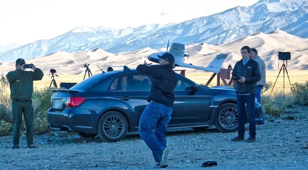
An innovative mapping project using unmanned aircraft systems within the Great Sand Dunes National Park and Preserve in south-central Colorado was completed by a collaboration among UAS Colorado, Black Swift Technologies, the National Park Service and Wohnrade Civil Engineers Inc.
Sanborn Expands Oblique Imagery Collection
COLORADO SPRINGS, Colo. — The Sanborn Map Company, Inc. (Sanborn), an industry leader in acquisition and processing of high-resolution oblique aerial imagery, announces the recent addition of 35 newly available oblique imagery datasets to its extensive oblique...
NOAA Releases First GOES-16 Image from Harris Corporation-Built Imager and Ground System
MELBOURNE, Fla. - The National Oceanic and Atmospheric Administration (NOAA) has released the first image taken by Harris Corporation’s (NYSE:HRS) Advanced Baseline Imager (ABI) onboard their next-generation weather satellite. The image taken from the Geostationary...
Airbus Defence and Space Delivers Propulsion Test Module for the Orion Programme to NASA
Bremen, 24/01/2017 - Mid-January 2017 Airbus Defence and Space delivered to NASA a propulsion test module for the Orion programme. The Propulsion Qualification Test Model (PQM) will be used to check that the Orion European Service Module (ESM) spacecraft’s...
RapidSOS and GeoComm Partner to Provide Accurate Location and Enhanced Data to 9-1-1 Centers
GeoComm and RapidSOS are pleased to announce a strategic partnership to provide public safety agencies that use GeoComm 9-1-1 Public Safety Answering Point (PSAP) mapping systems with accurate location and additional data from the RapidSOS Clearinghouse. Through this...
PCI Geomatics Marks Milestone in Cloud-Based Image Processing
PCI Geomatics, a world-leading developer of remote sensing and photogrammetric software and systems, announced today that it is six years since it began providing clients with cloud-based processing. Big data is a challenge that the remote sensing industry has...
UAS Colorado Joins Wohnrade Civil Engineers for Great Sand Dunes National Park Mapping Project
Denver, Colorado – January 24, 2017 – UAS Colorado is pleased to announce the completion of an innovative mapping project using unmanned aircraft systems (UAS) within the Great Sand Dunes National Park and Preserve in south central Colorado. This project was a...
Esri India Launches GIS Academia Council
NOIDA: Geographic Information System (GIS) Software & Solutions provider Esri India has launched GIS Academia Council of India. The council will serve as a platform for GIS knowledge sharing aimed at encouraging GIS adoption and promoting teaching excellence in...
exactEarth Announces Successful Initial Launch for its Second Generation Real-Time Constellation
Cambridge, ON – exactEarth Ltd. (TSX: XCT), the leading provider of Satellite AIS data services, announced the successful launch of four hosted payloads for its next generation constellation, exactView™ RT powered by Harris. Launched aboard an Iridium NEXT...
RapidSOS and Hexagon Safety & Infrastructure Partner to Equip 9-1-1 Centers with Accurate Location from Smartphone Callers
Huntsville, Alabama – Hexagon Safety & Infrastructure and RapidSOS have partnered to provide public safety agencies that use Hexagon’s Intergraph® Computer-Aided Dispatch (I/CAD) with accurate location and additional data from the RapidSOS NG911...