Covering 3,000 square kilometers, the Zambezi Delta in Mozambique is one of the most diverse and productive river delta systems in the world.
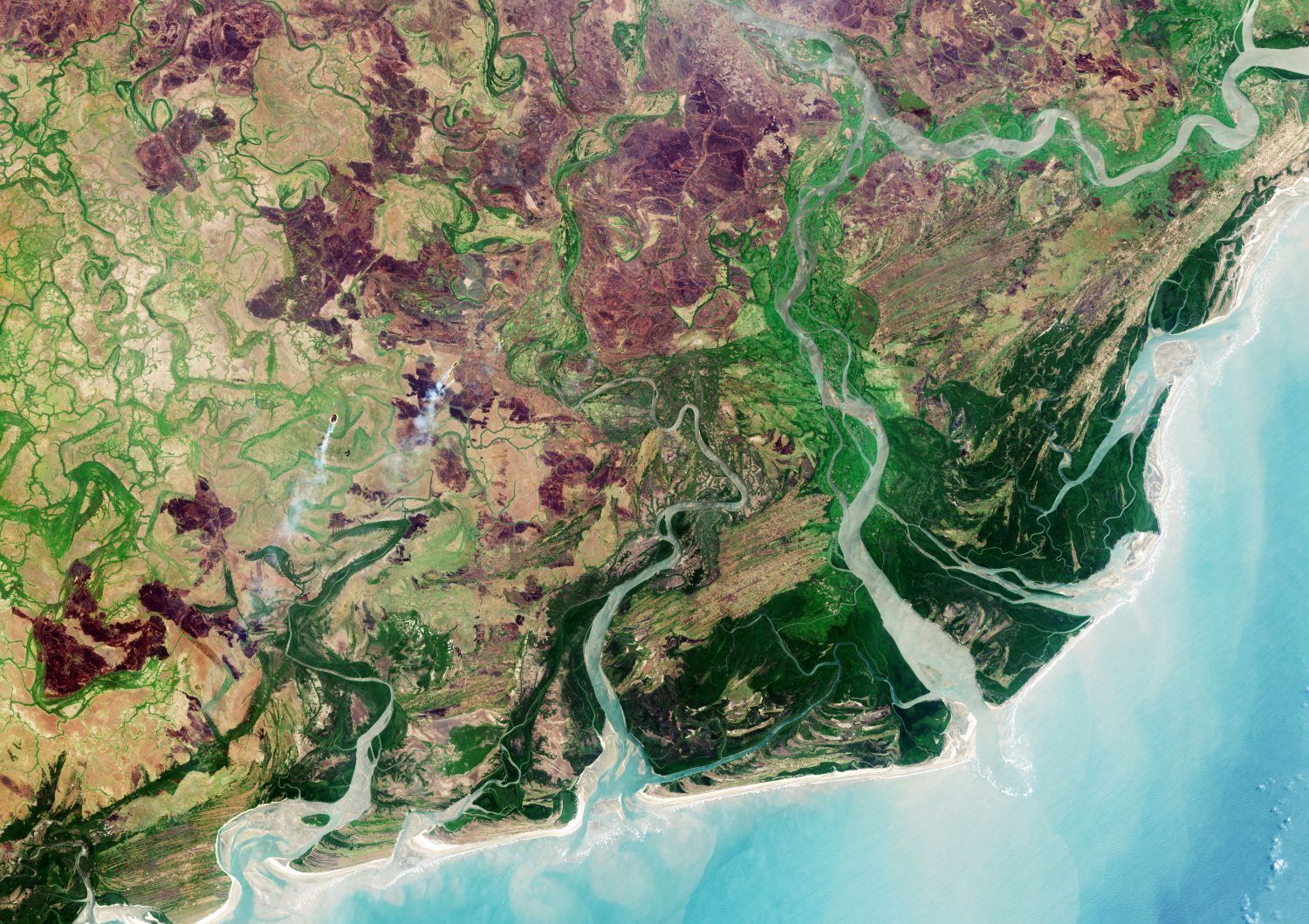
Covering 3,000 square kilometers, the Zambezi Delta in Mozambique is one of the most diverse and productive river delta systems in the world.
TerraGo, a leading provider of dissemination and collaboration software for defense and intelligence agencies, announced today the availability of R3, a mobile data collection and collaboration app customized for the missions of reconnaissance, response and recovery....
St. Louis, MO – May 22, 2018 – Boundless, the leader in open and scalable GIS, today introduced Boundless Offline Tile ServerTM, a lightweight, portable, purpose-built map tile server that provides detailed global basemaps on demand while offline. With this...
Herndon, VA – Skyline Software Systems Inc. announced today that it has released PhotoMesh™ v7.4 software suite as part of its SkylineGlobe products. This update integrates light detection and ranging (LiDAR) data, significantly improves processing speed and...
San Francisco, CA — Swift Navigation, ​​a ​​San ​​Francisco-based ​​tech ​​firm that is building centimeter-accurate ​​GPS ​​technology ​​to ​​power ​​a ​​world ​​of ​​autonomous ​​vehicles, ​​today...
The Samuel Finley Breese Morse Medal, awarded by the American Geographical Society (AGS), is one of several prestigious honors given by the Society. Dr. Christopher Baruth, former Curator of the American Geographical Society Library (AGSL), will receive the medal...
GAITHERSBURG, Md. - GL Communications Inc., a global leader in telecom test and measurement solutions, today announced its enhanced Location Services (LCS) architecture in LTE network briefly, and its latest MAPSâ„¢ SLs Emulator solution to meet the requirements in...
HARRISBURG, Pa.- The Pennsylvania Department of Transportation (PennDOT) has signed Woolpert to one of three statewide photogrammetry contracts. The five-year, $2 million contract is for geodetic survey and photogrammetric mapping, including stereo-compliant aerial...
MADRID and VANCOUVER - UrtheCast Corp. (TSX: UR) ("UrtheCast" or the "Company") and its subsidiary, the Earth Observation company Deimos Imaging SLU ("Deimos Imaging"), announced today that Deimos Imaging has entered into a contract with the Brazilian Ministry of...
SANTA CLARA, Calif. - Telenav®, Inc. (NASDAQ:TNAV), a leading provider of connected-car and location-based platform services, announced the world’s first open-source machine-learning technology designed to detect navigation features in street-level imagery....
