Nancy Grace Roman (1925-2018), NASA's first chief astronomer, is known as the Mother of Hubble.
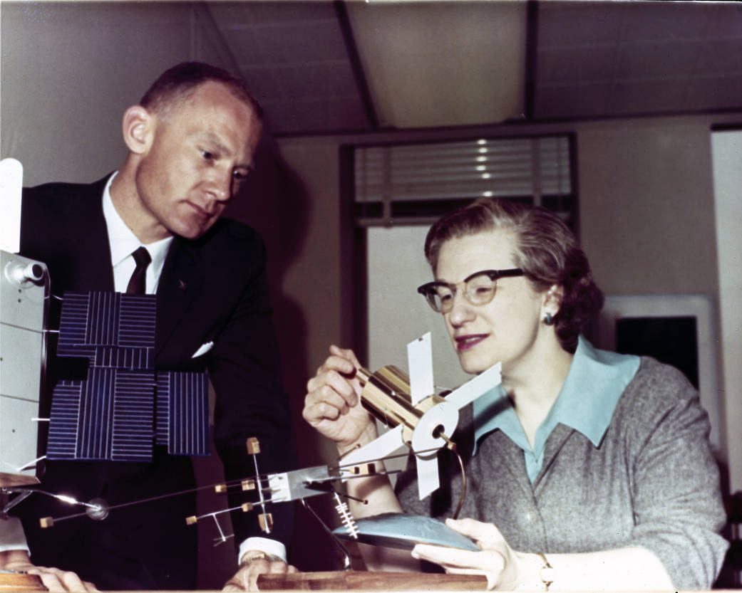
Nancy Grace Roman (1925-2018), NASA's first chief astronomer, is known as the Mother of Hubble.
REDLANDS, Calif.- Esri, the global leader in location intelligence, today announced a partnership with 3LOG Systems, the makers of the preeminent log inventory management solution in the world forestry marketplace. Together, Esri and 3LOG will offer the...
REDLANDS, Calif.- Esri, the global leader in location intelligence, today announced the publication of Women and GIS: Mapping Their Stories. Throughout history, women have greatly enriched fields from science to education, leading research and directing decisions...
RENO, Nev.-Â Flirtey has received approval from the Federal Aviation Administration (FAA) to conduct drone delivery flights beyond visual line of sight (BVLOS), the City of Reno and Flirtey announced today. The new approval enables Flirtey to conduct drone delivery...
Fort Collins, Colo. – Schneider Electric, the industry leader in Geographic Information System (GIS) solutions for utilities and communication providers, was honored with the Delivering Release-Ready Solutions Award at the Esri Partner Conference held March 2-4...
GENEVA - TomTom (TOM2), the leading independent location technology specialist, and Elektrobit (EB), an award-winning global supplier of embedded and connected software products for the automotive industry, today announced the release of an industry-first High...
Leicestershire, UK – As part of the Aerial Photography for Great Britain (APGB) contract with the UK’s Geospatial Commission, Bluesky and Getmapping are providing free at the point of use Web Mapping Services (WMS) for qualifying local government organisations....
MILL VALLEY, Calif.- CycloMedia, the leading provider of accurate geospatial imagery-data and data analytics, announced today that it has acquired Floating Point FX, a 3D geospatial modeling company based in Madison, Wisconsin. Floating Point FX (FPFX) provides...
REDLANDS, Calif.- Esri, the global leader in location intelligence, today announced that it will sponsor the Mayor Byron W. Brown's Civic Innovation Eco Challenge at the Civic Innovation Jam on Saturday, March 9, in Buffalo, New York. The event will include a hands-on...
SAN DIEGO - Kratos Defense & Security Solutions, Inc. (NASDAQ:KTOS), a leading National Security Solutions provider, announced today that Kratos’ XQ-58A Valkyrie completed its maiden flight on March 5, 2019 at Yuma Proving Grounds, Arizona. Kratos Unmanned...
