Tel Aviv, Israel - Israeli startup TriEye, whose innovative Short-Wave-Infra-Red (SWIR) sensing technology is able to see in adverse weather and night-time conditions, announced today a $17M Series A funding round, led by Intel Capital. Other investors include Marius...
Phase One Industrial Introduces Three High Performance Lenses for High-Altitude Aerial Photography and Long-Range Aerial and Ground Inspection
COPENHAGEN – Phase One Industrial today expanded its RS and RSM lens offering with three new high performance lenses for high-altitude aerial photography and long-range aerial and ground inspection applications. The 300mm AF, 180mm, and 150mm MK II lenses are...
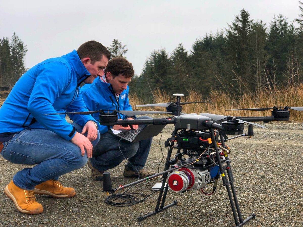
USGS, Scientists Test Drone-Based Stream Gauging at ˜2019 Aquatic Airshow'
AUBURN, Maine — U.S. Geological Survey (USGS) and independent scientists gathered this month in Auburn, Maine, to evaluate the use of sensor-mounted unmanned aircraft systems (UAS), or drones, to gauge stream stage, velocity, bathymetry and discharge. The technology...
LiDAR Used to Map Vegetation in Scottish Forests, Monitor Tropical Deforestation
Soaring over Scotland's majestic landscape and beautiful forests, drones are helping to map the species growing under the upper canopy of the trees thanks to advanced laser technology.
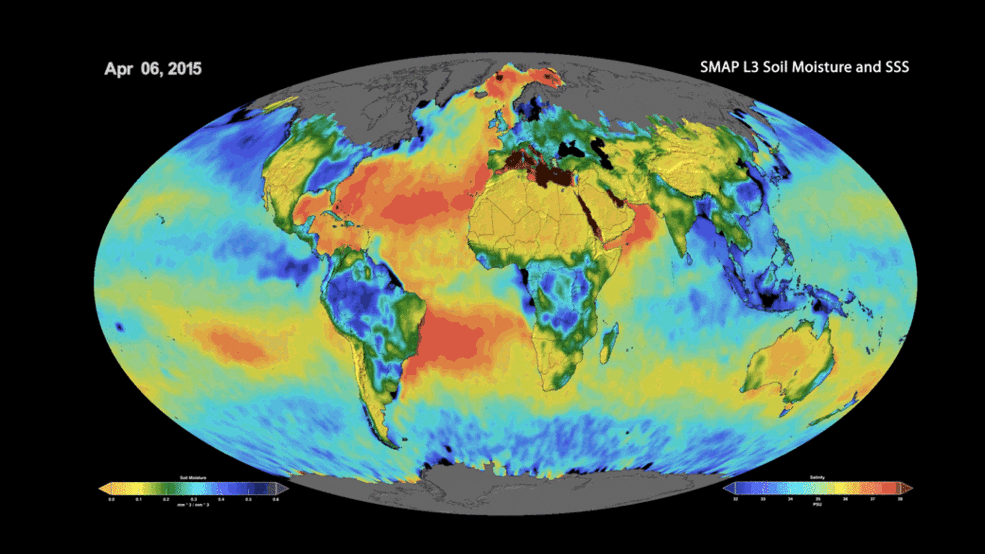
Seasonal Monsoon Rains Block Key Ocean Current
Our oceans and the complex “conveyer belt” system of currents that connects them play an important role in regulating global climate.
Australian Space Research Conference to be held in Adelaide
South Australia has further strengthened its position as the leader of Australia’s space industry by securing another important space conference. To be held at the Adelaide Convention Centre from September 30 to October 2, the 19th Australian Space Research...
Maptitude Team is a 2019 NEURISA Sponsor
NEWTON MA (USA) - The Maptitude mapping software team, who manage the popular business mapping application, today announced that they are a 2019 NEURISA sponsor. Stewart Berry, Vice President at Caliper Corporation, said, "We are proud to be able to make our...
Global LiDAR Market Size to exceed $10 Bn by 2025
LiDAR Market size is set to exceed USD 10 billion by 2025; according to a new research report by Global Market Insights, Inc. Â There has been a rise in the demand for 3D imaging solutions due to the increasing development of smart city projects and its expanding...
GSSI Receives Presidential Award for Exports
Nashua, New Hampshire— Yesterday, U.S. Secretary of Commerce Wilbur Ross presented Geophysical Survey Systems, Inc, (GSSI) with the President’s “E†Award for Exports at a ceremony in Washington, D.C. In total, Secretary Ross honored 48 U.S. companies with the...
Extensis to Cameo Digital Asset Management Solution Incorporating LizardTech's MrSID at GEOINT 2019
PORTLAND, Ore.– Extensis® will demonstrate its full suite of digital asset, font, and imagery management solutions - which now incorporate LizardTech products and technology - at GEOINT 2019 in San Antonio, Texas. Portfolio, the flagship Extensis digital asset...
