SANTA FE, N.M.- Descartes Labs, a New Mexico-based geospatial analytics company, today announced that it has won a $2.2 million direct award contract through the Air Force Research Lab’s (AFRL) Space Technology Advanced Research (STAR) program. With this contract,...
The tunable sensitivity of ActLight Dynamic Photodiode enables improved 3D sensing performance in LiDAR
LAUSANNE, Switzerland - ActLight, the Swiss technology firm known for its best in class signal-to-noise ratio photodiodes, announced today that the continuous development of its patented low voltage single photon sensitivity technology has reached outstanding...
Continental expands LiDAR technology portfolio by investing in robotic vision and sensing pioneer AEye
Technology company Continental is further strengthening its LiDAR sensor portfolio through a minority investment in LiDAR pioneer AEye, Inc. LiDAR sensors belong, besides camera and radar, to the key technologies for Automated Driving. Technology company Continental...
Plus3 IT Systems Awarded NGA’s Digital Engineering Contract
RESTON, Va. - Plus3 IT Systems, LLC (Plus3 IT) is pleased to announce it has been awarded the National Geospatial-Intelligence Agency (NGA) Digital Engineering (NDE) contract as a Prime contractor. Plus3 IT will provide improvements to the DevSecOps pipeline, Cloud...
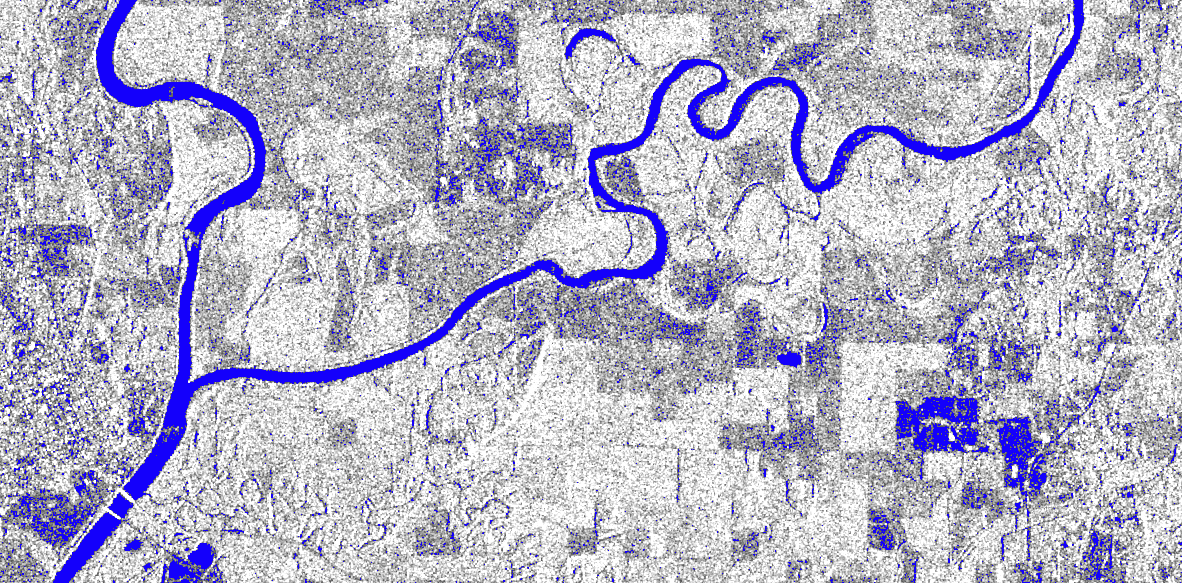
New radar system developed to help marine industry
A NEW radar system to help the marine industry safely navigate is being developed by a pioneering business. Createc, which has a worldwide reputation for providing imaging, sensors and robotics solutions to a range of sectors including defence, security, rail,...
North Dakota Announces Vantis as Statewide UAS BVLOS Network
Grand Forks, N.D. – Already a thriving ecosystem of unmanned aircraft systems (UAS) in public and private use, North Dakota takes the next step in UAS advancement, commercialization and development by introducing Vantis, the nation’s first statewide UAS...
UP42 Partners with Intermap to Bring High-Resolution Elevation Data to UP42's Geospatial Marketplace
BERLIN, Germany – UP42 is pleased to announce that the NEXTMap Elevation Data Suite from Intermap Technologies is now offered on the UP42 developer platform for Earth observation data and analytics. The NEXTMap 3D elevation products are available as Digital Surface...
GeoSLAM Completes Spook-Tacular Scanning of Californian Landmark
The team at geospatial 3D mapping specialist GeoSLAM has produced a digital twin of one of the world’s most haunted mansions, The Winchester Mystery House, using the newly-launched ZEB Go. It may be hard to believe the feat of scanning this vast architectural...
NASA Funds Projects to Make Geosciences Data More Accessible
NASA has funded 11 new projects as part of the agency's Earth Science Data Systems' Advancing Collaborative Connections for Earth Systems Science (ACCESS) program. Proposals submitted in 2019 and funded in 2020 focused on three areas: machine learning, science in the cloud and open source tools.
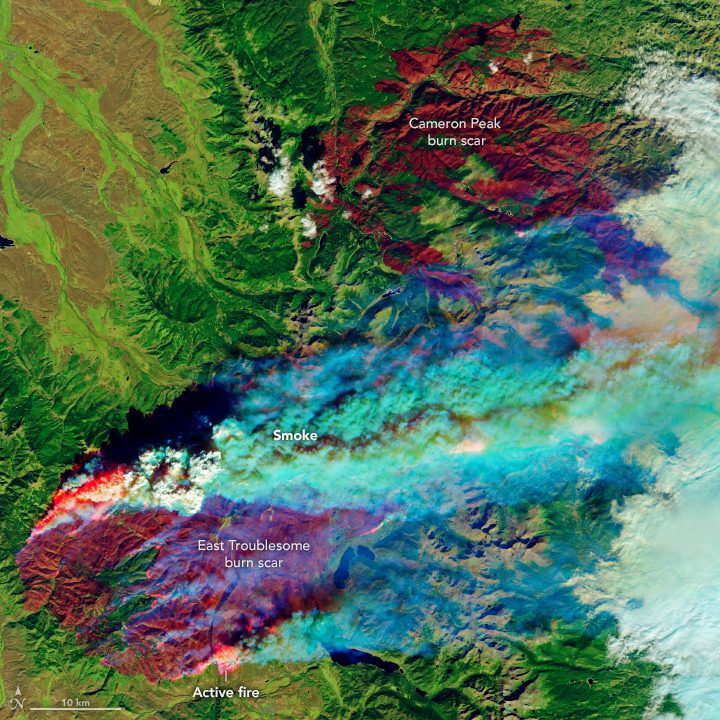
East Troublesome Fire Spreads to the Rockies
Within 10 days, the East Troublesome fire had burned through more than 190,000 acres (77,000 hectares) and had become Colorado's second largest fire (by area) on record. As of Oct. 26, 2020, it was 15 percent contained.
