The team at geospatial 3D mapping specialist GeoSLAM has produced a digital twin of one of the world’s most haunted mansions, The Winchester Mystery House, using the newly-launched ZEB Go. It may be hard to believe the feat of scanning this vast architectural...
NASA Funds Projects to Make Geosciences Data More Accessible
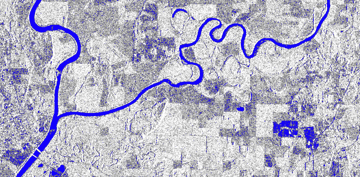
NASA has funded 11 new projects as part of the agency's Earth Science Data Systems' Advancing Collaborative Connections for Earth Systems Science (ACCESS) program. Proposals submitted in 2019 and funded in 2020 focused on three areas: machine learning, science in the cloud and open source tools.
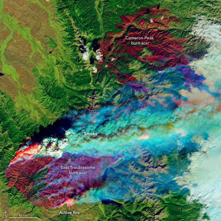
East Troublesome Fire Spreads to the Rockies
Within 10 days, the East Troublesome fire had burned through more than 190,000 acres (77,000 hectares) and had become Colorado's second largest fire (by area) on record. As of Oct. 26, 2020, it was 15 percent contained.
Dewberry’s Sid Pandey Appointed to URISA Vanguard Cabinet
The Urban and Regional Information Systems Association (URISA) has announced its members of the 2021-2023 cohort of the Vanguard Cabinet, including Sid Pandey, CSM. Pandey is an associate with Dewberry in its geospatial and technology services (GTS) group. He is...
Fugro receives US President's ˜E' Award for export growth
Fugro in the US has been granted the President’s ‘E’ Award for Exports from the US Department of Commerce. Established by Executive Order of the President in 1961, this award is the highest honour made to US exporters. Fugro is one of thirty-nine firms selected...
Industry leaders Parrot and Pix4D unite to offer the most complete professional solutions with ANAFI USA
ANAFI USA and the Pix4D software suite now offer an even more comprehensive and powerful solutions to respond to professionals’ ever-growing specific needs  Paris and Lausanne – Parrot, the leading European drone group, and Pix4D, the leading professional...
1Spatial partners with Environment Agency and Defra to enable automatic quality-assured and timely geoCOBie asset information delivery from suppliers
Cambridge, UK- (www.1spatial.com) 1Spatial, a global leader in Location Master Data Management software, solutions and business applications have been awarded the Environment Agency and Defra Datastore, Rules and Visualisation (DRV) contract following a competitive...
Prius Intelli Offers Free Access to* Aerial Imagery and GIS Services to Help Companies Make Business Decisions
FT. WORTH, Texas - Challenging times require extra measures for companies to succeed, and COVID-19 has indeed created many challenges.  To stay competitive in these times, industries such as oil and gas, real estate and agriculture are undergoing a digital...
Livox Continues To Push Lidar Industry Forward With Two New Solutions For Long Range and Short Range Detection
HENZHEN, China - Livox Tech, the world's leading Lidar developer and manufacturer, announced two new product solutions, the Mid-70 for blind spot free short range detection and Avia for improved long range detection. Since the release of the Mid-40, Livox continues to...
CACI's Aerial Sensor Technology Provides Real-Time Heat Mapping Data and Reduces Risk to Firefighters
ARLINGTON, Va.- CACI International Inc (NYSE: CACI) announced today that its aerial sensor technology is being deployed to help responders battle wildfires across the American West. CACI is providing electro-optical/infrared (EO/IR) sensors, which deliver data that...
