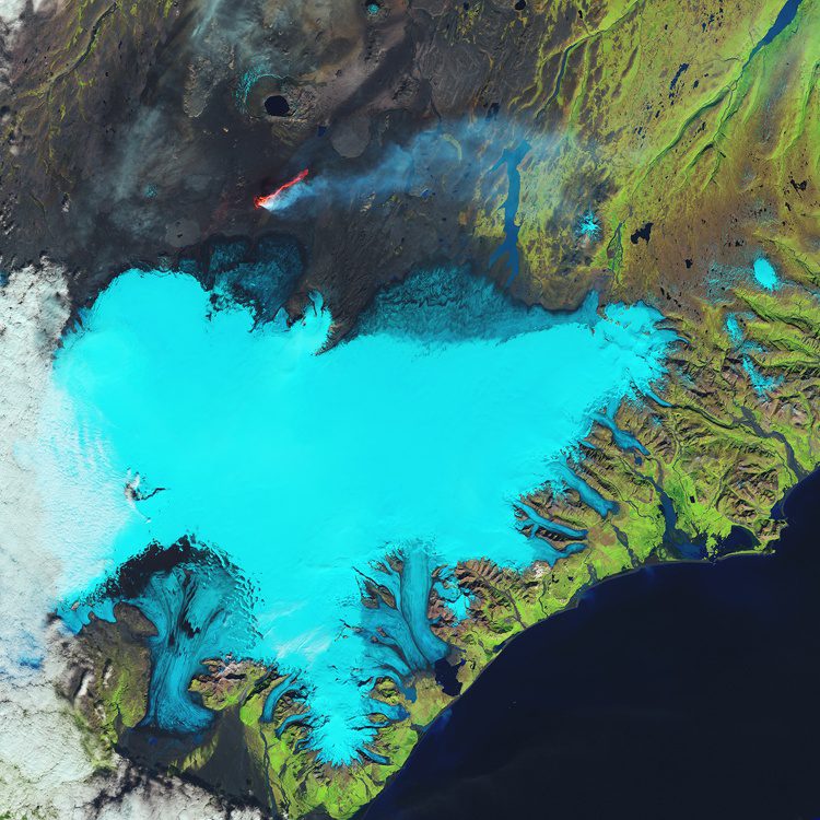
Glaciers cover 11 percent of Iceland's landscape, and the Vatnajökull (Vatna Glacier in English) is 8,000 square kilometers and the largest in Europe. The Landsat-8 satellite captured this false-color image over Iceland's southeastern coast and the Vatnajökull glacier.
Icelandic Organisations Pledge to Provide Data for Gateway to Pan-European Maps and Land Information
Iceland has committed to contribute data to a gateway to pan-European maps, geographic and land information from official sources. Following agreements with EuroGeographics, National Land Survey Iceland and Registers Iceland will provide a range of information,...