The service release applies to all Cadcorp SIS 8.0 desktop products as well as GeognoSIS®, Web Map Layers and Notice Board™. It allows a range of new data, supplied directly from Ordnance Survey, to be loaded into Cadcorp SIS including OS MasterMap Greenspace...
Sofradir and ULIS Undergo Structural Reorganization to Improve Efficiency
Veurey-Voroize, near Grenoble, France, June 7, 2018 – Sofradir and its subsidiary ULIS today announce a structural reorganization to improve overall efficiency, quality of service and time-to-market of its infrared technologies for commercial, aerospace and defense...
Guangzhou Public Security Technology: 2018 Show Opens, Highlighting Smart City Technology
Running into its 11th edition, this year’s Guangzhou Public Security Technology (GPST) show will officially open its doors from 9 – 12 June at the China Import and Export Fair Complex. Taking place alongside Guangzhou Electrical Building Technology, the two fairs...
Hexagon's Geospatial Division to Unveil the Rich Potential of 5D Location Intelligence at HxGN LIVE Conference in Las Vegas
ATLANTA, GA., June 6, 2018 – Hexagon’s Geospatial division is excited to showcase 5D location intelligence at Hexagon’s annual technology conference, HxGN LIVE, June 12th – 15th. More than 3,000 professionals from the technology community will come together at...
Aerial Imaging Market to grow at 12% CAGR from 2018 to 2024
According to a new research report by the market research and strategy consulting firm, Global Market Insights, Inc, the aerial imaging market to reach USD 4 billion by 2024. The aerial imaging market growth is attributed to the rising adoption of drones for aerial...
Corbley Communications Celebrates 25th Anniversary
CASTLE ROCK, Colorado, USA, 4 June 2018 – Corbley Communications Inc., a provider of marketing communications and consulting services to the worldwide geospatial industry, is celebrating 25 years in business. Kevin Corbley started the Colorado company in 1993 after...
Esri Location Intelligence to Integrate with SAP HANA Spatial Services
REDLANDS, Calif.— Esri, the global leader in spatial analytics, today announced that Esri's ArcGIS software is integrating into SAP's latest cloud-based offering, called SAP HANA spatial services, to help customers create location-aware business applications faster....
Boundless Server Enterprise Now Available as Managed Cloud Service
St. Louis, MO – Boundless, the leader in open and scalable GIS, today announced that Boundless Server Enterprise™ is now available as a managed cloud service using the most advanced IT infrastructure available. With this release, customers are able to take...
Trimble RealWorks Announces Performance and UI Enhancements
Trimble RealWorks has announced a new version of its all-in-one point-cloud software platform. The new version of Trimble RealWorks — featuring performance and user interface (UI) improvements — will be available for download June 19. Changes include the...
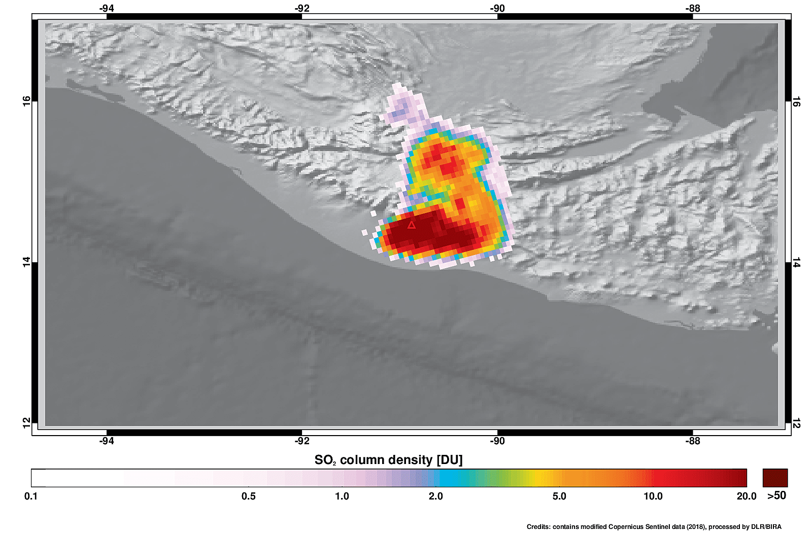
Guatemala's Fuego Plume
On June 3, 2018, the Copernicus Sentinel-5P satellite measured sulphur dioxide in the plume spewing from the Fuego volcano in Guatemala.
