CANBERRA, AUSTRALIA and LAS VEGAS, NV, September 2, 2015Â -Â Locata Corporation announced today that NASA plans to install a Locata network (LocataNet) as the core positioning technology for safety-critical Unmanned Aerial Systems (UAS) research at its world-renowned...
AirGon LLC Granted FAA Section 333 UAS Exemption
Huntsville, AL, August 28, 2015 — AirGon LLC, a wholly owned subsidiary of GeoCue Group Inc., has been granted a section 333 exemption by the Federal Aviation Administration (FAA) for its AV-900 Metric Mapping system. Under the exemption, AirGon will be permitted to...
Juniper Unmanned Providing Training Services for Trimble's Unmanned Aircraft Systems
Wheat Ridge, Colorado, August 27, 2015 — Juniper Unmanned, Inc. announced that it has been designated as an official training services provider for Trimble’s unmanned aircraft system (UAS) portfolio, which include the Trimble® UX5, UX5 HP and ZX5 multirotor...
Trimble Takes Flight with New Multirotor Unmanned Aircraft System
SUNNYVALE, Calif., August 25, 2015 —Trimble (NASDAQ: TRMB) announced today the ZX5 Multirotor Unmanned Aircraft System (UAS), a new aerial imaging and workflow solution that captures and processes geo-referenced photo and video data for mapping, agriculture and...
U.S. Army Awards AeroVironment Contracts Totaling $47 Million for RQ-11B Raven and RQ-20A Puma AE Unmanned Aircraft Systems Sustainment
MONROVIA, Calif., August 24, 2015 — AeroVironment, Inc. (NASDAQ: AVAV) today announced receipt since May 1, 2015 of ten orders from the United States Army totaling $47.1 million for RQ-11B Raven® and RQ-20A Puma™AE unmanned aircraft systems (UAS) sustainment....
100 Resilient Cities — Pioneered by the Rockefeller Foundation — Teams with Trimble for Innovative Global Urban Resilience Initiative
SUNNYVALE, Calif., August 22, 2015 — 100 Resilient Cities - Pioneered by the Rockefeller Foundation (100RC) is partnering with Trimble (NASDAQ: TRMB), which will offer a critical resilience building tool to 100RC's network cities. Using Trimble® eCognition®...
NSF Awards $6 Million to UK and Three Partner Schools to Develop Weather Research Drones
LEXINGTON, Ky., August 20, 2015 — A $6 million National Science Foundation grant will allow researchers at the University of Kentucky, Oklahoma State University, University of Oklahoma, and University of Nebraska to develop unmanned aircraft systems, otherwise known...
Northrop Grumman Demonstrates New Capabilities in Mission Management and Control Systems
SAN DIEGO, August 13,, 2015 — Northrop Grumman Corporation (NYSE:NOC) successfully demonstrated mission management control features that create more unmanned aircraft system (UAS) versatility and efficiencies. During a series of high-altitude, long-endurance RQ-4...

Bluesky Introduces Prototype UAV Flight-Restriction Map
Aerial mapping company Bluesky produced a prototype map showing where it may be unsafe or even illegal to fly Unmanned Aerial Vehicles (UAVs), commonly referred to as drones. Bluesky combined expertise in flight planning and 3D aerial mapping with various geographic datasets to come up with the concept of a UAV Flight-Restriction Map for the United Kingdom (UK).
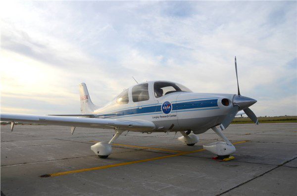
NASA Aircraft Assists in Drone Medical-Supply Delivery Research
Some underserved Virginia patients were among the first to be officially helped by an Unmanned Aircraft System (UAS), more commonly known as a drone, during research flights to a medical clinic in Wise County during July 2015.
