The European Space Agency (ESA) released the first Sentinel-1 satellite images sent via the European Data Relay System (EDRS), also known as the SpaceDataHighway. The two radar images were taken over La Reunion Island and its coastal area.
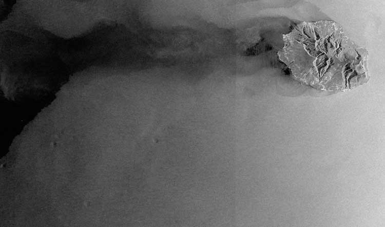
The European Space Agency (ESA) released the first Sentinel-1 satellite images sent via the European Data Relay System (EDRS), also known as the SpaceDataHighway. The two radar images were taken over La Reunion Island and its coastal area.

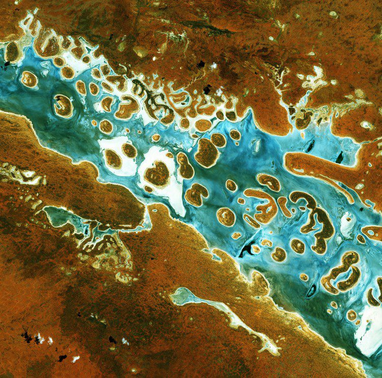
A colorful image of central western Namibia, taken on Jan. 28, 2016, by the European Space Agency (ESA) Sentinel-2A satellite, details the world's oldest desert: the Namib. Also present is the Namib Naukluft National Park, the largest game park in Africa and the fourth largest in the world.

The second satellite of the Sentinel-1 mission, Sentinel-1B, was successfully launched from Europe's Spaceport in French Guiana on April 22, 2016.
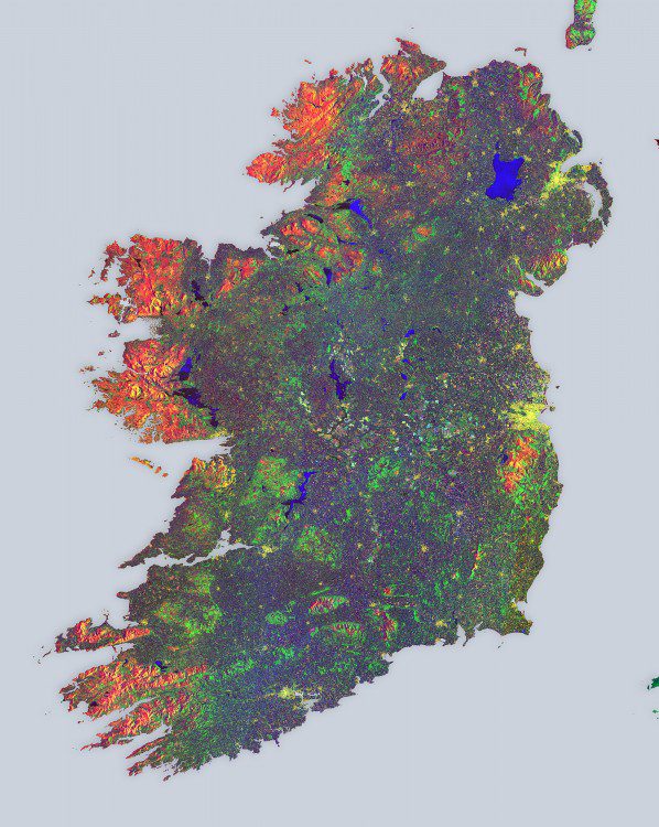
European Space Agency (ESA) Sentinel-1A satellite data were used to create a multi-temporal color composite of land coverage across Ireland. With a coastline of 7,500 kilometers, Ireland is home to 4.8 million people.
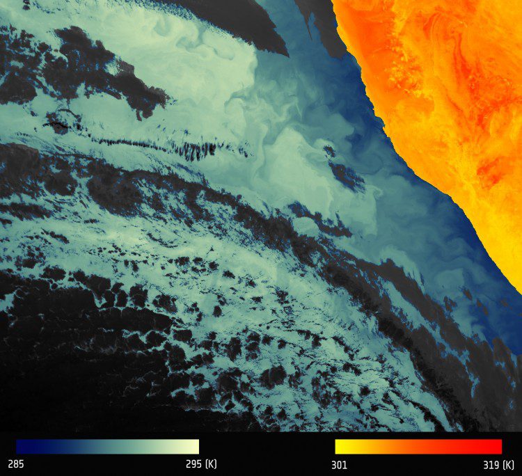
The first image from the European Space Agency (ESA) Sentinel-3A Sea and Land Surface Temperature Radiometer (SLSTR) depicts thermal signatures over a part of western Namibia and the South Atlantic Ocean.
The European Space Agency (ESA) and Australia's national geological survey, Geoscience Australia (GA), partnered to ensure data from EU's Sentinel satellites are accessible in Southeast Asia and the South Pacific.
On Feb. 16, 2016, the European Space Agency (ESA) Sentinel-3A satellite was successfully launched from the Plesetsk cosmodrome in northern Russia. Sentinel-3A carries a suite of instruments that will measure Earth's oceans, land, ice and atmosphere, providing information in near-real time for ocean and weather forecasting as part of Europe's Copernicus program.
ESA has agreed with NASA, the National Oceanic and Atmospheric Administration (NOAA) and the US Geological Survey (USGS) to make data available to them from the European Sentinel satellites. With the third Copernicus satellite, Sentinel-3A, recently launched, ESA has...

Two weeks after its successful launch on Feb. 16, 2016, the Copernicus Sentinel-3A satellite captured its first image, the transition from day to night over Svalbard, Norway.
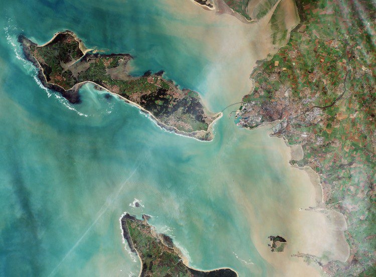
With approximately 80,000 inhabitants, La Rochelle, France, is a city and seaport on the Atlantic Ocean's Bay of Biscay, connected to the Île de Ré by a 2.9-kilometer bridge that's visible in the center of this image captured by the European Space Agency (ESA) Sentinel-2A satellite.
