New Web-based platforms for delivering satellite imagery and other critical geospatial information to first responders are revolutionizing disaster management. By Tara Byrnes, director, North American channel, GeoEye (http://www.geoeye.com/), Herndon, Va. Sometimes we...
Disaster Response in JAPAN
Geospatial Community to the Rescue Following the devastating March 11, 2011, earthquake and tsunami that struck Japan, a host of geospatial companies provided pivotal disaster response information and services. Many of the same companies and more will contribute to...

Sensor-Knowledge System Protects Critical Infrastructure
Threat Detection and Assessment A development team led by TerraEchos and its sister company, GCS Research, both of Missoula, Mont., have introduced a commercial sensor-knowledge system capable of detecting, locating and classifying threats to remote high-risk...
Earth-Mapping Shuttle Mission Marks 10th Anniversary
The data benefit scientists, engineers, government agencies and the public with applications that range from land-use planning to virtual Earth exploration. NASA is currently using Shuttle Radar Topography Mission data to create an even better global topographic map...
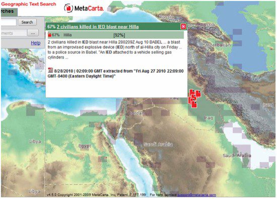
Protecting the Nation and the Warfighter with Location-Based Intelligence
Geographic Search and Referencing It’s not a lack of information that hinders today’s homeland security and military defense
operations; it’s a lack of information convergence necessary to deliver relevant information about threats in a timely and efficient...
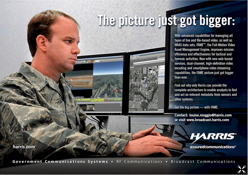
Full-Motion Video Architecture Delivers Homeland Security Benefits
Law Enforcement Using the same commercial broadcast technologies that have been proven in demanding television networks around the world, Harris offers the latest architecture of FAME™ — the full-motion video asset management engine — now optimized for federal...
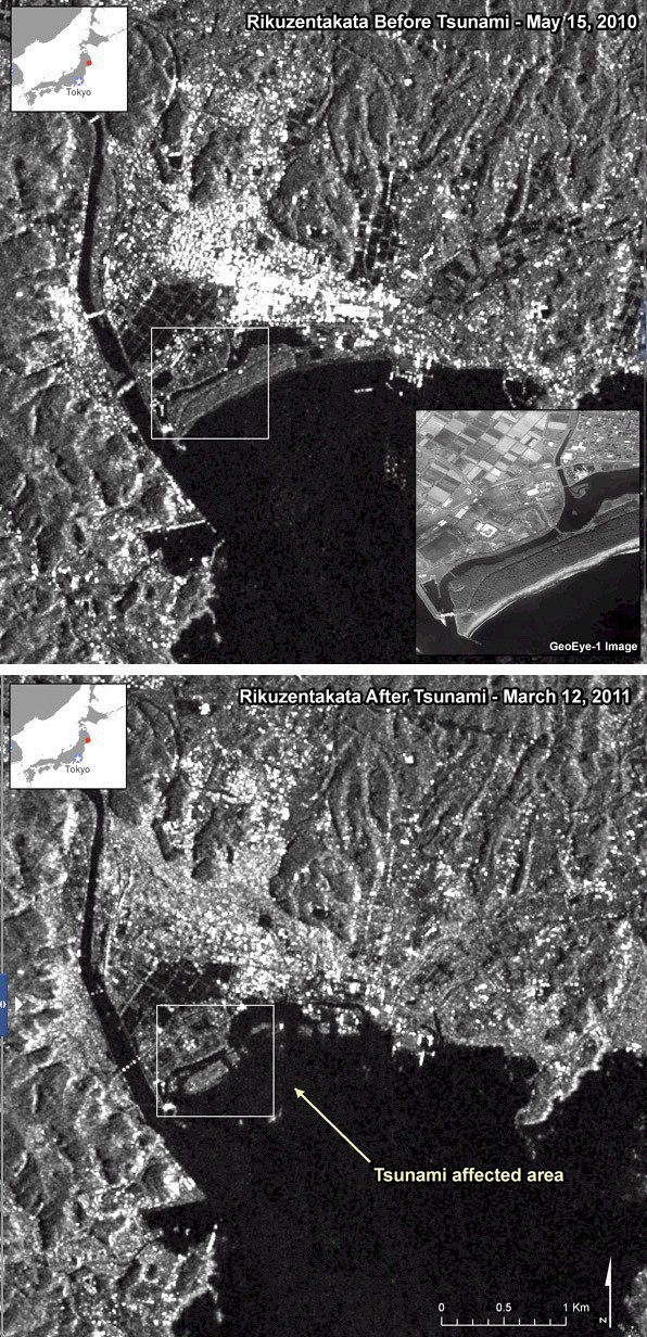
Satellite Images Reveal Earthquake/Tsunami Damage in Japan
Satellite imagery provided dramatic before-and-after perspectives after an 8.9-magnitude earthquake and resulting tsunami struck Japan’s coast on March 11, 2011. The imagery provided an assessment of the damage seen at the two Fukushima nuclear power plants...
Rapid Mapping Bolsters Security and Disaster Response
High-Resolution Airborne Imagery Security and disaster mapping specialists have an insatiable appetite for imagery; fortunately, there’s an ever-expanding menu of sensors to meet the demand. From large-format digital aerial photos to sub-meter-resolution satellite...
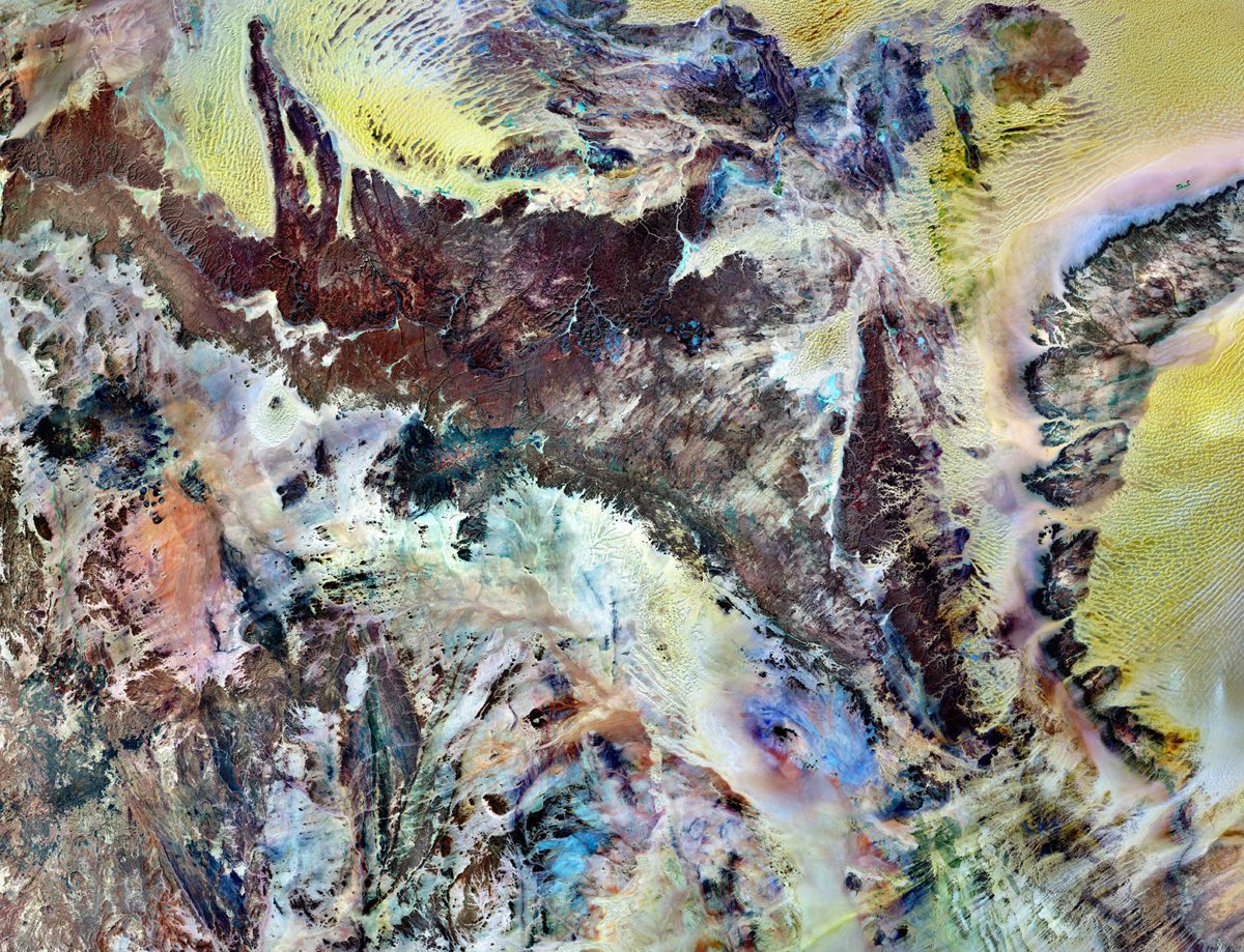
Tassili n'Ajjer National Park
Tassili n’Ajjer National Park covers 72,000 square kilometers (27,800 square miles) in southeastern Algeria. Part of the Sahara Desert, the park has a bone-dry climate with scant rainfall, yet does not blend in with Saharan dunes. Instead, the rocky plateau rises...
FEATURE EXTRACTION: Approaching Near Real-Time Mapping Solutions for Geointelligence
The ability to derive intelligence from airborne or satellite-based sensors in an automated or semi-automated way offers numerous advantages for government and relief agencies responding to global disasters and conflicts. It is also a key element in an early response...
