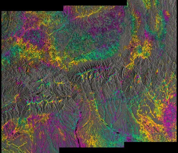
The twin Sentinel-1A and 1B satellites, orbiting 180-degrees apart at an altitude of almost 700 kilometers, provided their first combined radar image, demonstrating a capability to reveal small deformations in Earth's surface.
The twin Sentinel-1A and 1B satellites, orbiting 180-degrees apart at an altitude of almost 700 kilometers, provided their first combined radar image, demonstrating a capability to reveal small deformations in Earth's surface.
