The In-Q-Tel partnership supports technical capability enhancements. San Francisco (February 17, 2022) – Orbital Sidekick (OSK), the leader in commercial space-based hyperspectral monitoring, shares the validation of first light imagery from the company’s recent...
Verisk Announces Important Remote Sensing Capabilities in Its Geomni Business
JERSEY CITY, N.J — Verisk Analytics (Nasdaq:VRSK), a leading data analytics provider, today announced a range of new capabilities in its Geomni business unit. The Geomni Remote Sensing Fleet Verisk recently acquired a number of leading U.S.-based aerial survey...

Shadows Across Arctic Iceberg
The shadow of NASA’s P-3 aircraft is seen over an iceberg on a May 8, 2017, flight supporting NASA’s Operation IceBridge mission. IceBridge began its final week of Arctic Spring 2017 surveys with a glacier-packed mission in Greenland.
Space Flight Laboratory (SFL) to Discuss Remote Sensing SmallSat Missions at IAA Berlin
Space Flight Laboratory (SFL), a provider of complete microspace missions, will present papers on the successful GHGSat-D greenhouse gas monitoring and CanX-7 aircraft tracking nanosatellite missions next week in Berlin, Germany, at the 11th IAA Symposium on Small...
Launch of ARMADA Smartphone-Based Hyperspectral Remote Sensing for Agri-science Applications
MELBOURNE, Fla. -Â Galileo Group, Inc. announces the launch of the ARMADAâ„¢ smartphone-based hyperspectral system for agri-science applications and research, opening the way for generational improvement capabilities in phenotyping, disease detection and experimental...
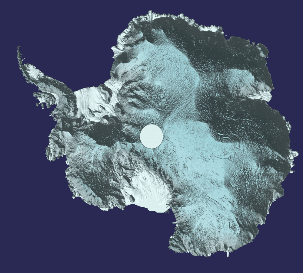
Antarctica in 3D
Approximately 250 million measurements taken by the European Space Agency (ESA) CryoSat during the last six years have been used to create a unique 3D view of Antarctica, offering a snapshot of the undulating surface of this vast ice sheet.
Maxtech to Conduct Enhanced Remote Sensing and Analyses Targeting Manganese in Brazil
VANCOUVER, BRITISH COLUMBIA, -- VANCOUVER, BRITISH COLUMBIA - Maxtech Ventures Inc. (cse:MVT)(cse:MVT.CN)(otc pink:MTEHF)(frankfurt:M1N) ("Maxtech" or the "Company") is pleased to announce that it has entered into an agreement with Auracle Geospatial Science...
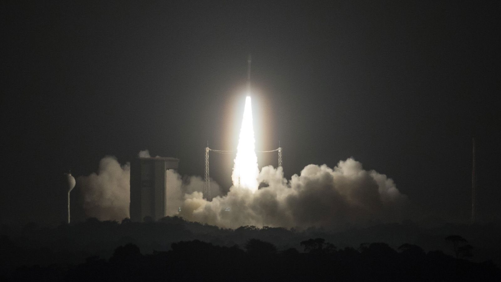
Sentinel-2B Satellite Launch
The European Space Agency (ESA)-developed Sentinel-2B satellite was launched on March 7, 2017, doubling the coverage of high-resolution optical imaging in the Sentinel-2 mission for the European Union Copernicus environmental monitoring system.
Planet to Acquire Terra Bella from Google
WASHINGTON — Commercial remote sensing company Planet announced Feb. 3 it was acquiring rival Terra Bella from Google for an undisclosed sum, bringing together what the companies believe are complementary capabilities to image the Earth from space. Under the deal,...

NOAA's GOES-16 Satellite Sends First Images to Earth
GOES-16, the first spacecraft in NOAA's next-generation of geostationary satellites, sent back to Earth the first high-resolution images from its Advanced Baseline Imager (ABI) instrument.
