The United States Federal Aviation Administration (FAA) has released its Performance-Based Navigation (PBN) National Airspace System (NAS) Navigation Strategy 2016, the result of a concerted year-long effort by FAA and aviation industry stakeholders. It describes how...
TomTom Maps and Navigation Software Power Subaru's New Infotainment Platform
AMSTERDAM - TomTom (TOM2) has been chosen by Subaru to be the global maps and navigation supplier for their next generation infotainment platform. The global platform will launch first in North America with the all-new 2017 Subaru Impreza. HARMAN International, the...
TomTom Announces TomTom BRIDGE Connected for Fleets
LAS VEGAS - TomTom, Inc. a global leader in navigation and mapping products, today announces TomTom BRIDGE Connected, with a built-in modem for wireless functionality. Wireless connectivity allows drivers to directly connect with their customers, get updates as they...
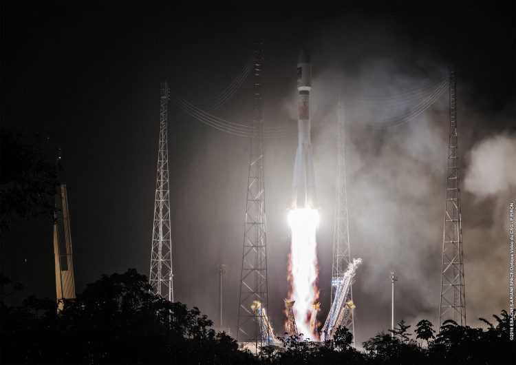
Europe's Galileo Navigation System Adds Two Satellites
The European Union-funded Galileo satellite navigation system added its 13th and 14th satellites after a successful launch atop a Soyuz rocket from French Guiana on May 24, 2016. Nearly four hours after liftoff, the twin Galileos were deployed into orbit approximately 23,522 kilometers above Earth.
Trimble Seismic Navigation Systems Support Stakeless Operations for Geophysical Exploration
SUNNYVALE, Calif.—Trimble (NASDAQ:TRMB) announced today the availability of its Trimble® Seismic Navigation Systems (SNS). The Trimble SNS portfolio of advanced hardware and software solutions include two vehicle guidance applications for geophysical exploration...
Navmii Appoints Steve Coast, OSM Founder, as Board Advisor
LONDON — Navmii, the free, smart navigation and traffic app, today announces that Steve Coast, the founder of the OpenStreetMap Foundation (OSM), will join Navmii as a board advisor to further enhance its B2B mapping products and services. Navmii has created...
HERE And 1Spatial Announce a Strategic Partnership
UK, 11 January 2016 — HERE, a leader in navigation, mapping and location experiences and 1Spatial (www.1spatial.com), the global spatial software company, which manages the world’s largest spatial data, today announced that they are teaming up to deliver high...
Locata Positioning Will Underpin Future Unmanned Aerial System Research at NASA’s Famed Langley Research Center
CANBERRA, AUSTRALIA and LAS VEGAS, NV, September 2, 2015Â -Â Locata Corporation announced today that NASA plans to install a Locata network (LocataNet) as the core positioning technology for safety-critical Unmanned Aerial Systems (UAS) research at its world-renowned...
MMIST deploys MapLink Pro Mobile to support SkyLink Parachutist Situational Awareness System
June 24, 2015 — ENVITIA is pleased to announce that Mist Mobility Integrated Systems Technology Inc. (MMIST), a Canadian full solution provider of Precision Aerial Delivery products and services, has chosen MapLink Pro Mobile to provide the map visualisation...
New NaviPac Module Navigates World's Longest Moveable Man-Made Structure
June 3, 2015 — EIVA has launched a new module for the offshore navigation solution NaviPac, developed in close collaboration with Subsea 7. The Bundle Monitor module has already proven its worth, having undergone numerous field tests in connection with the offshore...
