On June 17, 2017, lightning reportedly ignited a deadly wildfire that spread across the mountainous areas of Pedrógão Grande”a municipality in central Portugal located about 160 kilometers northeast of Lisbon.
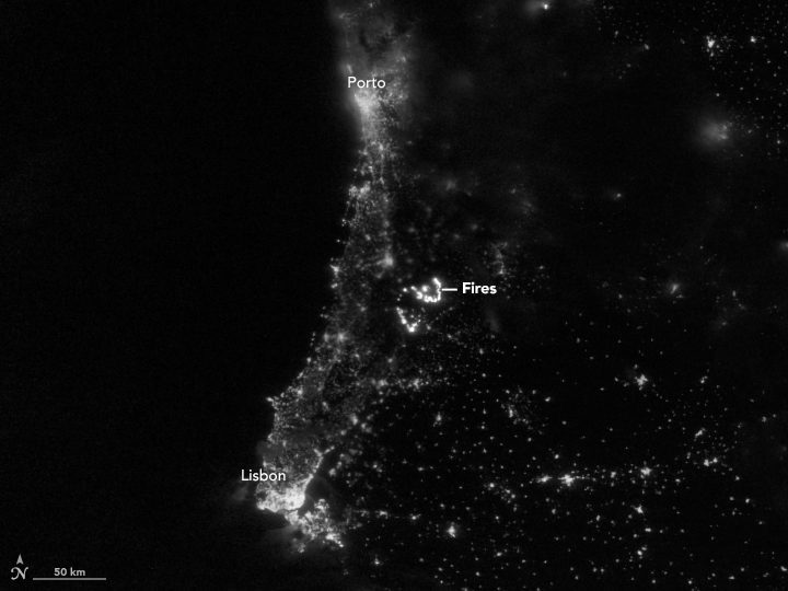
On June 17, 2017, lightning reportedly ignited a deadly wildfire that spread across the mountainous areas of Pedrógão Grande”a municipality in central Portugal located about 160 kilometers northeast of Lisbon.
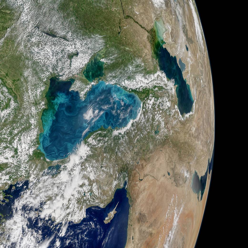
Most summers, jewel-toned hues appear in the Black Sea, a result of phytoplankton that trace the flow of water currents and eddies. The Moderate Resolution Imaging Spectroradiometer (MODIS) on NASA's Aqua satellite recently collected imagery of such an ongoing phytoplankton bloom.
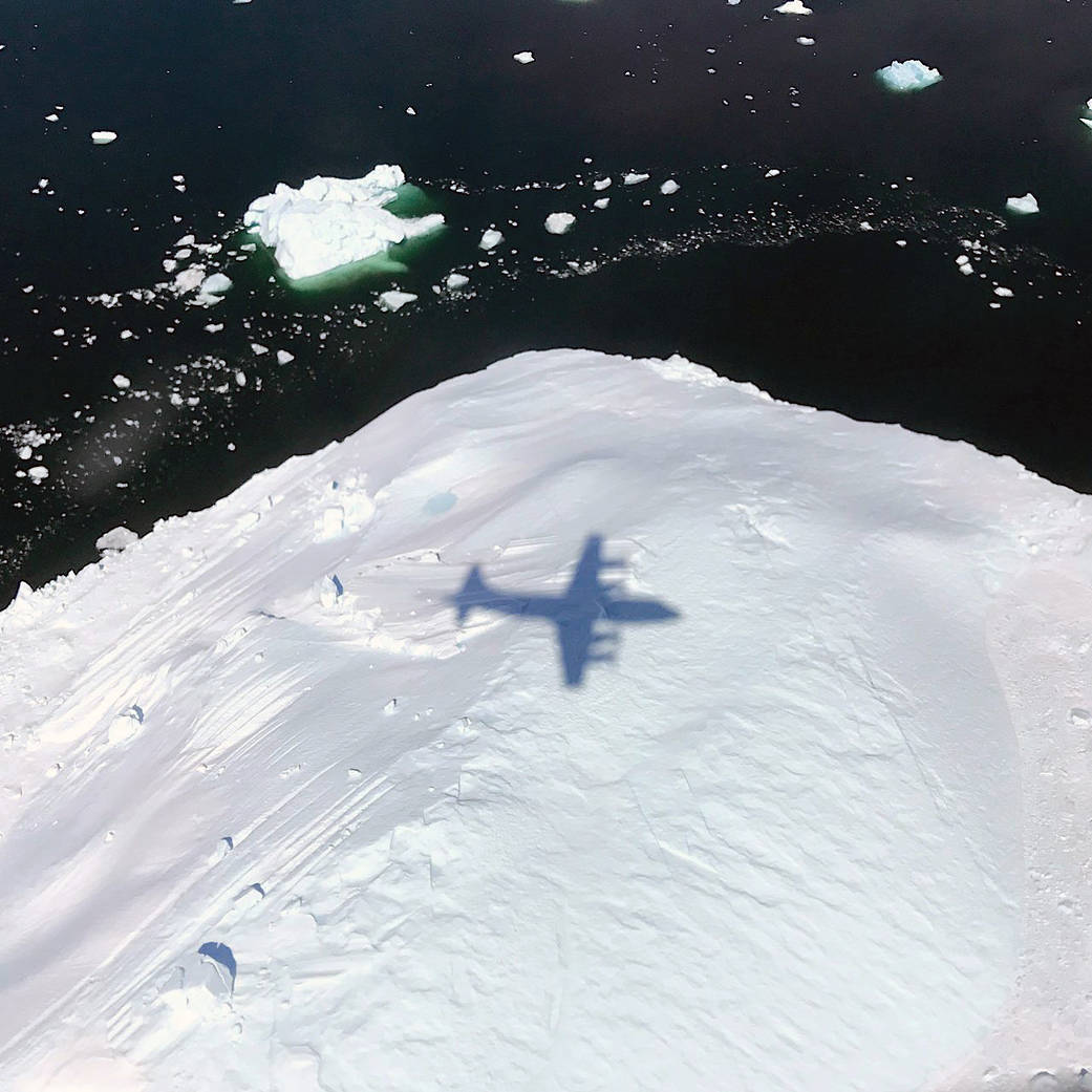
The shadow of NASA’s P-3 aircraft is seen over an iceberg on a May 8, 2017, flight supporting NASA’s Operation IceBridge mission. IceBridge began its final week of Arctic Spring 2017 surveys with a glacier-packed mission in Greenland.
James Webb telescope and instrument module shipped by NASA from Goddard Space Flight Centre in Washington to Johnson Space Centre in Houston for final tests Houston 08/05/2017 – OTIS (Optical Telescope Element and Integrated Science), the payload module...
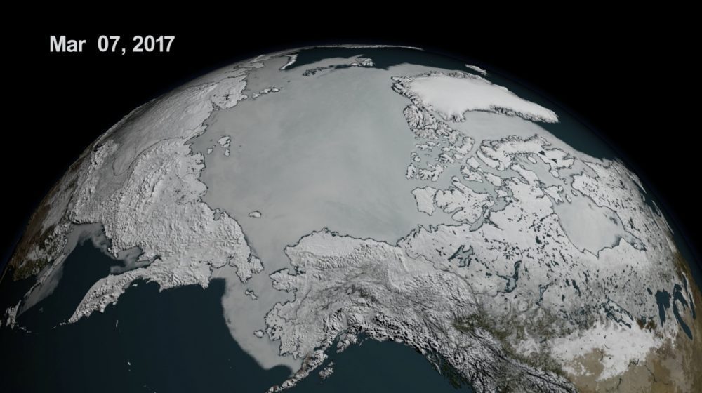
On Feb. 13, 2017, the combined Arctic and Antarctic sea-ice numbers were at their lowest point since satellites began to continuously measure sea ice in 1979.
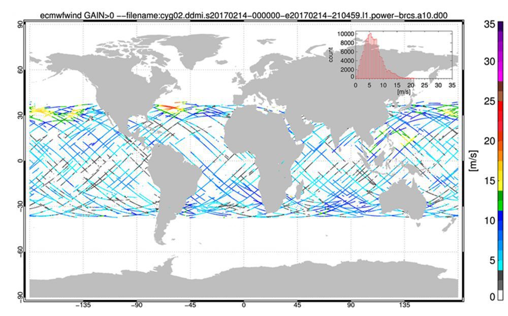
NASA's Cyclone Global Navigation Satellite System (CYGNSS), a constellation of eight microsatellites that will take detailed measurement of wind speeds inside hurricanes, successfully completed the development and on-orbit commissioning phases of its mission and moved into the science operations phase.
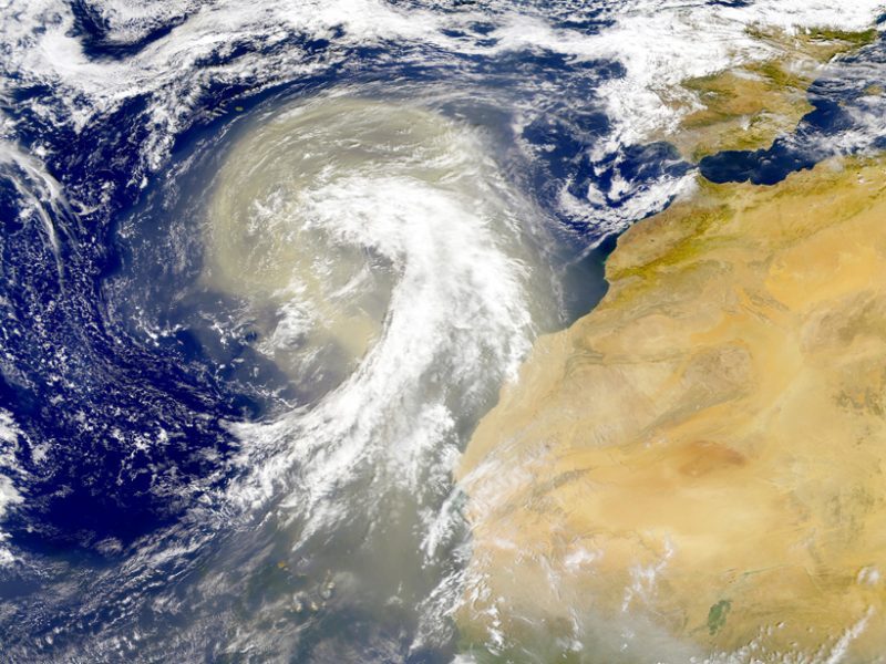
Earth's atmosphere is dusted with tiny particles known as aerosols, which include windblown ash, sea salt, pollution, and other natural and human-produced materials. Aerosols can absorb or scatter sunlight, affecting how much light reflects back into space or stays trapped in the atmosphere.
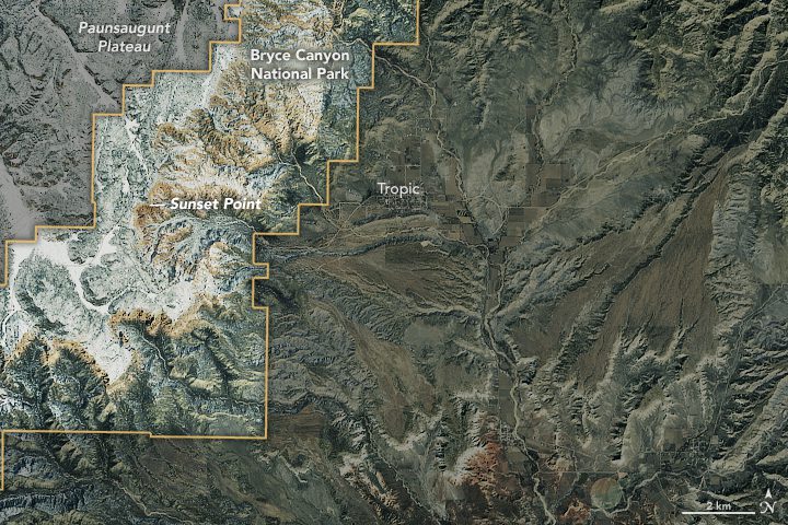
Utah's Bryce Canyon is not the deepest canyon in the United States; its largest amphitheater of naturally eroded rock drops 240 meters. Arizona's Grand Canyon, for comparison, measures more than 1,800 meters deep in places. But photographers who visit Bryce Canyon National Park typically aren't looking for dizzying heights and depth; they're often trying to capture images of the delicate spires called hoodoos that rise from the canyon.
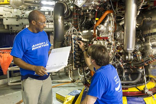
An RS-25 rocket engine with a new flight-model engine controller and flight configuration software was successfully tested for the first time at NASA's Stennis Space Center on March 23, 2017.
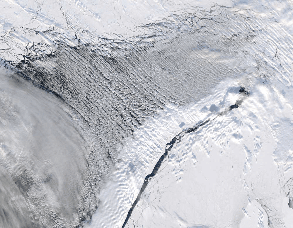
The Moderate Resolution Imaging Spectroradiometer (MODIS) on NASA's Aqua satellite captured this natural-color image of cloud streets over the Barents Sea and Mezhdusharsky Island on March 7, 2017.
