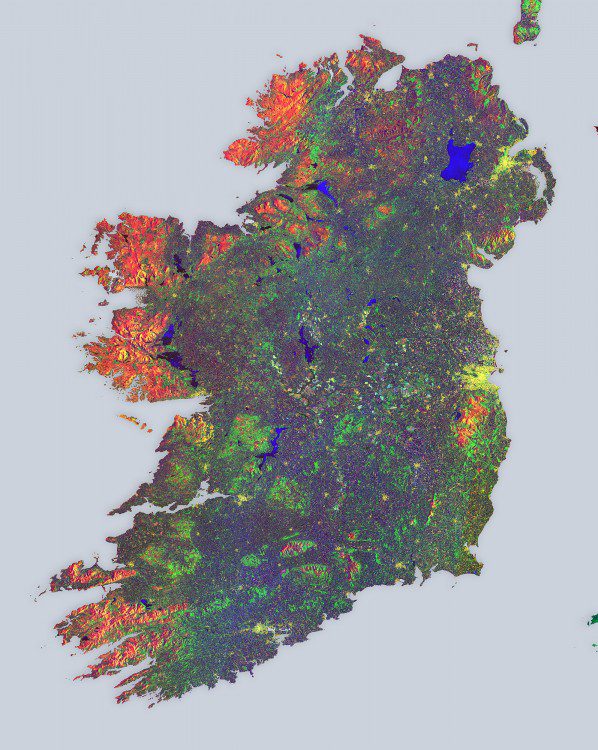
European Space Agency (ESA) Sentinel-1A satellite data were used to create a multi-temporal color composite of land coverage across Ireland. With a coastline of 7,500 kilometers, Ireland is home to 4.8 million people.
European Space Agency (ESA) Sentinel-1A satellite data were used to create a multi-temporal color composite of land coverage across Ireland. With a coastline of 7,500 kilometers, Ireland is home to 4.8 million people.
