Expedition 47 Commander Tim Kopra of NASA captured this night image of Chicago on April 5, 2016, from the International Space Station. Expedition 47 began March 1, 2016, and ends June 5, 2016, with no spacewalks currently planned.

Expedition 47 Commander Tim Kopra of NASA captured this night image of Chicago on April 5, 2016, from the International Space Station. Expedition 47 began March 1, 2016, and ends June 5, 2016, with no spacewalks currently planned.
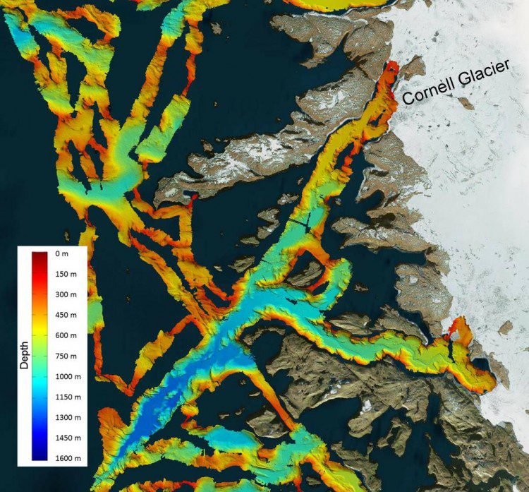
NASA's Oceans Melting Greenland (OMG) field campaign is gathering data that will help scientists understand how the oceans are joining with the atmosphere to melt the vast ice sheet as well as predict the extent and timing of the resulting sea-level rise.
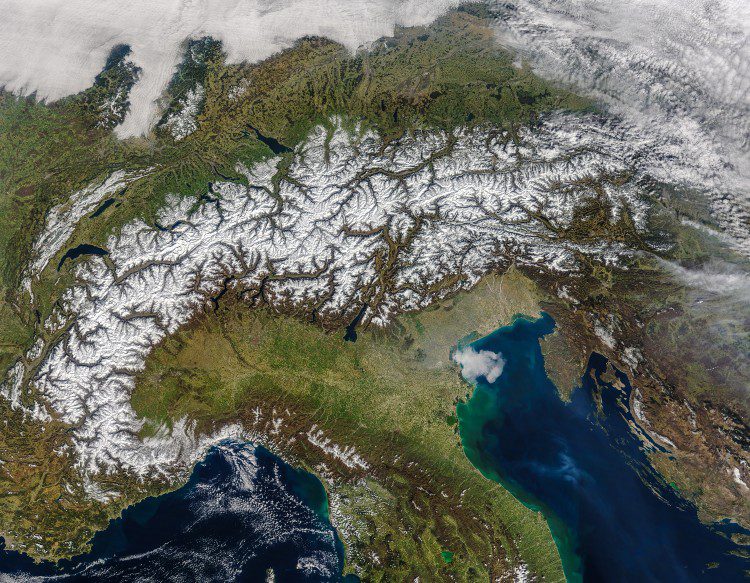
The European Alps stretch 1,200 kilometers (750 miles) across eight countries, and it's the longest mountain chain situated entirely within Europe. The Alps include more than 100 peaks higher than 4,000 meters (13,000 feet), and this image from NASA's Moderate Resolution Imaging Spectroradiometer (MODIS) on its Terra satellite beautifully captures a recent snowfall across the region.
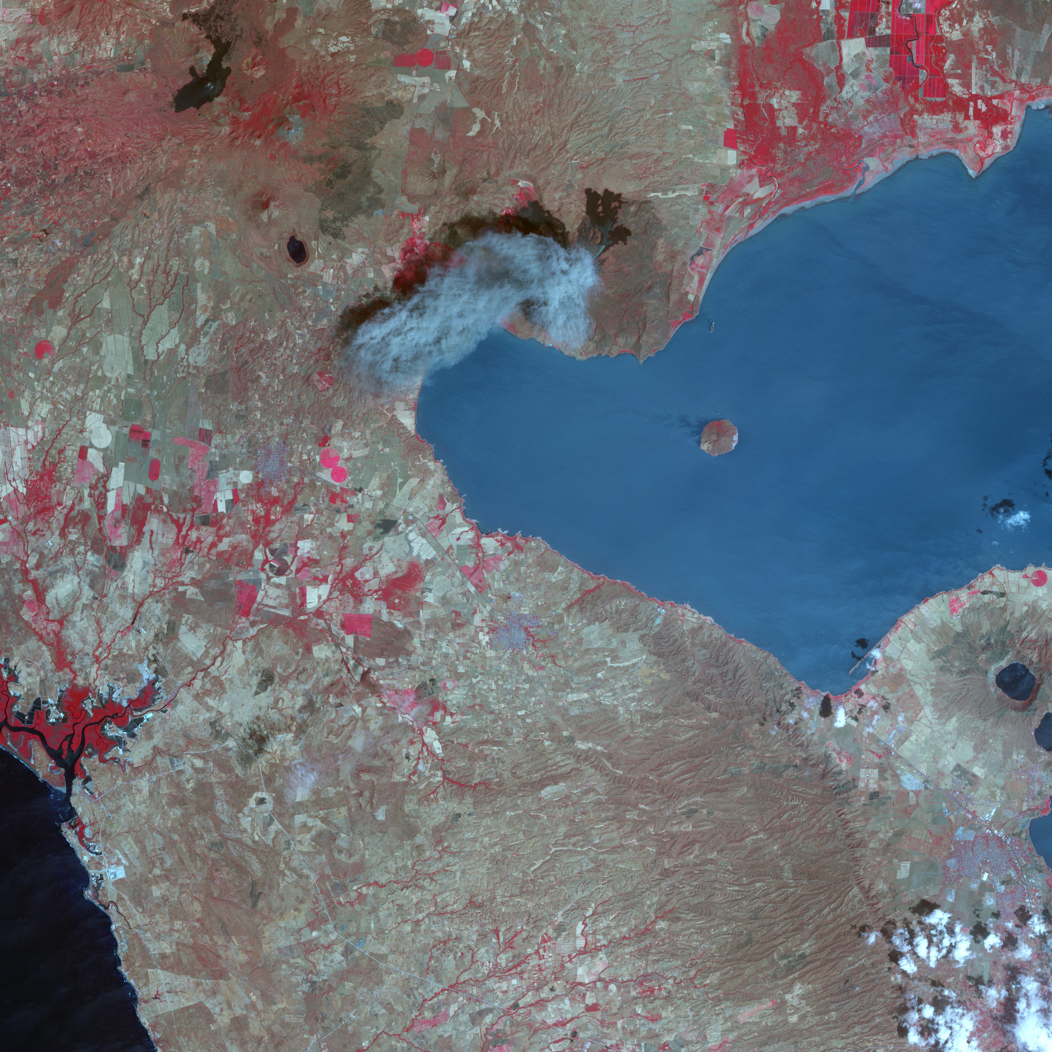
After more than 100 years of dormancy, Nicaragua's Momotombo volcano has erupted more than 80 times in the last three months. Momotombo rises from a chain of 19 active volcanos that run northwest to southeast in western Nicaragua, one of the most volcanically and seismically active areas on Earth.
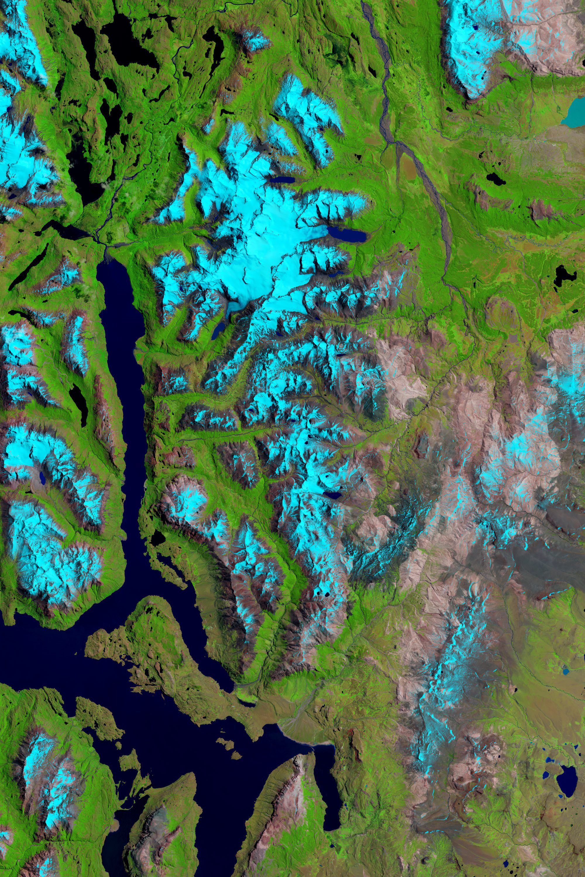
Reports and studies of shrinking glaciers and ice sheets in Greenland and Antarctica come in regularly, but an additional ice field can be added to the list: Patagonia, the mountainous area at the southern end of South America shared by Argentina and Chile.
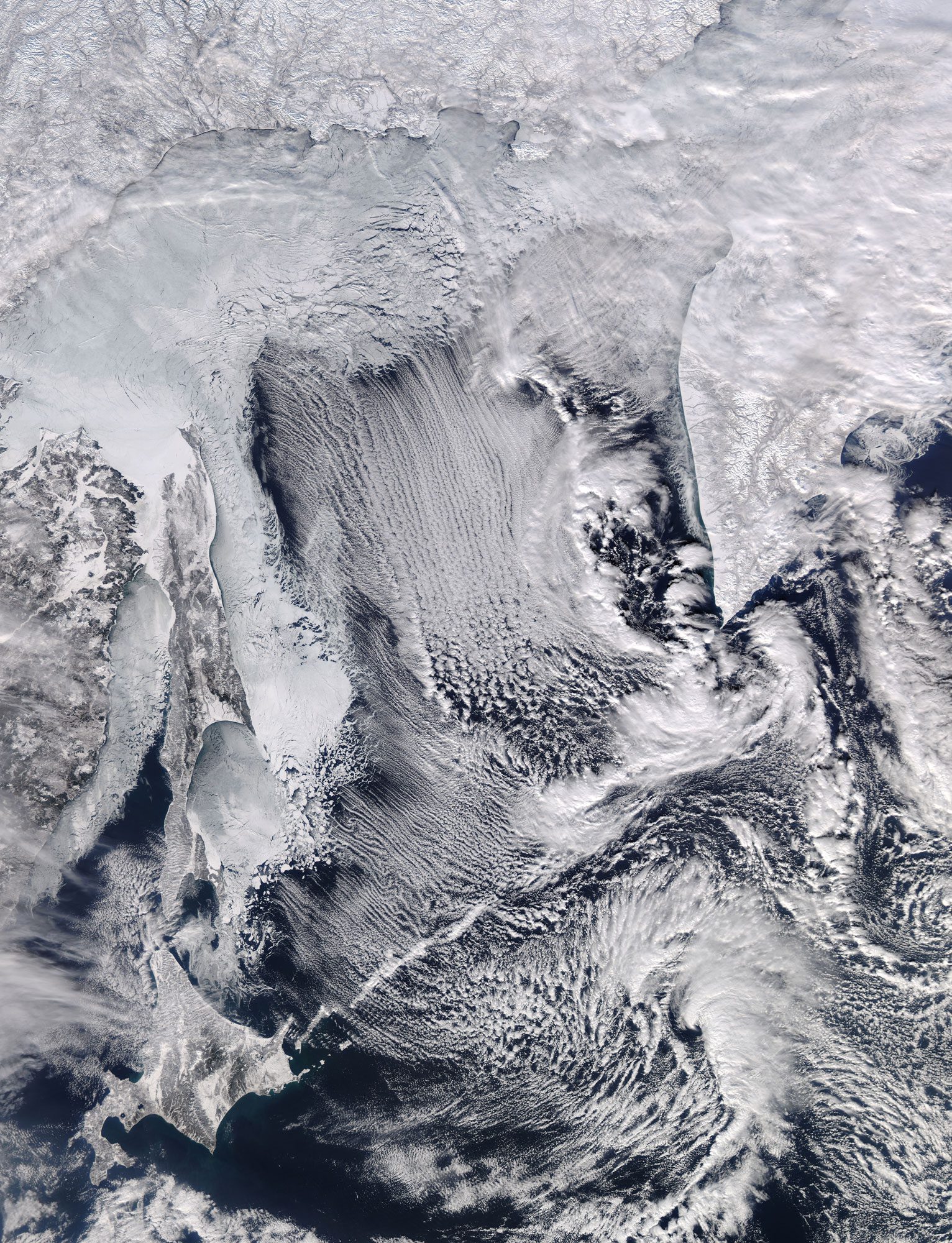
A NASA satellite captured a stunning image of winter's effects on the Sea of Okhotsk, which is part of the western Pacific Ocean surrounded by mostly Russian territory as well as the Japanese island of Hokkaido.
