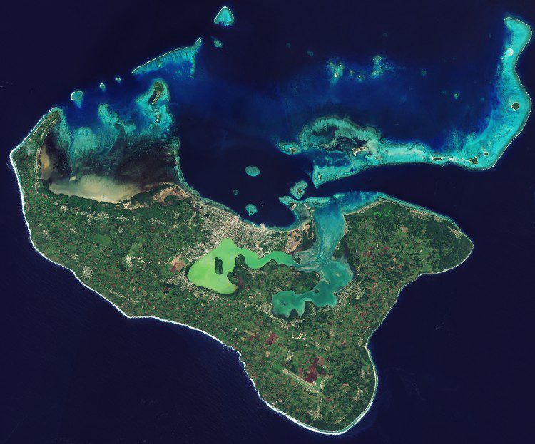
The Kingdom of Tonga in the southern Pacific Ocean has a population dispersed across 36 of its 169 islands, but about 70 percent of the people live on the main island captured in this image from the European Space Agency (ESA) Sentinel-2A satellite.
The Kingdom of Tonga in the southern Pacific Ocean has a population dispersed across 36 of its 169 islands, but about 70 percent of the people live on the main island captured in this image from the European Space Agency (ESA) Sentinel-2A satellite.
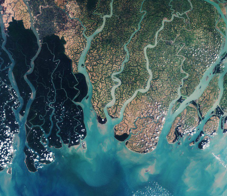
The Sundarbans, comprising southern Bangladesh and a small part of the Indian state of west Bengal, include approximately 10,000 square kilometers of mangrove and swamp forests”the world's largest single chunk of tidal halophytic mangrove forest.
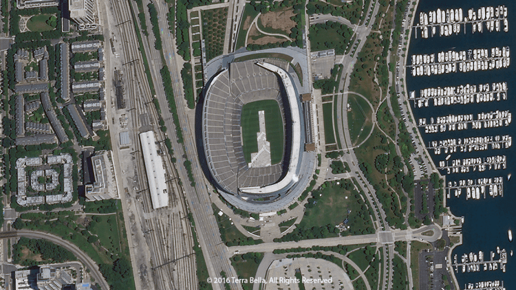
Within days of its launch aboard a Polar Satellite Launch Vehicle from the Indian Space Research Organization on June 22, 2016, the SkySat-3 satellite from Terra Bella (formerly Skybox Imaging) delivered its first images.
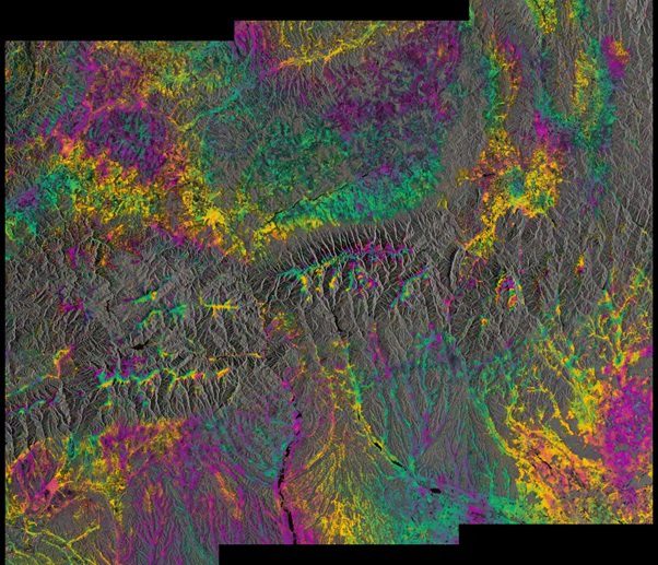
The twin Sentinel-1A and 1B satellites, orbiting 180-degrees apart at an altitude of almost 700 kilometers, provided their first combined radar image, demonstrating a capability to reveal small deformations in Earth's surface.
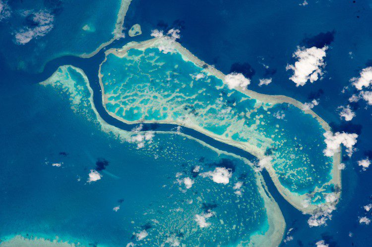
An astronaut aboard the International Space Station used a powerful lens to photograph these three reefs in Australia's Great Barrier Reef. The area spans about 15 kilometers of the 2,300-kilometer reef system.
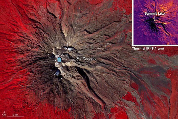
Mount Ruapehu is a 2,797-meter (9,177-foot) peak on New Zealand's North Island that's popular with skiers and snowboarders and other outdoor adventurers. One of the most-active volcanos in New Zealand, major eruptions occur approximately every 50 years, most recently in 1895, 1945 and 1995.
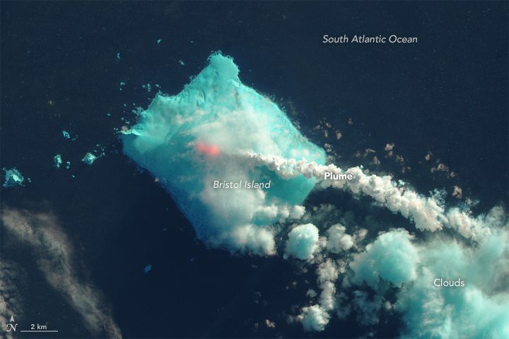
In late April and early May 2016, satellite sensors detected signs of a volcanic eruption in the far South Atlantic Ocean between South America and Antarctica. Mount Sourabaya, a stratovolcano on Bristol Island, appeared to be erupting for the first time in 60 years.
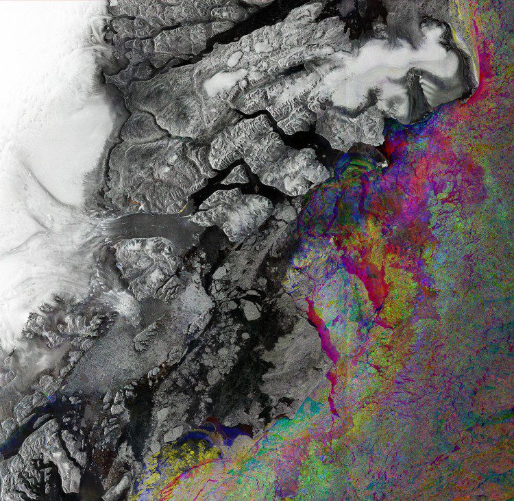
A graphic built from three different images collected by the European Space Agency's Sentinel-1A radar shows sea-ice change along northeast Greenland's coast.
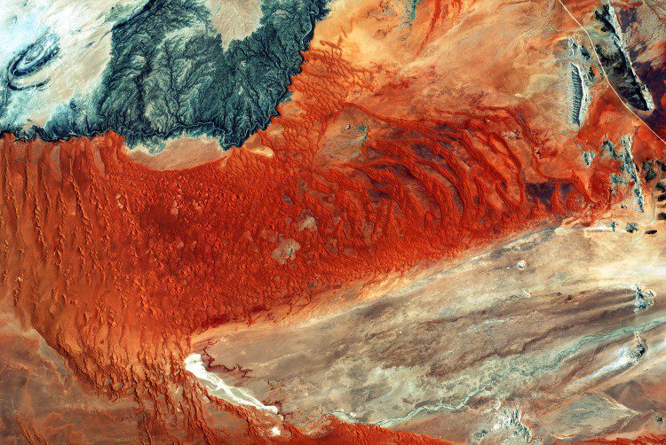
A colorful image of central western Namibia, taken on Jan. 28, 2016, by the European Space Agency (ESA) Sentinel-2A satellite, details the world's oldest desert: the Namib. Also present is the Namib Naukluft National Park, the largest game park in Africa and the fourth largest in the world.
Students participating in NASA's EarthKAM program can request photographs of specific Earth features, such as this image of South Africa, which are taken by a special camera mounted on the International Space Station when it passes over those features.
