On Sept. 24, 2017, the VIIRS instrument aboard NASA-NOAA’s Suomi NPP satellite provided this visible image of Hurricane Maria when it was northeast of Bahamas and east of the Florida east coast.
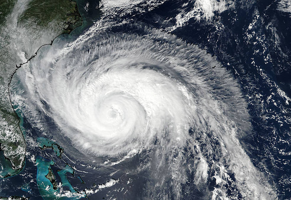
On Sept. 24, 2017, the VIIRS instrument aboard NASA-NOAA’s Suomi NPP satellite provided this visible image of Hurricane Maria when it was northeast of Bahamas and east of the Florida east coast.
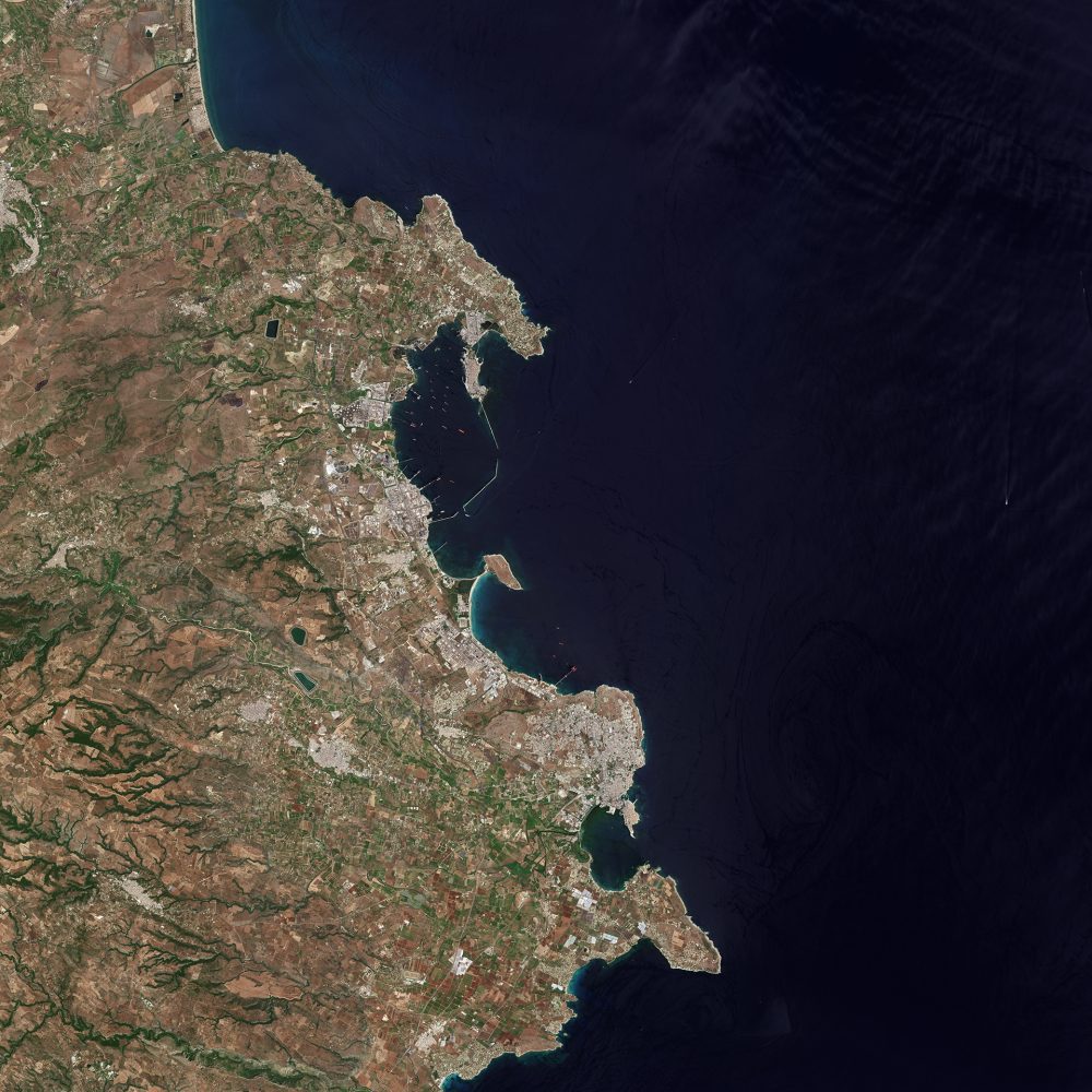
The province of Syracuse on the southeastern coast of the Italian island of Sicily is pictured in this image from the European Space Agency (ESA) Sentinel-2A satellite.
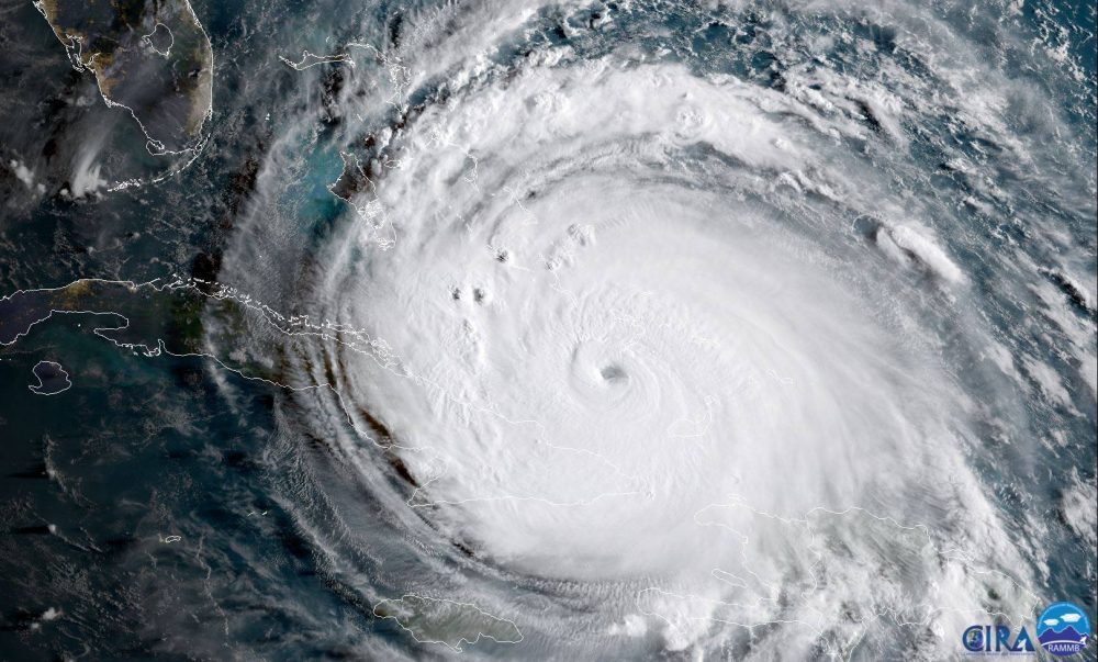
The NOAA satellite GOES-16 captured this geocolor image of Hurricane Irma passing the eastern end of Cuba at about 8:00 a.m. EDT on Sept. 8, 2017.

NASA-NOAA's Suomi NPP Satellite provided a night-time and infrared look at Hurricane Irma, revealing the power under the clouds. NASA's GPM also provided a look at the rainfall being generated by the storm.
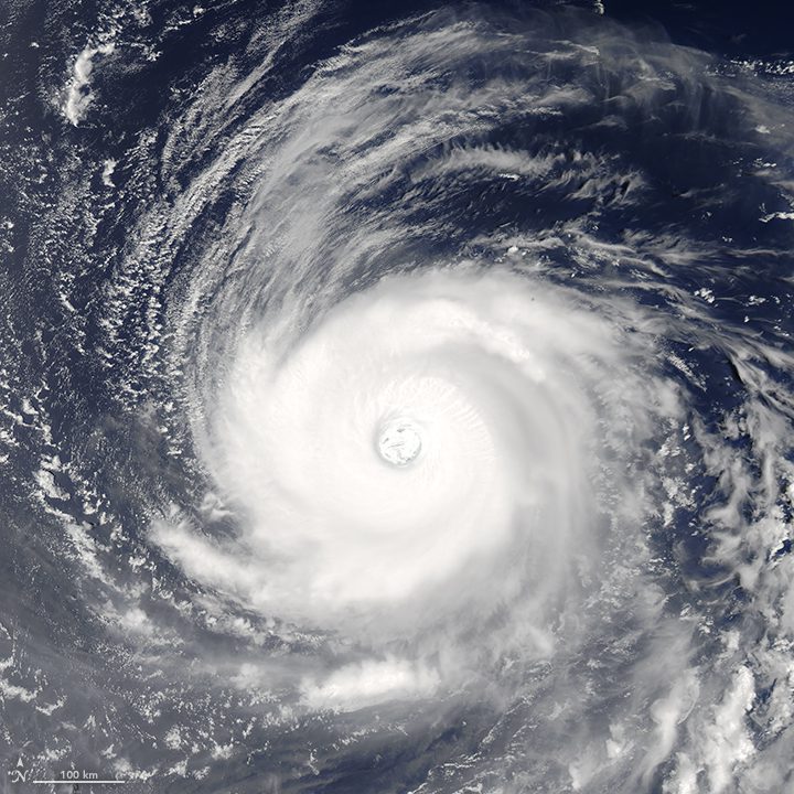
On July 31, 2017, the Moderate Resolution Imaging Spectroradiometer (MODIS) on NASA's Aqua satellite observed Super Typhoon Noru over the western tropical Pacific Ocean.
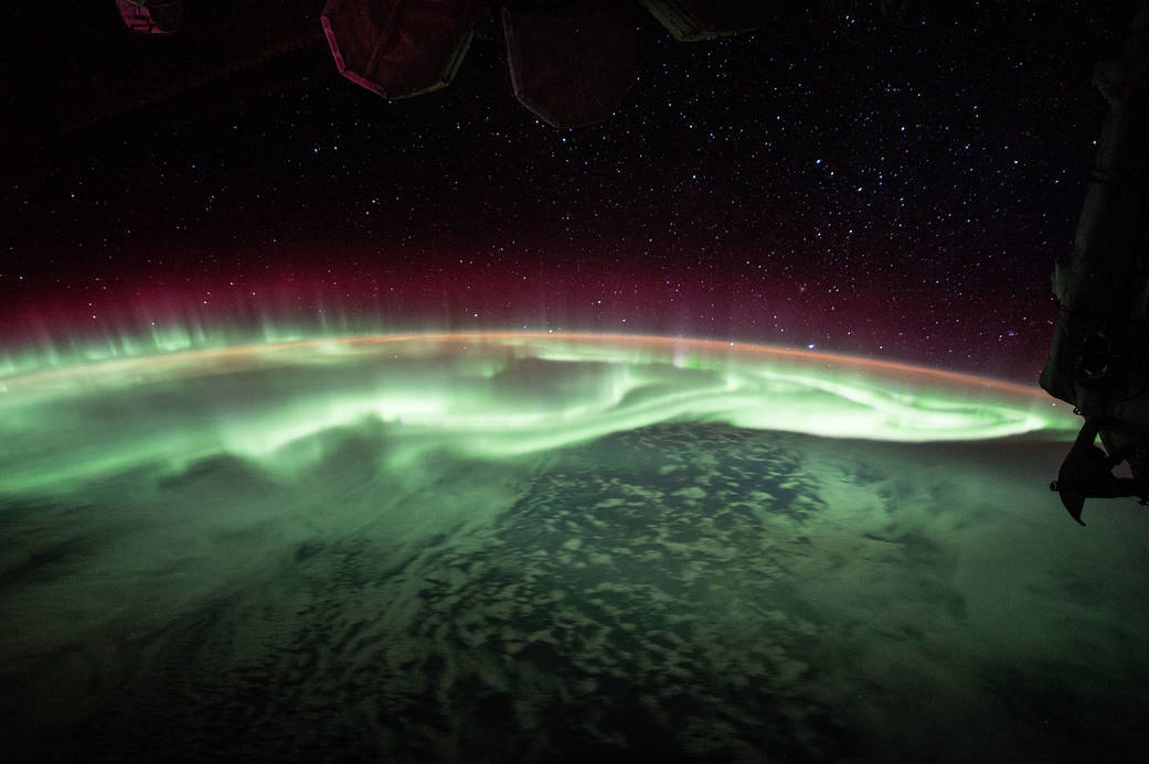
Expedition 52 Flight Engineer Jack Fischer of NASA shared photos and a time-lapse video of a glowing green aurora seen from his vantage point 250 miles up, aboard the International Space Station.
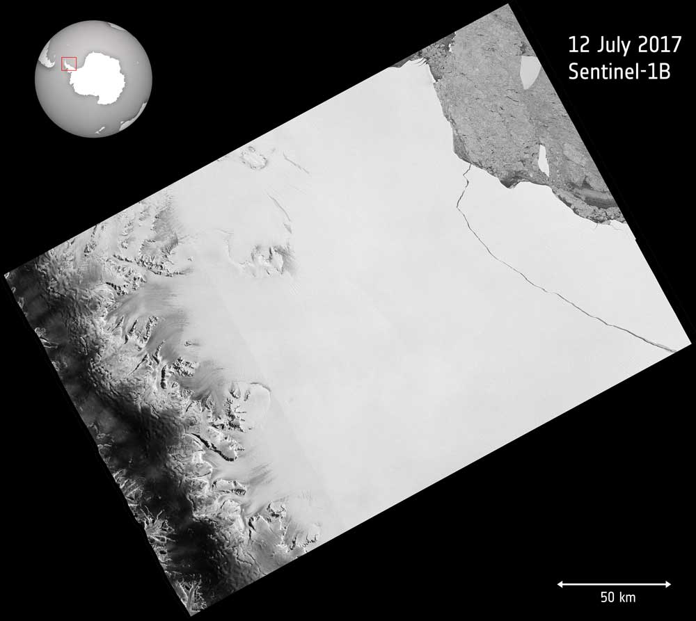
Over the last few months, a chunk of Antarctica's Larsen C ice shelf has been hanging on precariously as a deep crack cut across the ice. Witnessed by the European Space Agency (ESA) Copernicus Sentinel-1 mission, a lump of ice more than twice the size of Luxembourg finally broke off on July 12, 2017.
A new study shows that winds are responsible for the widespread growth of ponds in three watersheds along the Mississippi River.
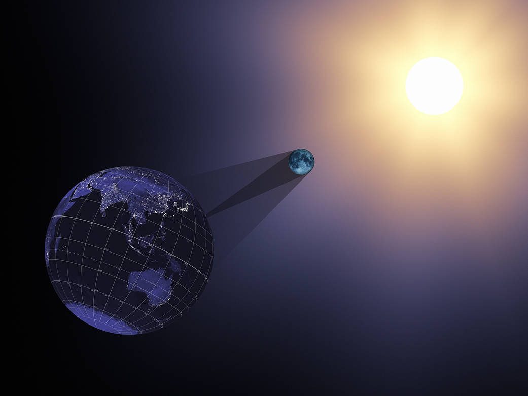
On Aug. 21, 2017, the Earth will cross the shadow of the moon, creating a total solar eclipse. Eclipses happen about every six months, but this one is special. For the first time in almost 40 years, the path of the moon’s shadow passes through the continental United States.
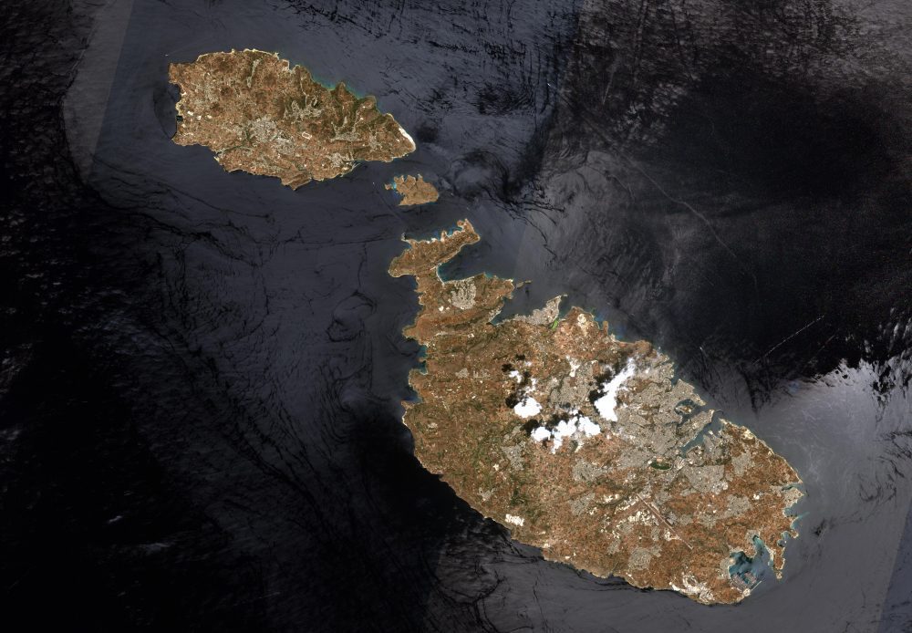
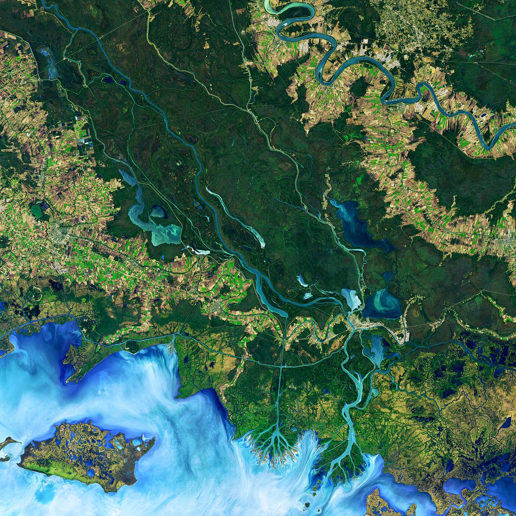
This image of Malta, captured by the European Space Agency (ESA) Copernicus Sentinel-2B satellite, is one of the first sets of images delivered via Alphasat, which is in geostationary orbit 36,000 kilometers above Earth.
