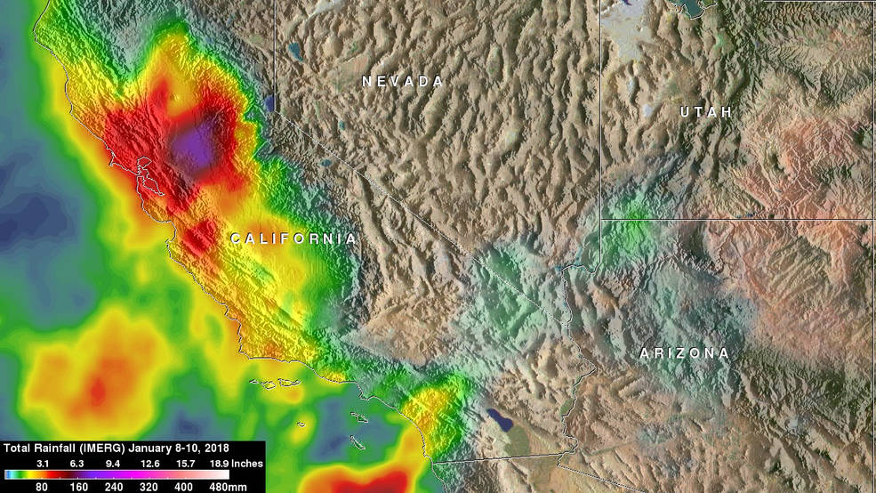
NASA recorded the amount of rainfall between Jan. 8-10, 2018, and calculated the potential for landslides. At least 17 residents of southern California were killed by the deadly mudslides.
NASA recorded the amount of rainfall between Jan. 8-10, 2018, and calculated the potential for landslides. At least 17 residents of southern California were killed by the deadly mudslides.
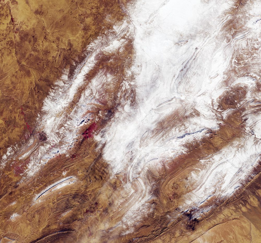
On Jan. 8, 2018, the European Space Agency (ESA) Copernicus Sentinel-2 mission captured rare snowfall in northwest Algeria, on the edge of the Sahara desert”only the third time in nearly 40 years that this part of the desert has seen snow.
he new Copernicus Sentinel-5P satellite captured the presence of elevated absorbing aerosols”caused by fires”in the atmosphere off the west coast of the United States on Dec. 12, 2017.
Launched on Oct. 13, 2017, the European Space Agency (ESA) Sentinel-5P satellite has delivered its first images of air pollution.
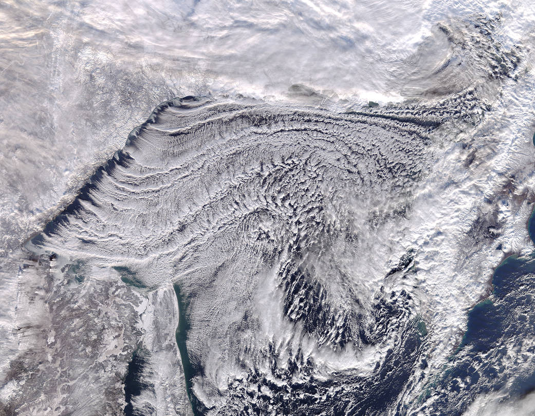
Frigid air blowing from Eastern Russia created dramatic cloud formations over the Sea of Okhotsk on Nov. 25, 2017, with the Moderate Resolution Imaging Spectroradiometer (MODIS) aboard NASA's Terra satellite acquiring a true-color image of the stunning scene.
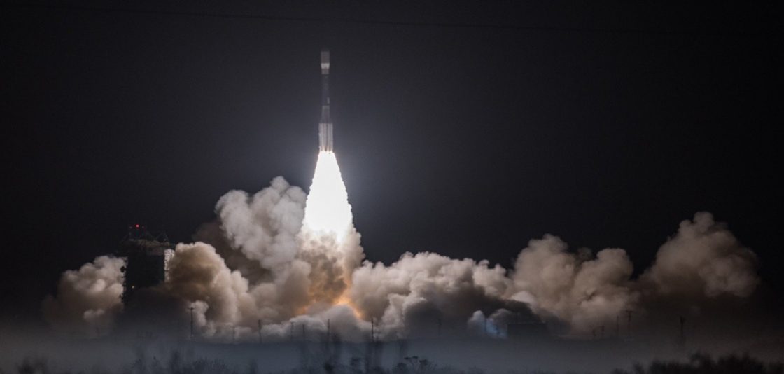
JPSS-1 will join the NOAA/NASA Suomi NPP satellite in the same polar orbit, also providing scientists with observations of atmospheric temperature and moisture, clouds, sea-surface temperature, ocean color, sea-ice cover, volcanic ash, and fire detection.
On Nov. 18, 2017, the Joint Polar Satellite System-1, the first in a new series of four highly advanced NOAA polar-orbiting satellites, lifted off from Vandenberg Air Force Base, Calif.
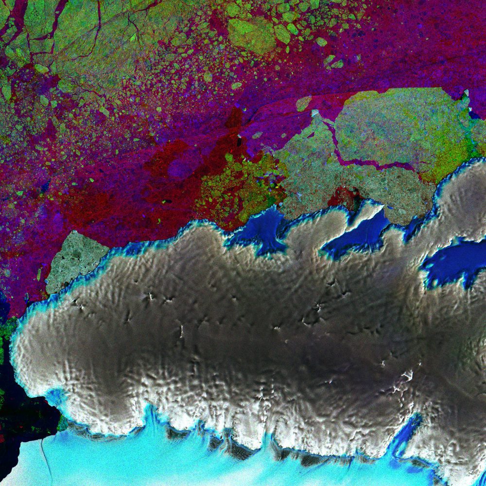
The European Space Agency (ESA) Copernicus Sentinel-1 mission provides radar vision over part of Antarctica's third-largest island, Thurston Island, seeing through clouds and in the dark, making it a valuable tool for monitoring polar regions prone to bad weather and long periods of darkness.
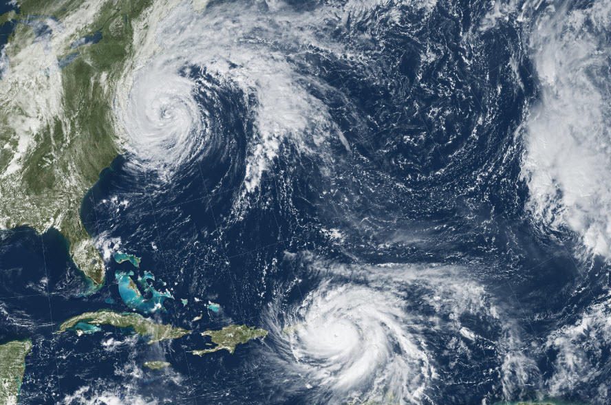
Remotely sensed imagery was provided”at no cost and almost daily”through the USGS Hazard Data Distribution System (HDDS) for analysis on the extent, severity and evolution of hurricanes Harvey, Irma and Maria.
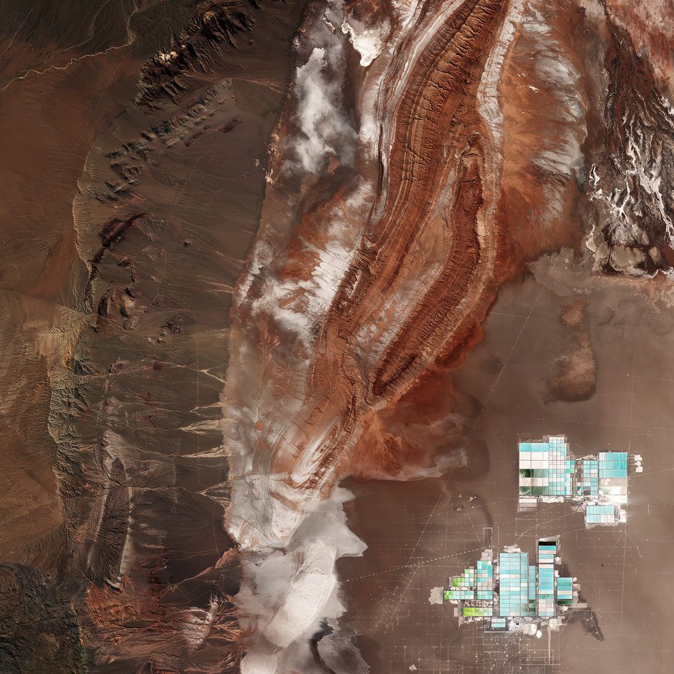
The Atacama Desert in northern Chile runs along part of South America's central west coast and is considered one of the driest places on Earth.
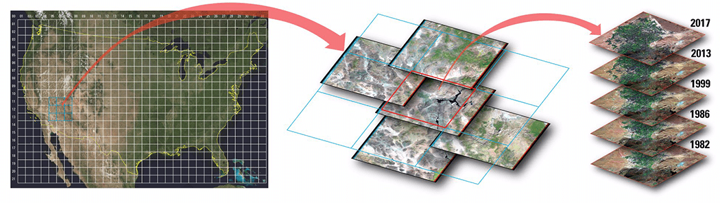
Improvements to the quality and usability of Landsat satellite data have been made with the release of a new USGS product called Landsat Analysis Ready Data (ARD), which will help reduce the time needed to process and analyze data and imagery, a significant advantage to scientists studying landscape changes, including changes from wildfires, hurricanes, vegetation cover, drought and other events.
