Monitoring Grasslands for Agricultural Subsidies

Monitoring Grasslands for Agricultural Subsidies

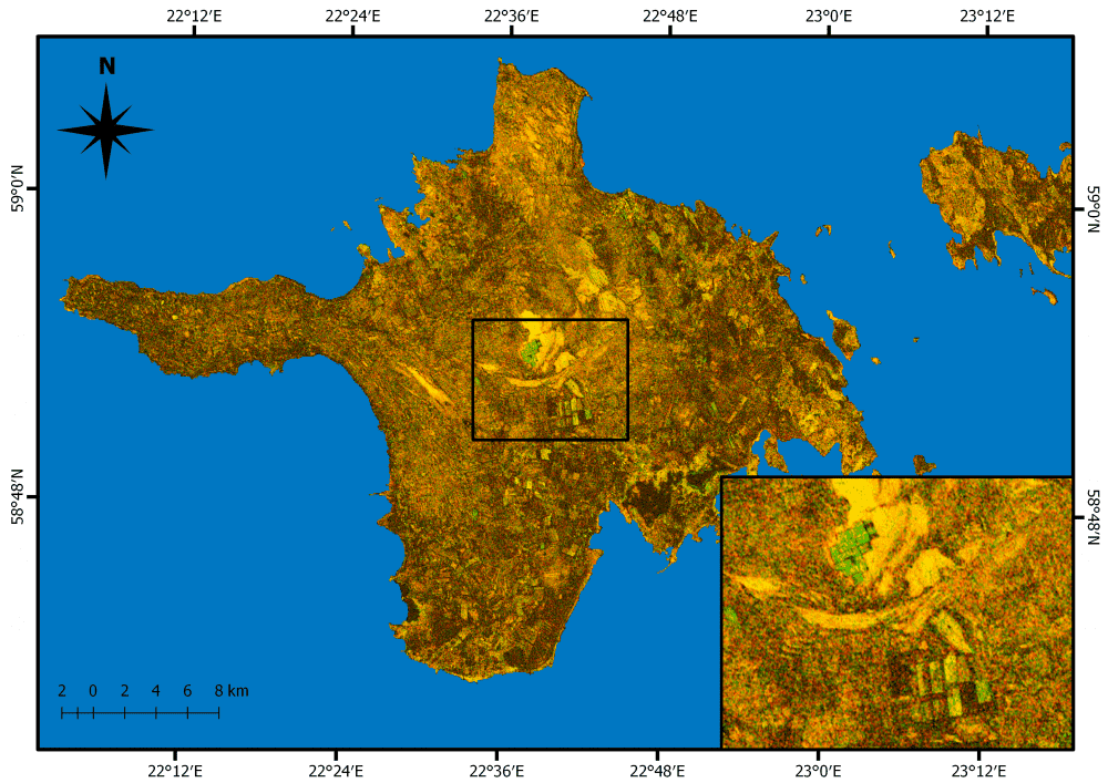
Grasslands cover approximately 37 percent of Earth's land surface when calculated with shrub-lands and savannas. In Western Europe, grasslands comprise 40 percent of agricultural land. And now European Space Agency (ESA) Copernicus Sentinel satellites are being used to detect and better evaluate management practices of grasslands in Estonia.

Satellites Identify Unplanned Urbanization

Satellites Identify Unplanned Urbanization

East View Geospatial is teaming with Planet and the World Bank to identify unplanned urbanization in specific developing areas using satellite imagery. Starting in mid-2017, East View Geospatial will begin calculating and detecting change to the Floor Space Index...

Airbus Creates  ˜Airbus Aerial' Commercial Drone Services Startup

Airbus Creates  ˜Airbus Aerial' Commercial Drone Services Startup

Airbus recently launched its U.S. base and operations of a new commercial drone startup: Airbus Aerial. With bases in the United States and Europe, Airbus Aerial's initial business will focus on developing new imagery services that leverage software and aerospace technology to offer actionable data and analysis of information provided by drones, satellites, high-altitude aircraft and other sources.

16th Century Dutch Star-Shaped ˜Moat Fort'

16th Century Dutch Star-Shaped ˜Moat Fort'

Fort Bourtange is a star-shaped moat fort, located in the village of Bourtange in the east of Groningen in the Netherlands near the German border. This fort was built in 1593 to create a border around the only road between Germany and Groningen, which was was occupied by Spaniards around the time of the Eighty Years War.

Shadows Across Arctic Iceberg

Shadows Across Arctic Iceberg

The shadow of NASA’s P-3 aircraft is seen over an iceberg on a May 8, 2017, flight supporting NASA’s Operation IceBridge mission. IceBridge began its final week of Arctic Spring 2017 surveys with a glacier-packed mission in Greenland.

Satellites Locate Optimal Shipping Paths

Satellites Locate Optimal Shipping Paths

With approximately 90 percent of world trade carried by ships, ensuring a vessel follows the fastest route has obvious economic benefits. By merging measurements from different satellites, the European Space Agency (ESA) is providing key information on ocean currents to make shipping more efficient and help reduce carbon dioxide emissions.

NEWEST V1 MEDIA PUBLICATION

April Issue 2024