The second satellite of the Sentinel-1 mission, Sentinel-1B, was successfully launched from Europe's Spaceport in French Guiana on April 22, 2016.
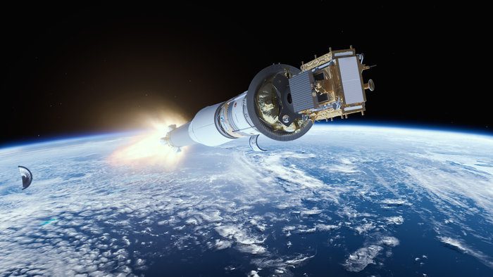
The second satellite of the Sentinel-1 mission, Sentinel-1B, was successfully launched from Europe's Spaceport in French Guiana on April 22, 2016.
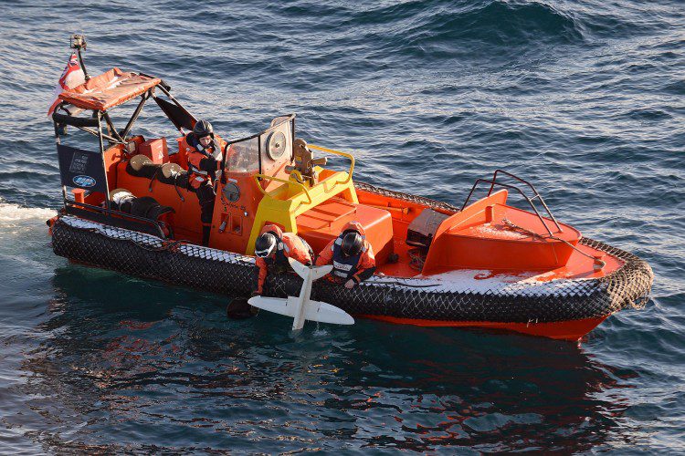
A 3D-printed UAS built by the University of Southampton is helping the British Royal Navy's ice-patrol ship HMS Protector navigate through Antarctic seas.
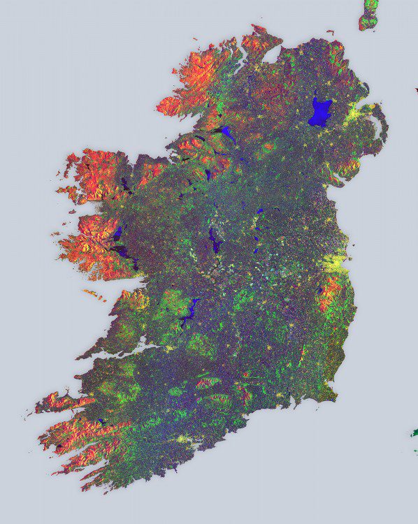
European Space Agency (ESA) Sentinel-1A satellite data were used to create a multi-temporal color composite of land coverage across Ireland. With a coastline of 7,500 kilometers, Ireland is home to 4.8 million people.

A study recently published in the Remote Sensing of Environment journal used Landsat data from 1984 and 2010 to show how paved surfaces in the Washington, D.C., area have increased dramatically.
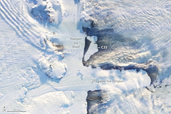
On April 7, 2016, multiple satellites captured the birth of two large icebergs that were shed along a crack on Antarctica's Nansen Ice Shelf during persistent strong offshore winds. The icebergs currently pose no threat to shipping, but they may pose a threat to scientific instruments moored to the seafloor to monitor climate change.

Expedition 47 Commander Tim Kopra of NASA captured this night image of Chicago on April 5, 2016, from the International Space Station. Expedition 47 began March 1, 2016, and ends June 5, 2016, with no spacewalks currently planned.
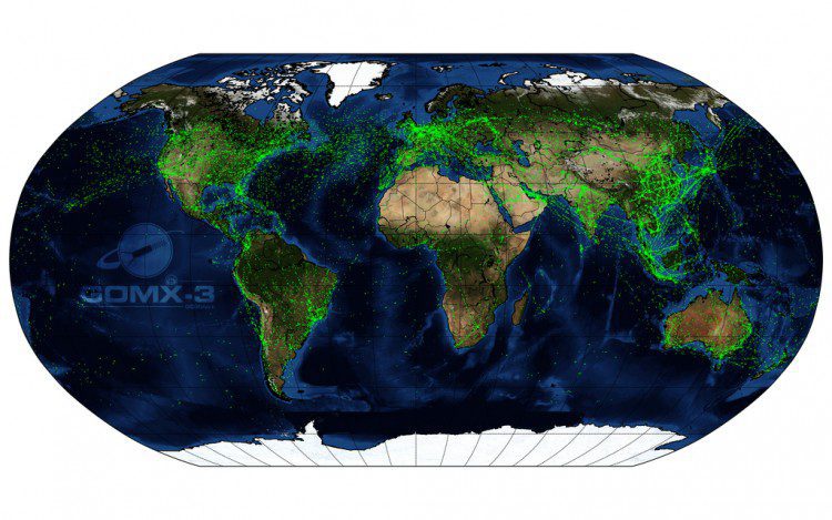
The GomX-3 CubeSat, which was ejected from the International Space Station on Oct. 5, 2015, has been tracking aircraft in flight across Earth. Built for the European Space Agency (ESA) by GomSpace in Denmark, the CubeSat's distinctive helical antenna has detected millions of signals from aircraft.
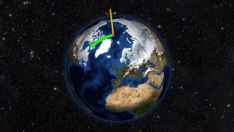
Using satellite data on how water moves around Earth, NASA scientists solved two mysteries about wobbles in the planet’s rotation. Earth's spin axis drifts slowly around the poles; the farthest away it has wobbled since observations began is 37 feet (12 meters). These wobbles don't affect daily life, but they must be taken into account to get accurate results from GPS, Earth-observing satellites and ground-based observatories.
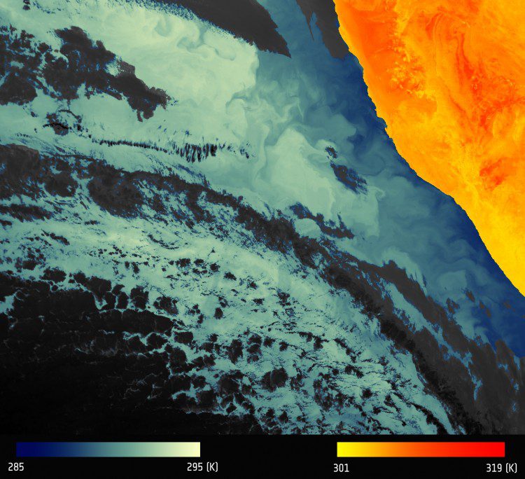
The first image from the European Space Agency (ESA) Sentinel-3A Sea and Land Surface Temperature Radiometer (SLSTR) depicts thermal signatures over a part of western Namibia and the South Atlantic Ocean.
The European Space Agency (ESA) and Australia's national geological survey, Geoscience Australia (GA), partnered to ensure data from EU's Sentinel satellites are accessible in Southeast Asia and the South Pacific.
