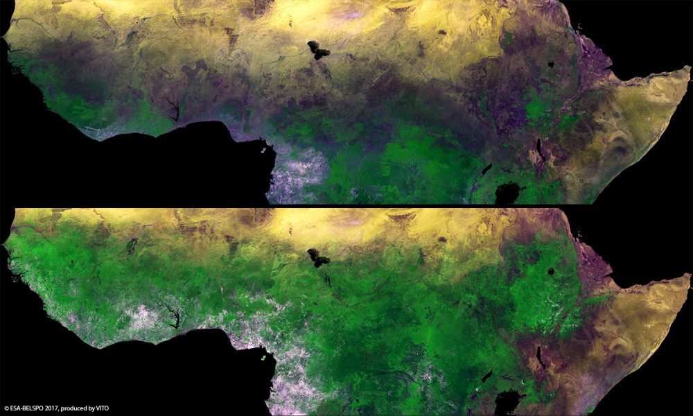
The European Space Agency (ESA) Proba-V minisatellite recorded the seasonal changes in Africa's sub-Saharan Sahel, which stretches more than 5,000 kilometers across Africa, from the Atlantic Ocean (Senegal, Mauritania) to the Red Sea (Sudan).
The European Space Agency (ESA) Proba-V minisatellite recorded the seasonal changes in Africa's sub-Saharan Sahel, which stretches more than 5,000 kilometers across Africa, from the Atlantic Ocean (Senegal, Mauritania) to the Red Sea (Sudan).
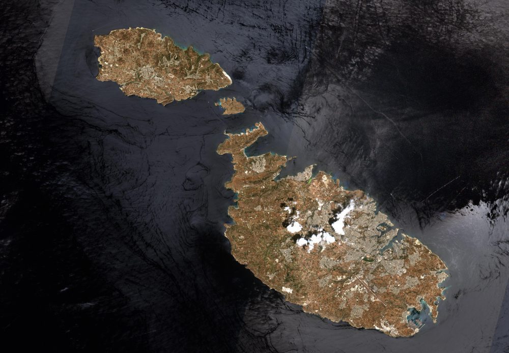
This image of Malta, captured by the European Space Agency (ESA) Copernicus Sentinel-2B satellite, is one of the first sets of images delivered via Alphasat, which is in geostationary orbit 36,000 kilometers above Earth.
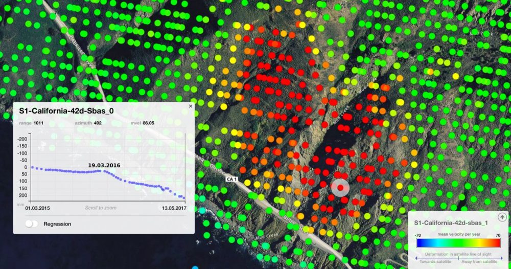
On May 20, 2017, more than a million tons of dirt and rock buried part of California's Highway 1 along the Pacific coastline in the state's Big Sur region. In addition to cutting off the route, the landslide added some 12 acres of land to the shoreline.
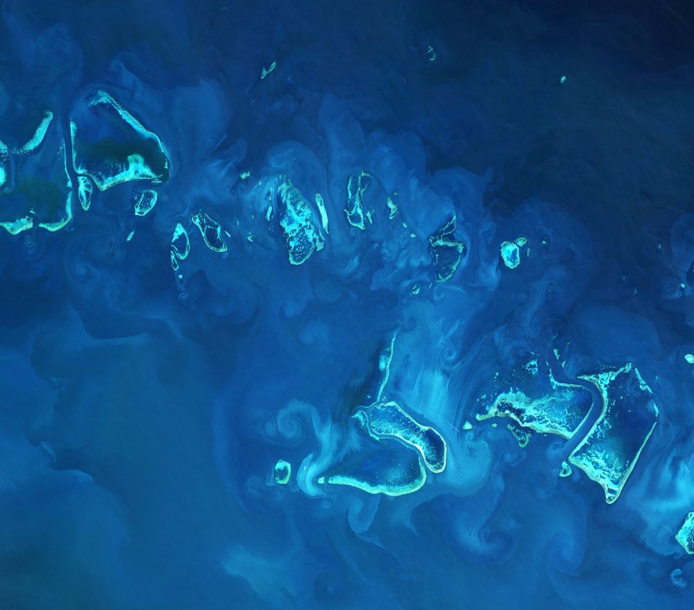
The European Space Agency (ESA) Copernicus Sentinel-2A satellite collected an image of part of the Great Barrier Reef off Australia's northeast coast on April 1, 2017.
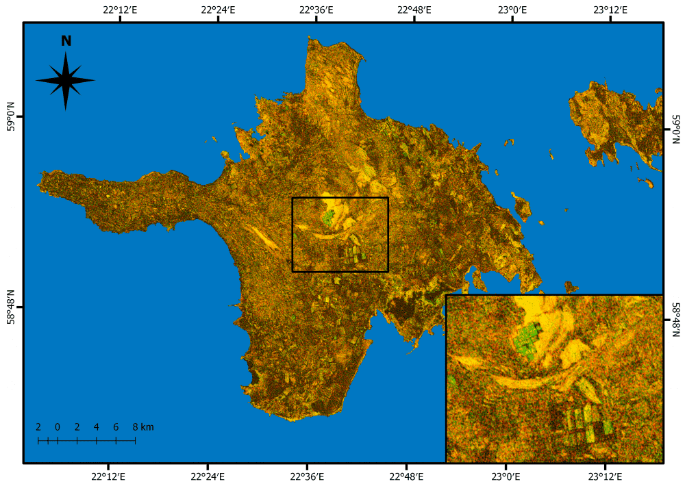
Grasslands cover approximately 37 percent of Earth's land surface when calculated with shrub-lands and savannas. In Western Europe, grasslands comprise 40 percent of agricultural land. And now European Space Agency (ESA) Copernicus Sentinel satellites are being used to detect and better evaluate management practices of grasslands in Estonia.
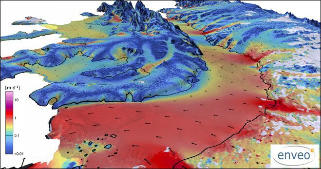
More than two decades of observations by five radar satellites show the acceleration of ice loss of 30 glaciers in Western Palmer Land in the southwest Antarctic Peninsula.
The European Space Agency (ESA) Copernicus Sentinel-3A satellite collected this image of the Bering Sea, north of the Alaska Peninsula, on March 26, 2017.
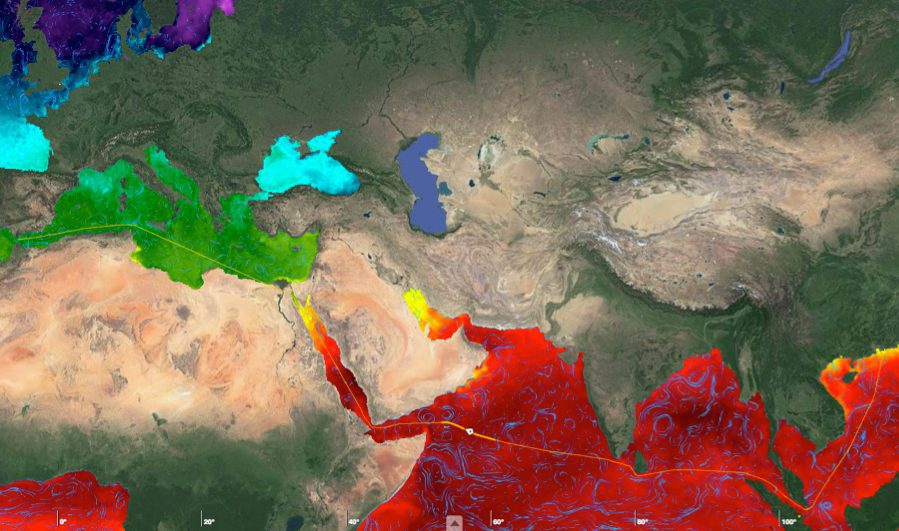
With approximately 90 percent of world trade carried by ships, ensuring a vessel follows the fastest route has obvious economic benefits. By merging measurements from different satellites, the European Space Agency (ESA) is providing key information on ocean currents to make shipping more efficient and help reduce carbon dioxide emissions.
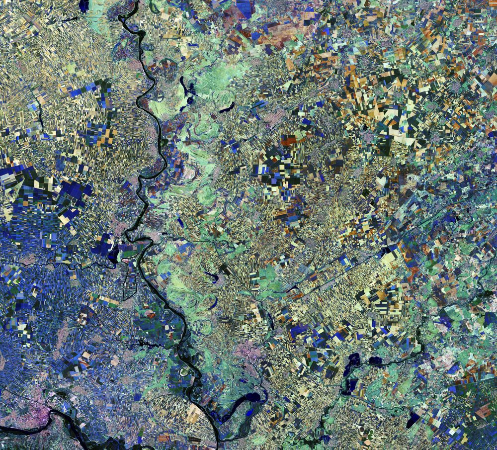
The European Space Agency (ESA) Copernicus Sentinel-2A satellite captured this image of the Vojvodina region of northern Serbia. The area lies in the southern part of a region previously covered by the Pannonian Sea from two million to 23 million years ago. Today, the land boasts a fertile soil, as evidenced by the many agricultural fields visible as geometric shapes.
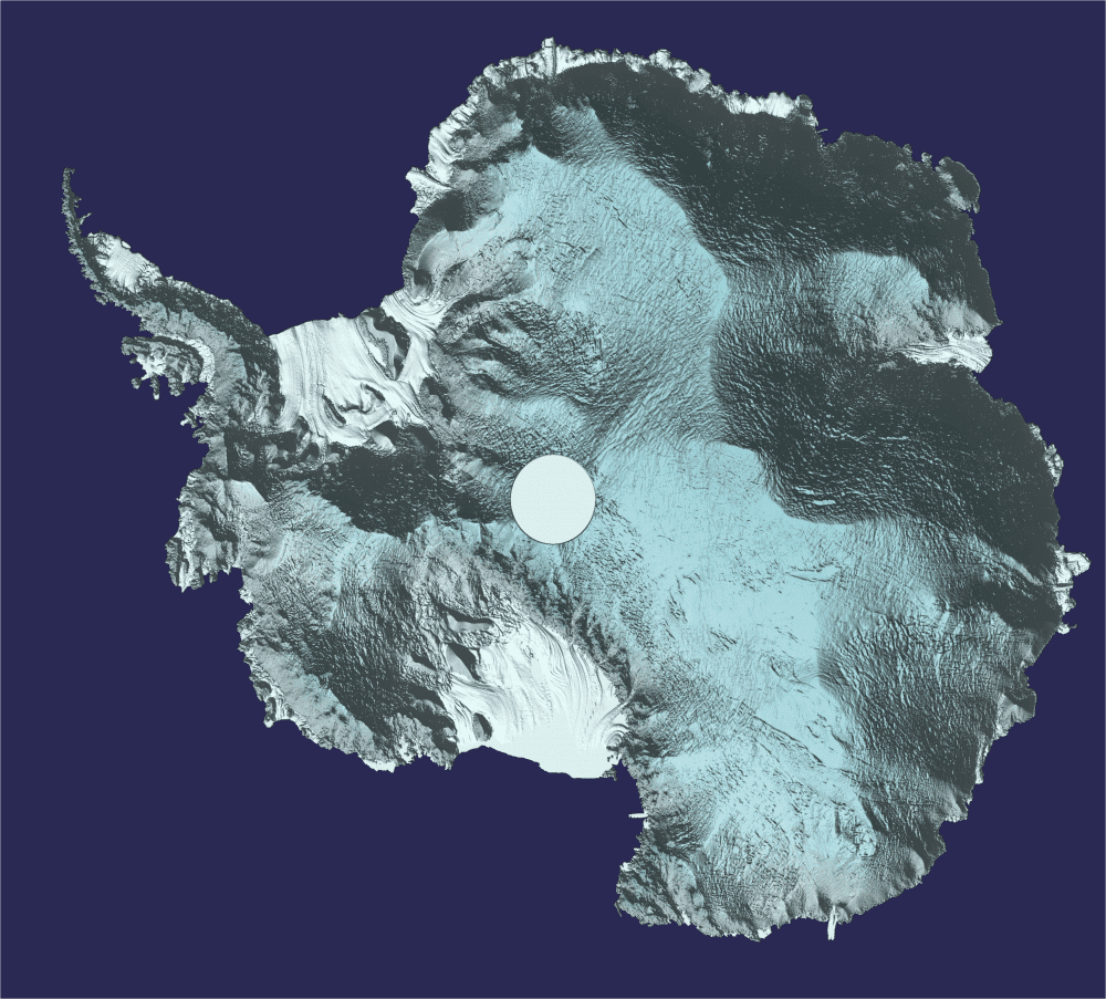
Approximately 250 million measurements taken by the European Space Agency (ESA) CryoSat during the last six years have been used to create a unique 3D view of Antarctica, offering a snapshot of the undulating surface of this vast ice sheet.
