A new study shows that winds are responsible for the widespread growth of ponds in three watersheds along the Mississippi River.
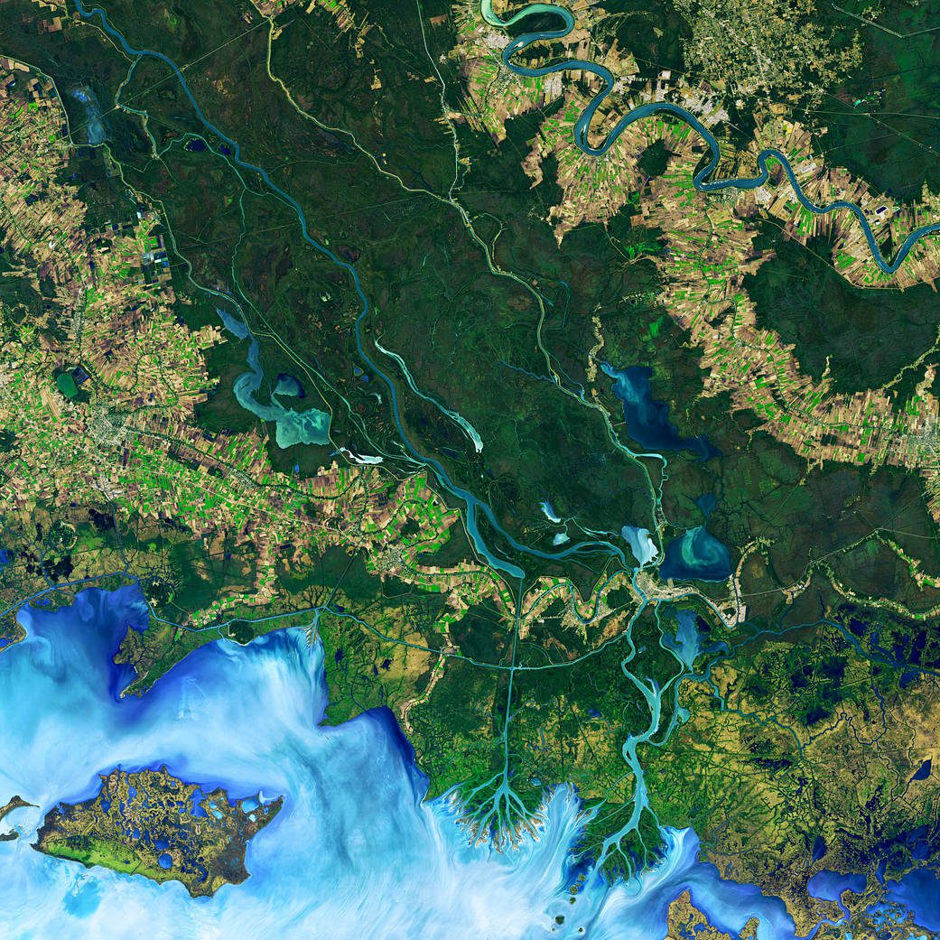
A new study shows that winds are responsible for the widespread growth of ponds in three watersheds along the Mississippi River.
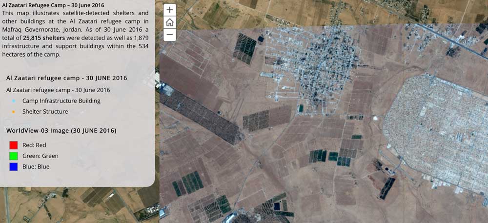
The United Nations Institute for Training and Research (UNITAR), through its Operational Satellite Applications Programme (UNOSAT), and Radiant.Earth agreed to explore new Earth observation data innovations supporting humanitarian disaster management, global health, climate change, sustainable water management and cultural heritage.
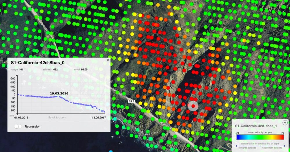
On May 20, 2017, more than a million tons of dirt and rock buried part of California's Highway 1 along the Pacific coastline in the state's Big Sur region. In addition to cutting off the route, the landslide added some 12 acres of land to the shoreline.
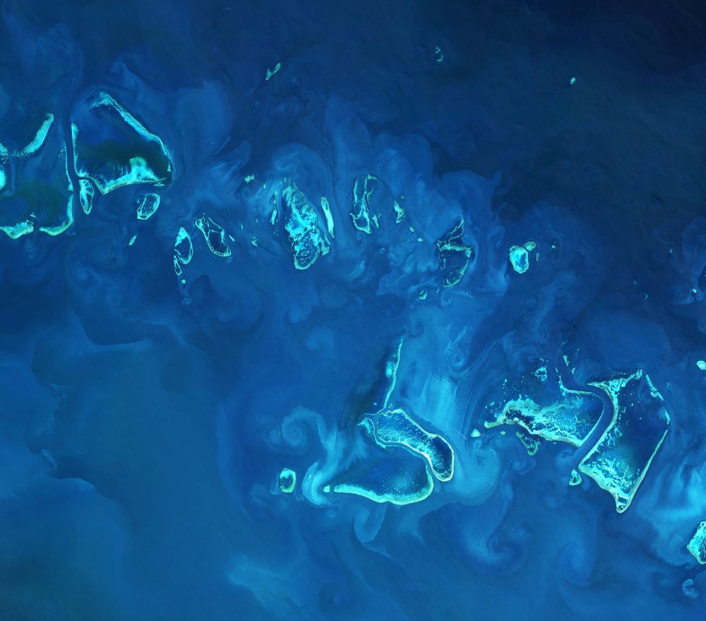
The European Space Agency (ESA) Copernicus Sentinel-2A satellite collected an image of part of the Great Barrier Reef off Australia's northeast coast on April 1, 2017.
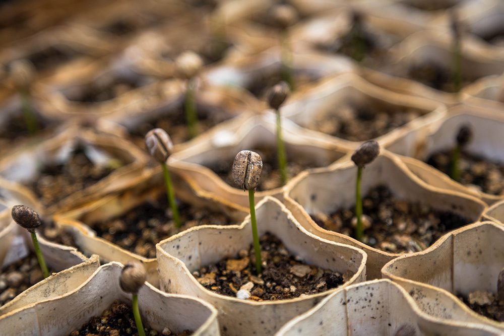
Earth-i teamed with WeatherSafe to support coffee farmers of Burundi through Earth-i's ACCORD program, which combines high-resolution satellite imagery with crop analysis to provide stakeholders with critical insights on key coffee farming decisions to improve crop quality, thereby supporting sustainable growth for coffee farmers large and small.
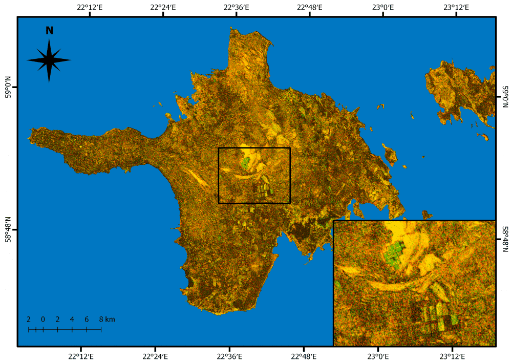
Grasslands cover approximately 37 percent of Earth's land surface when calculated with shrub-lands and savannas. In Western Europe, grasslands comprise 40 percent of agricultural land. And now European Space Agency (ESA) Copernicus Sentinel satellites are being used to detect and better evaluate management practices of grasslands in Estonia.
The Geological Remote Sensing Group (GRSG) expanded its membership as Planet”owners and operators of the world's largest commercially operated fleet of satellites”became the group's latest corporate member.
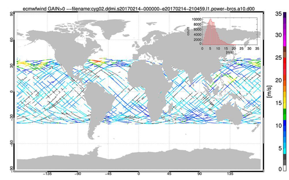
NASA's Cyclone Global Navigation Satellite System (CYGNSS), a constellation of eight microsatellites that will take detailed measurement of wind speeds inside hurricanes, successfully completed the development and on-orbit commissioning phases of its mission and moved into the science operations phase.
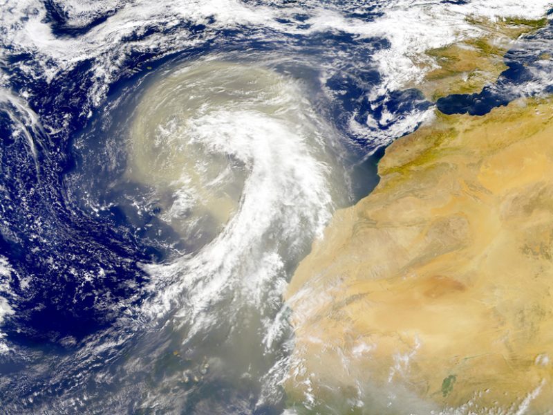
Earth's atmosphere is dusted with tiny particles known as aerosols, which include windblown ash, sea salt, pollution, and other natural and human-produced materials. Aerosols can absorb or scatter sunlight, affecting how much light reflects back into space or stays trapped in the atmosphere.
Cape Canaveral, 31/03/2017 – The SES-10 telecommunications satellite built by Airbus for the Luxembourg-based operator SES has been successfully launched by Falcon 9 from NASA’s Kennedy Space Center in Florida, USA. It will provide replacement and additional...
