Users of UAS aerial images must be open to the idea that legitimate UAS operators interested in complying with the law might not be able to fly the mission as planned due to operational restrictions imposed by the FAA.

Users of UAS aerial images must be open to the idea that legitimate UAS operators interested in complying with the law might not be able to fly the mission as planned due to operational restrictions imposed by the FAA.

The concept of cloud-based augmented reality (AR) is on the precipice of fundamentally changing organizational decision making for all types of industries. However, with any new technological frontier, there are many innovative startups vying to take the lead in the practical, commercial application of AR. And this is exactly what's happening today, with the geospatial sector being on the forefront of this technology frontier.

It's difficult to believe there was a time with parallel worlds of GIS and imagery. Now they're tightly tied and getting more tightly integrated.
The agency I'm privileged to lead celebrates a major anniversary this fall. It's been a remarkable 20 years”from NIMA stand-up to NGA transition to the GEOINT Revolution. And I can proudly”and confidently”say that GEOINT is on the rise, more relevant than ever to our customers today and poised for a tomorrow that's filled with possibility.
Even before the National Geospatial-Intelligence Agency (NGA) renaming transformed the agency from the more-static-sounding National Imagery and Mapping Agency (NIMA), the organization was hard at work to speed and ease the workflow of turning raw images into insight. The organization has been at the technological forefront of exploiting imagery and continues to provide valuable information in a timely manner that impacts missions and lives.
Deepwater Horizon”the memories are fading, but the negative effects still are being felt six years later and will be for a while to come. Much has been said about the impacts on the wildlife, coastal ecosystems, fisheries, tourism and other parts of the local environment and economy.
I recently had the distinct pleasure of addressing the U.S. Park Service, and U.S. Fish and Wildlife Service Geospatial Training Workshop at the National Conservation Training Center outside Shepardstown, West Virginia. The talk was an overview of how far we've come as well as where we're headed in terms of remote-sensing inputs and geospatial understanding.

In 2015, I developed and taught a free Massive Open Online Course (MOOC), Geospatial Intelligence (GEOINT) and the Geospatial Revolution, to help broaden the discipline. When I began outlining the course, I asked several in the community, what should be the focus of the MOOC? The common reply was teach the principles.
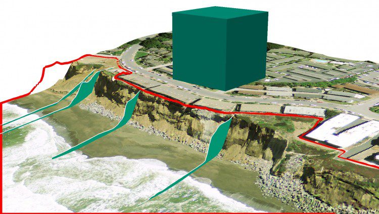
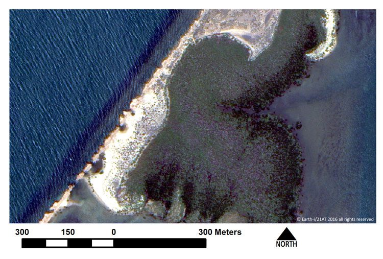
Coastal erosion is a persistent problem along the California coast that can drastically affect local communities. In the last 20 years alone, erosion has taken a particularly high toll in Pacifica, Calif. Through wind, rain and wave action, the scenic bluffs that line the ocean in this beachside town have continued to retreat to a point where local homes have been evacuated and condemned for demolition.

Right now, it's kind of a Wild West out there, says Scott Simmons, executive director of the Standards Program of the Open Geospatial Consortium (OGC).
