Ball Aerospace has been actively developing its TotalSight Flash LiDAR system for the last six years. Flash LiDAR works much like a traditional digital camera, with the sensor taking a range and intensity snapshot with each laser pulse.
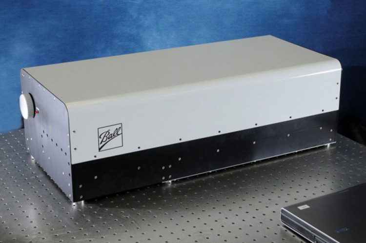
Ball Aerospace has been actively developing its TotalSight Flash LiDAR system for the last six years. Flash LiDAR works much like a traditional digital camera, with the sensor taking a range and intensity snapshot with each laser pulse.

Ambitious statewide use of LiDAR is a natural progression for the technology, as the realism of such data dramatically improves human understanding.
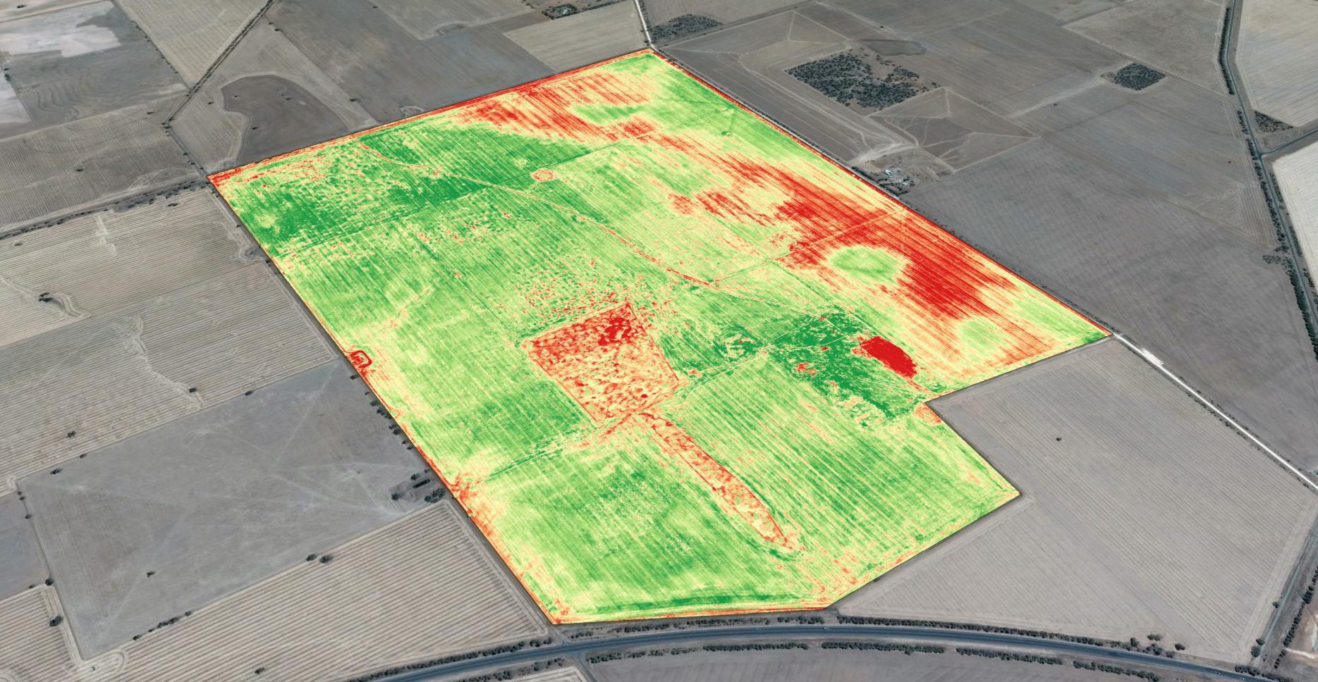
Basic crop scouting from drones provides a major improvement over how field surveys previously were done, and it's the primary driver for drone-technology adoption. Crop scouts traditionally were employed to walk farm fields to monitor crop condition. This is hot, time-consuming work, and crop scouts have difficulty visiting even a small percentage of a whole field, easily missing problem areas.
By Chris Crosiar, Office of Basic and Applied Research, National Geospatial-Intelligence Agency (www.nga.mil), Springfield, Va. In my experience as a research and development scientist at the National Geospatial-Intelligence Agency, I recall a time when the mention of...
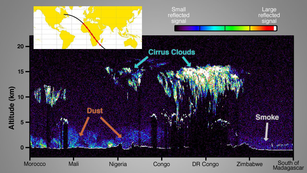
By Steve Cole, public affairs officer, Earth Science Division, NASA (www.nasa.gov), Washington, D.C. Four new NASA Earth-observing missions are collecting data from space—with a fifth newly in orbit—after the busiest year of NASA Earth science launches in more...
When looking at all the coming changes to the geospatial technology tools and inputs that are emerging and immediately over the horizon, there's a mixed feeling of excitement and trepidation. How will all of these new data-collection platforms, workflows and analytics impact the world of today's practitioners as well as the vendor community?
By Dale Lehner, Office of Corporate Communications, National Geospatial-Intelligence Agency (www.nga.mil), Springfield, Va. The National Geospatial-Intelligence Agency (NGA) Advanced Visualization Branch, known as ASCSV, is taking imagery to new heights of...
