The European Space Agency (ESA) Copernicus Sentinel-2A satellite collected this false-color image over the jagged islands along the west coast of Greenland on Aug. 8, 2017.
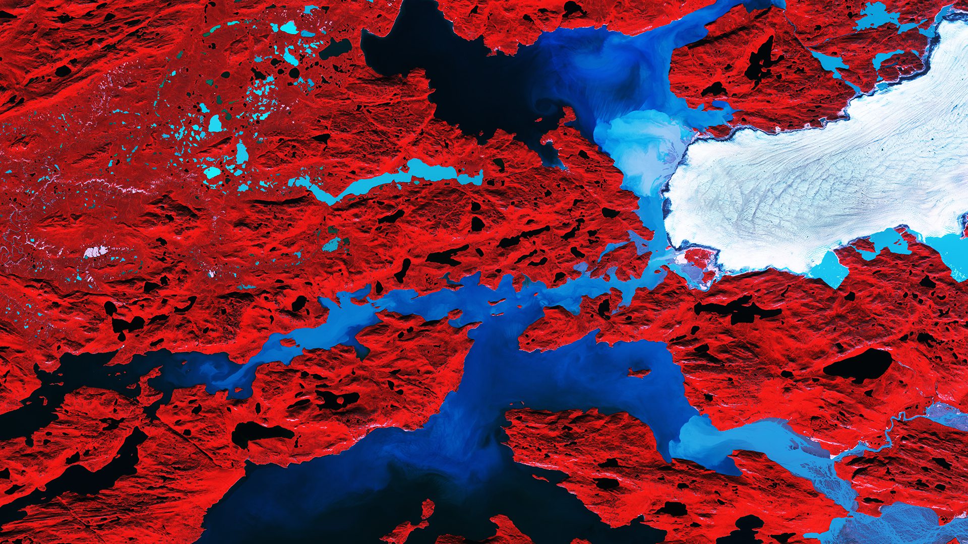
The European Space Agency (ESA) Copernicus Sentinel-2A satellite collected this false-color image over the jagged islands along the west coast of Greenland on Aug. 8, 2017.
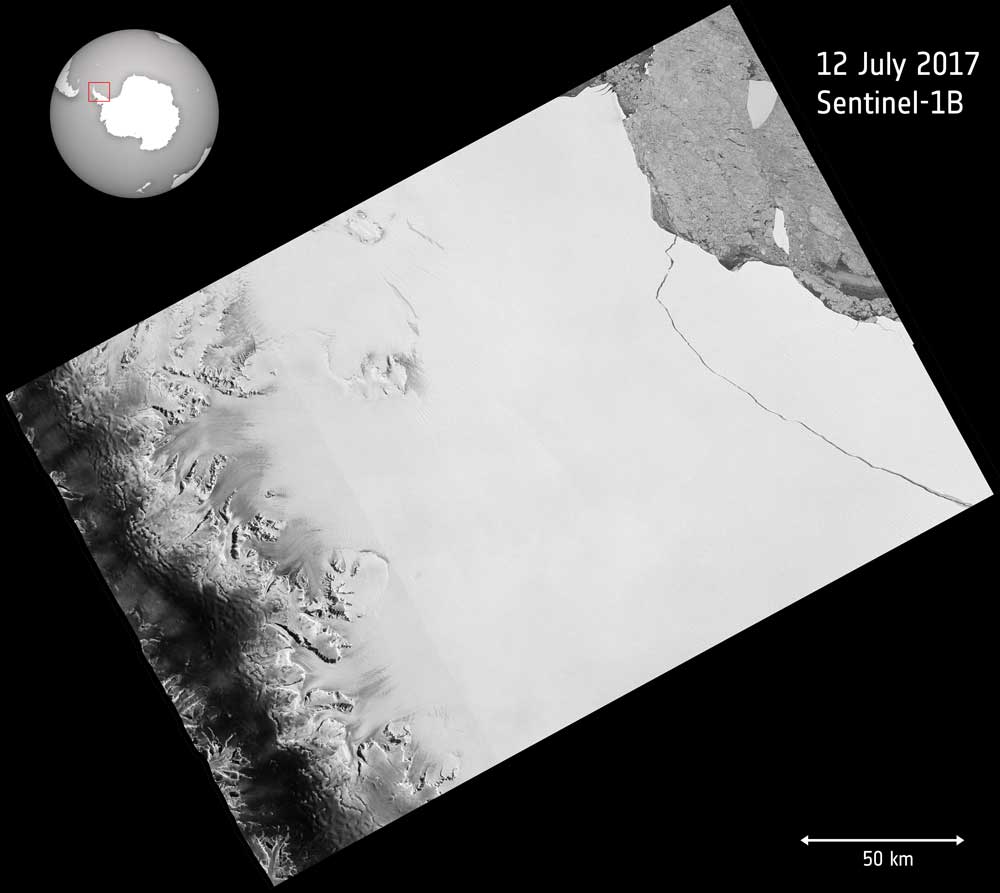
Over the last few months, a chunk of Antarctica's Larsen C ice shelf has been hanging on precariously as a deep crack cut across the ice. Witnessed by the European Space Agency (ESA) Copernicus Sentinel-1 mission, a lump of ice more than twice the size of Luxembourg finally broke off on July 12, 2017.
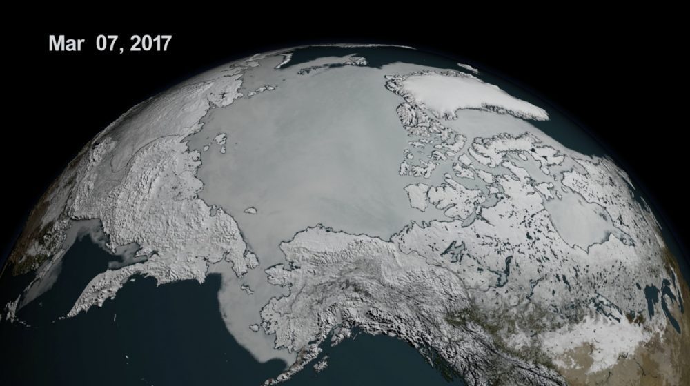
On Feb. 13, 2017, the combined Arctic and Antarctic sea-ice numbers were at their lowest point since satellites began to continuously measure sea ice in 1979.
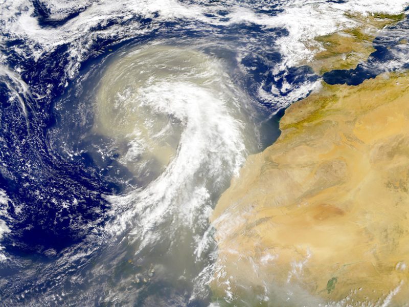
Earth's atmosphere is dusted with tiny particles known as aerosols, which include windblown ash, sea salt, pollution, and other natural and human-produced materials. Aerosols can absorb or scatter sunlight, affecting how much light reflects back into space or stays trapped in the atmosphere.
FAYETTEVILLE, Ark. – A geospatial science expert at the University of Arkansas will help refine international guidelines for greenhouse gas inventories that will be considered for adoption by the Intergovernmental Panel on Climate Change. The panel, known as IPCC,...
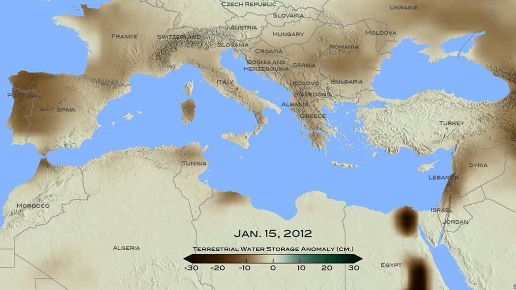
A new NASA study used remote-sensing and tree-ring data to conclude that the recent drought that began in 1998 in the eastern Mediterranean Levant region (Cyprus, Israel, Jordan, Lebanon, Palestine, Syria and Turkey) is likely the worst drought of the last nine centuries.
BLACKSBURG, Va., Nov. 23, 2015 — A professor in Virginia Tech’s College of Natural Resources and Environment ( www.cnre.vt.edu) is launching a new project to enable scientists to look many decades ahead and predict the effectiveness of land management practices...
WASHINGTON, D.C., November 19, 2015 — If you wanted to know whether shifts in the African climate during Paleolithic times correlated with the appearance and disappearance of hominin species, how would you find the answer? It’s a tricky question because of the...
By Chris Crosiar, Office of Basic and Applied Research, National Geospatial-Intelligence Agency (www.nga.mil), Springfield, Va. In my experience as a research and development scientist at the National Geospatial-Intelligence Agency, I recall a time when the mention of...
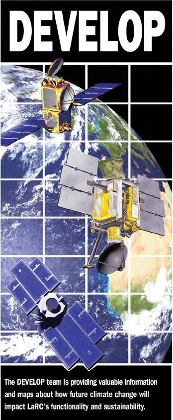
GIS and remote sensing play a dual role in shaping education and NASA development. By Anup Myneni, NASA Applied Sciences DEVELOP National Program (http://develop.larc.nasa.gov), NASA Langley Research Center, Hampton, Va. Educating future technological leaders and...
