In early May 2016, a destructive wildfire burned through Canada's Fort McMurray in the Northern Alberta region, forcing the evacuation of more than 80,000 people.
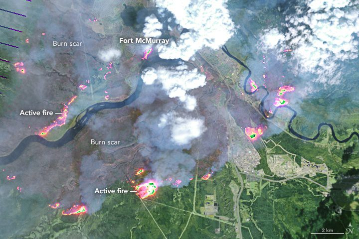
In early May 2016, a destructive wildfire burned through Canada's Fort McMurray in the Northern Alberta region, forcing the evacuation of more than 80,000 people.
December 21, 2015 — How can access to Sentinel data increase Canada’s ability to offer improved information on sea ice? Radar satellite data like those from Sentinel-1 can provide day and night information, and through clouds, of entire coastal areas even during...
