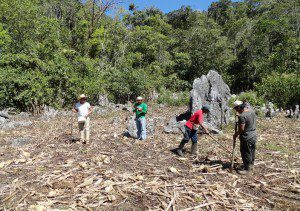
Satellite imagery will be used in Mexico's El Ocote Biosphere Reserve to help monitor such land-use changes as crop burning and logging. (Credit: Ecometrica)
An international project lead by sustainability software and data firm Ecometrica and funded by the UK Space Agency’s International Partnership Space Programme helped local organizations in Mexico secure funding of more than $1 million from the Global Environment Facility to support conservation of the El Ocote Biosphere Reserve in the state of Chiapas.
The project is providing new satellite data and mapping technology to local organizations to help monitor land-use change, fires and forest health. Satellite-derived information will be analyzed and delivered to local organizations via a network of regional labs.
Satellite data and mapping technology are helping us identify areas where community activities to promote forest-friendly agriculture are succeeding or running into problems, said Project Director Elsa Esquivel of Mexican NGO Ambio. We also hope the satellite data and mapping system will be expanded to other parts of Chiapas to help communities mitigate and adapt to climate change.

