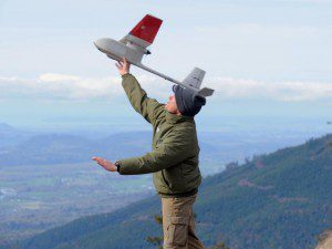
Mark Feller of the U.S. Geological Survey launches a drone from a ridge north of Hamilton, Wash., in this undated photo. The 4-pound UAS, equipped with cameras, was used to help track a local elk herd.
A survey over a section of public land near Mount Vernon, Wash., was a first-time trial run using an unmanned aircraft system (UAS) to survey elk in dense, forested areas to estimate herd population. Surveyors will compare the number of radio-tagged elk in the area at the time of the survey with the number of tagged animals observed in video footage to estimate the herd's population.
The U.S. Geological Survey's Unmanned Aircraft Systems Project Office and U.S. Bureau of Land Management provided and operated the 4-pound, battery-powered aircraft. The U.S. Army previously used the planes in Afghanistan and Iraq.
Image courtesy of Associated Press/The Spokesman-Review.

