NAVIGATION It mounts on top of a vehicle, has 64 lasers that generate millions of data points per second, and is a potential game changer in the world of autonomous vehicle technology. The HDL-64E LiDAR sensor from Morgan Hill, Calif.-based Velodyne is designed for...
Consider an Integrated Approach for Upgrading Transmission Lines
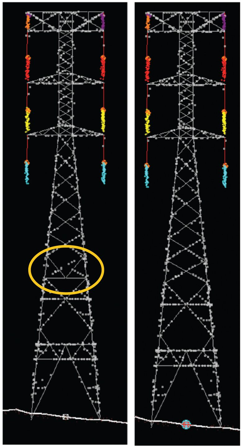
UTILITIES MANAGEMENT W.I.R.E. Services, a division of Manitoba Hydro International Ltd. (MHI), recently completed an aerial LiDAR survey and engineering upgrade project for a large transmission line utility in Panama. The project included a LiDAR survey from which...
Delivering Time-Sensitive 3-D Imagery to the Warfighter
 In August 2011, Ball Aerospace & Technologies Corp., under a contract from the Rapid Reaction Technology Office in the Office of the Secretary of Defense, demonstrated its real-time, full-motion 3-D Flash LiDAR Imaging System with supporting Ball-developed...
Emergency Relief, Humanitarian Efforts Require Accurate, Real-Time Satellite Imagery
To support humanitarian relief and human security activities around the world, DigitalGlobe has formed an alliance with the United Nations Institute for Training and Research’s Operational Satellite Applications Programme (UNOSAT). Using FirstLook, a DigitalGlobe...
Satellite Technology Bolsters Global Maritime Surveillance
The Satellite Automatic Identification System (S-AIS) from exactEarth is forever changing the way geospatial intelligence professionals enhance maritime domain awareness. S-AIS provides a timely, unambiguous foundation of the maritime common operating picture for the...
Solve Problems with the Best I.D.E.A.S.: Intelligent Data Exploration and Analytics System
The SI Organization and partners Global Marketing Insights and GCS Research, along with a commercial high-performance computing facility, have found a way to reach the masses with a user-friendly, easily accessible system for satellite data and operational models. ...
Exploiting Time-Derived, Activity-Based Intelligence
Historically, geospatial intelligence (GEOINT) analysis focused on scheduled, precise, preplanned reconnaissance against known targets—countries or actors with the capability to threaten U.S. interests with military force. Today advanced communications systems and...
Creating Clarity for Human Terrain Analysis
In a world that’s increasingly influenced by nontraditional, disparate data, as well as open source information channels, the Department of Defense (DoD) continues to lack the critical ability to rapidly synthesize and aggregate information at scale to fully...
Racing to Adopt FMV Technology
The rapid emergence of full-motion video (FMV) technology is assuming the role aerial photography once filled. As “instant access†to information becomes the norm, how do we envision meeting the demand to handle growing amounts of streaming FMV? With more than...
Kairos Targets Physical, Cyber Threats with Big Data-in-Motion Analysis
Protecting critical infrastructure against physical and cyber attacks is among the most crucial challenges facing government and commercial organizations in the 21st century. The solution is elusive because it requires “Big Data-in-Motion Analytics,†the real-time...
