Automated Extraction Solution Meets Demanding Requirements

Automated Extraction Solution Meets Demanding Requirements

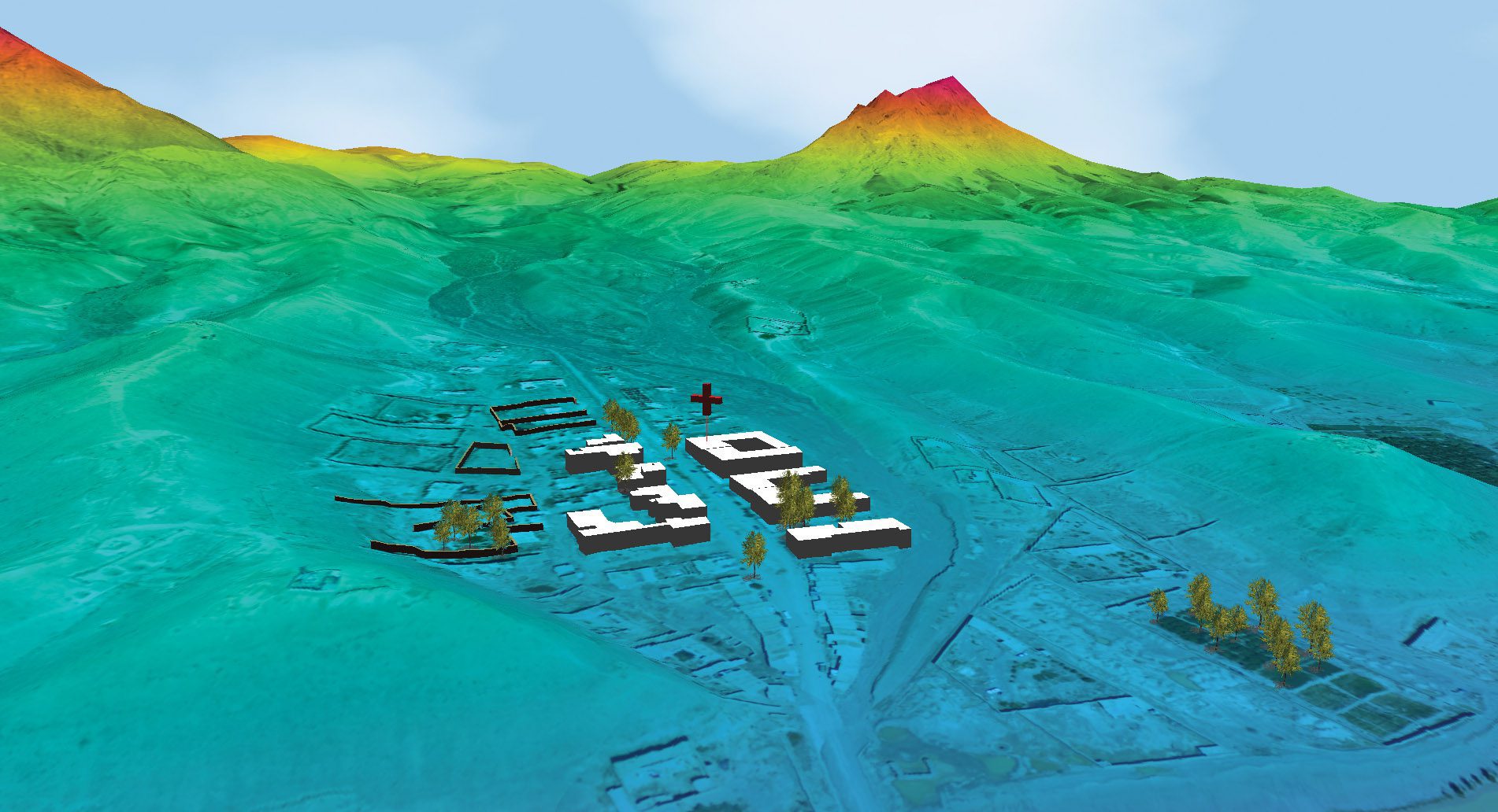
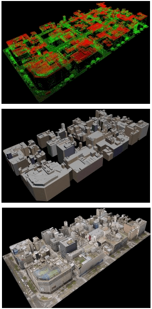
3-D GEOINT Overwatch’s optimized solutions dramatically reduce the time required to produce high-quality 3-D GEOINT products. Identifying the Problem High-resolution 3-D terrain and mission modeling helps decision makers understand the real-world conditions they...

Pan-sharpening: Solving Consistency and Complexity Problems

Pan-sharpening: Solving Consistency and Complexity Problems

Image Fusion For the defense industry, the ability to have accurate color satellite image information is invaluable. Satellite data can be generated daily and from a safe distance. This means a target can be monitored for changes in activities real time and with...

Accessing Previously Unattainable Solutions

Accessing Previously Unattainable Solutions

Geospatial Data and Model Discovery In the age of big data, the volume of geospatial information available through disparate sources can be overwhelming. Even the most sophisticated users often struggle to discover the right data and models to make decisions and solve...

How Disaster Ready Are You?

How Disaster Ready Are You?

Esri Helps Central U.S. States Participate in the Nation’s Largest Emergency Exercise On the morning of May 20, 2011, hundreds of emergency responders across the central United States got the alert: A devastating earthquake along the New Madrid fault line had just...

Improve Public Services, Protect Communities

DigitalGlobe Homeland Security Solutions Provide Critical Insight DigitalGlobe’s high-resolution imagery and information solutions have played a key role in the effectiveness of programs designed to manage and monitor industries that impact homeland security. Using...

Bolster Incident Management and Mass Notification

Bolster Incident Management and Mass Notification

Buffalo Computer Graphics Delivers Large-Scale, High-Capacity Solutions Buffalo Computer Graphics Inc. (BCG) is a global provider of geographic information systems, crisis incident management and mass notification solutions, maritime training simulation systems, and...

Merrick Maps the Southeastern U.S. Coastline

MULTISENSOR MAPPING Merrick & Company provided LiDAR and hyperspectral imaging services and products to the U.S. Army Corps of Engineers (USACE), Joint Airborne Lidar Bathymetry Technical Center of eXpertise (JALBTCX), to map the southeastern U.S. coastline....

Use LiDAR, Oblique Images to Texture 3-D City Models

Use LiDAR, Oblique Images to Texture 3-D City Models

3 - D MODELING Terrasolid added new functionality to TerraScan, the company’s point cloud processing software. For two years the software has had the ability to automatically vectorize 3-D building models based on classified point clouds and building roof points....

NEWEST V1 MEDIA PUBLICATION

April Issue 2024