April 10, 2014
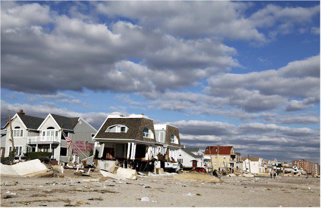
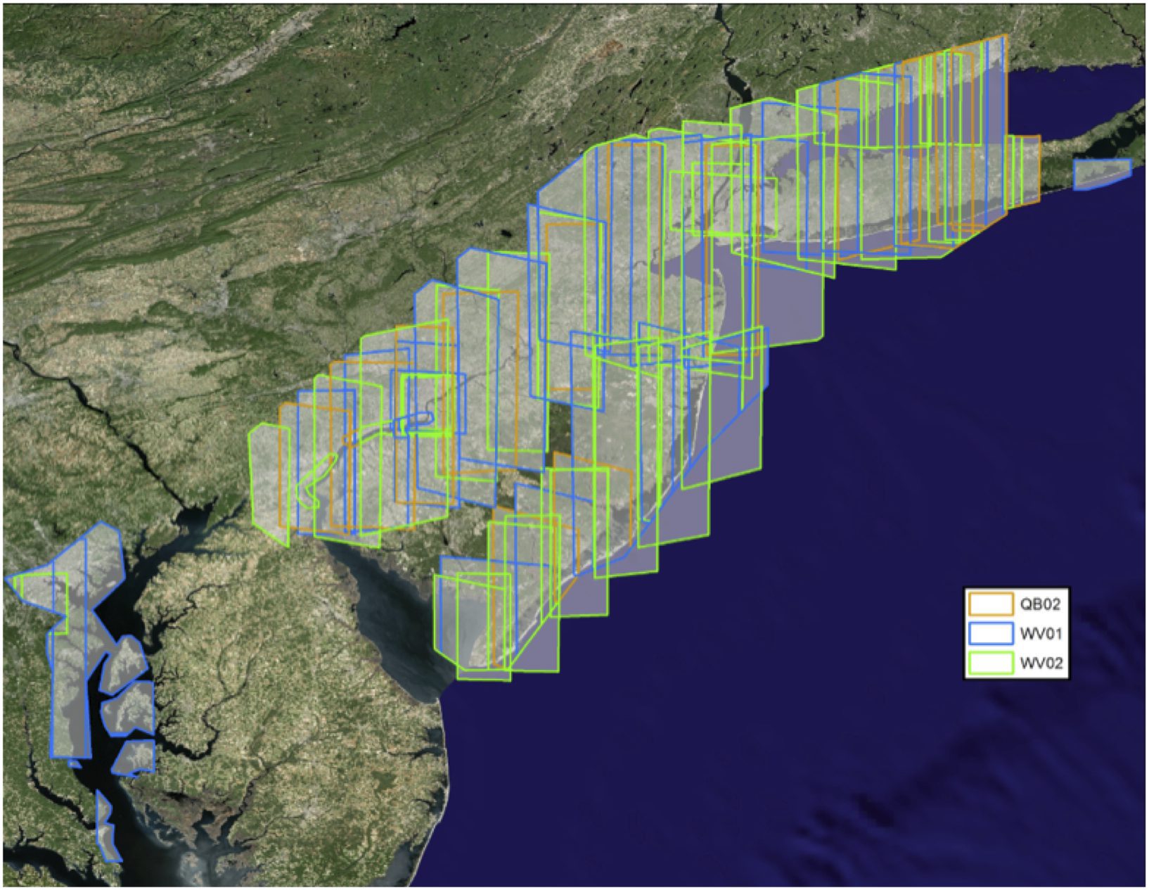
Geospatial Analysis Geospatial information is increasingly being used to drive critical decisions in government agencies of all sizes. In times of humanitarian crisis or disaster response, when it’s critical for federal agencies to collaborate with state and local governments, geospatial information can enhance many key activities. Two key examples are predicting storm surge
April 10, 2014
Visualization/Simulation Simulation-based virtual training systems require geo-specific visual environments for realistic training of military and security forces, but scenarios often are based in areas of the world with limited map data availability. LAND INFO creates map datasets optimized for visualization and simulation (viz/sim) applications on a worldwide basis by leveraging the global reach of
April 10, 2014
Activity-Based Intelligence Want to put the power of Geospatial Intelligence (GEOINT) in your hands? Lockheed Martin delivers capabilities and tools for actionable intelligence. We combine big data analytics with advanced geo-registration empowered by a cloud configuration. With Lockheed Martin, activity-based intelligence (ABI) is a present-day reality, not a future state. Lockheed Martin’s GeoFlix™ full-motion
April 10, 2014
Threat Detection With water covering about 70 percent of the planet, maritime domain awareness is one of the most important activities undertaken by national and international agencies. Traditionally, maritime security agencies have relied on surveillance aircraft, ships following patrol patterns and coastal radar to search for suspicious vessels and activities. Typically this approach is
October 17, 2013
Want to put the power of Geospatial Intelligence (GEOINT) in your hands? Lockheed Martin delivers capabilities and tools for actionable intelligence. We combine big data analytics with advanced geo-registration empowered by a cloud configuration. With Lockheed Martin, activity-based intelligence (ABI) is a present-day reality, not a future state. Lockheed Martin’s GeoFlix™ full-motion video application provides
October 17, 2013
Simulation-based virtual training systems require geo-specific visual environments for realistic training of military and security forces, but scenarios often are based in areas of the world with limited map data availability. LAND INFO creates map datasets optimized for visualization and simulation (viz/sim) applications on a worldwide basis by leveraging the global reach of com-mercial high-resolution
October 17, 2013
Geospatial information is increasingly being used to drive critical decisions in government agencies of all sizes. In times of humanitarian crisis or disaster response, when it’s critical for federal agencies to collaborate with state and local governments, geospatial information can enhance many key activities. Two key examples are predicting storm surge impacts and stopping the
October 17, 2013
DigitalGlobe owns and operates the world’s most agile constellation of high-resolution commercial Earth imaging satellites. With five satellites orbiting the globe, DigitalGlobe collects more than 2.5 million square kilometers every day and can revisit the same location daily. WorldView-3, with its newly added superspectral, short-wave infrared (SWIR) sensor, is scheduled to launch in 2014, further