TerraGo, a pioneer of geospatial collaboration and enterprise mobility software, announced today the integration with Topcon’s Sokkia high-accuracy GNSS receivers to meet the needs of the most demanding field positioning tasks. TerraGo Magic now offers advanced...
DigitalGlobe Announces SpaceNet Challenge Round 2 Results and Future Challenges
WESTMINSTER, Colo. - DigitalGlobe, Inc. (NYSE: DGI), the global leader in Earth imagery and information about our changing planet, today announced the SpaceNet Challenge Round 2 results and plans for the next two SpaceNet Challenges. A collaboration between...
Geospatial Companies Join Forces to Fight Wildfires
Insitu, FireWhat and Esri partnered to help aerial reconnaissance for fighting wildfires. Insitu's INEXA Solutions professional aerial remote-sensing services group will work with FireWhat's fire professionals, using its GIS customized for firefighters and hosted on Esri's ArcGIS platform.
Excelitas Technologies Celebrates 20 Years of Continuous, Failure-Free Operations of its Rubidium Atomic Frequency Standard (RAFS) Aboard On-Orbit GPS-IIR Satellite
WALTHAM, Mass. – Excelitas Technologies, a global provider of innovative, customized high-performance optoelectronic solutions, reached a major milestone today, the celebration of 20 years of continuous, reliable, failure-free on-orbit operation of its Rubidium...
Lockheed Martin Will Build New Space Instrument Focused on Vegetation Health and Carbon Monitoring
PALO ALTO, Calif. – Scientists will get a better understanding of our planet’s carbon cycle and vegetation health through a first-of-a-kind NASA instrument built by Lockheed Martin (NYSE: LMT). The Geostationary Carbon Cycle Observatory (GeoCARB) mission will use...
FARO Introduces FocusS 70 Laser Scanner
Lake Mary, FL - FARO® (NASDAQ: FARO), the world’s most trusted source for 3D measurement and imaging solutions for factory metrology, product design, construction BIM/CIM, public safety-forensics and 3D machine vision applications, announces the release of the...
FARO Introduces Next Generation FaroArm
Lake Mary, FL - FARO® (NASDAQ:FARO), the world’s most trusted source for 3D measurement and imaging solutions for factory metrology, product design, construction BIM/CIM, public safety-forensics and 3D machine vision applications, introduces the new FARO® QuantumS...
CoreLogic Completes Acquisition of Mercury Network, LLC
CoreLogic® (NYSE: CLGX), a leading global property information, analytics and data-enabled solutions provider, today announced that the company has completed the 100 percent acquisition of Mercury Network, LLC from Serent Capital. In June the company purchased a 45...
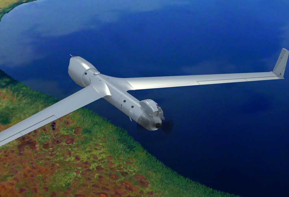
Insitu, FireWhat, Esri Join Forces in Fighting Wildfires With Eyes in the Sky
COSTA MESA, Calif. – Insitu, a leading information services company with more than one million operational unmanned aircraft systems flight hours, today announced its partnership with FireWhat, and Esri, the world leader in spatial analytics. Through this...
Airbus DS Communications Showcases Latest Solutions and Hosts Educational Sessions at APCO 2017
TEMECULA, CA - North America's leading Public Safety communications provider announces its plans for the upcoming Association of Public-Safety Communications Officials (APCO) 2017 Conference & Expo, August 13-16, in Denver, Colo. From its booth, #1601, Airbus DS...
