A NASA-produced map showing areas of eastern Puerto Rico that were likely damaged by Hurricane Maria has been provided to responding agencies, including the Federal Emergency Management Agency (FEMA).
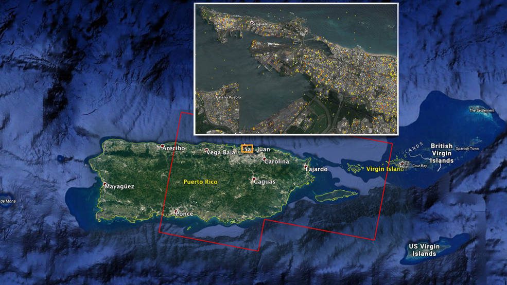
A NASA-produced map showing areas of eastern Puerto Rico that were likely damaged by Hurricane Maria has been provided to responding agencies, including the Federal Emergency Management Agency (FEMA).
JERSEY CITY, NJ – GRM Information Management, a leader in enterprise content management and records management, has introduced FieldForms. FieldForms is the latest advancement in GRM’s SaaS-based Intelligent Forms technology that incorporates intelligence behind...
Widnau, SWITZERLAND: GeoMax, professional surveying and construction product provider, announced today the X-PAD Office Fusion, the all-in-one office software combining data from multiple sensors into one easy-to-use interface X-PAD Office Fusion software manages,...
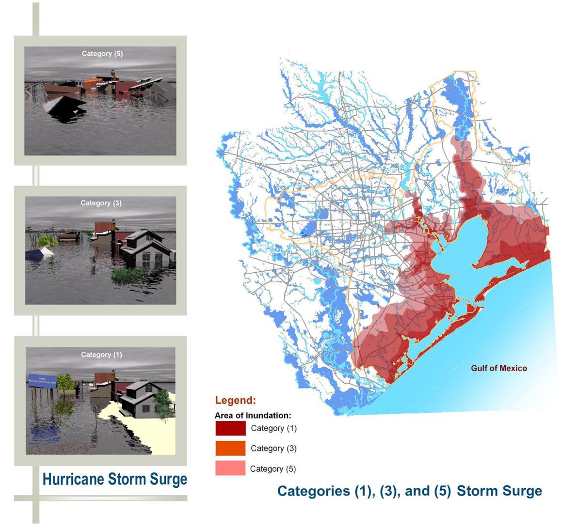
The prevalence of such extreme weather events with the rise of the number and intensity of hurricanes that rolled through the region, bringing with them violent winds and rains, highlighted the importance of utilizing decision-support tools such as these that help communities better plan for disasters, expedite response operations and better position resources to minimize the impact of these inevitable and disastrous events.
PALO ALTO, Calif./Hong Kong - Asia Satellite Telecommunications Company Limited (AsiaSat), Asia’s leading satellite operator and SSL, a leading provider of innovative satellites and spacecraft systems, today announced that the high performance AsiaSat 9 satellite...
In the 1960s and 70s, it was recognized that phosphorus runoff was negatively impacting the Everglades Protection Area. By the mid-80s, one solution was use of constructed wetlands, called Stormwater Treatment Areas (STAs). STAs biologically filter the water flowing...
WILSONVILLE, Ore. – FLIR announced today that the FLIR C3 thermal camera for contractors is now available for purchase. Unveiled earlier this year at the Consumer Electronics Show (CES), the FLIR C3 is a ruggedized, pocket-portable, dedicated thermal camera ideal...
RESTON, Va.- Leidos (NYSE: LDOS), a FORTUNE 500® science and technology company, was awarded a prime contract by the Defense Intelligence Agency (DIA) to apply more than 40 years of systems integration expertise to develop the DOMEX Data Discovery Platform (D3P)....
LIVERMORE, Calif., U.S./ CAPELLE A/D IJSSEL, the Netherlands - Topcon Positioning Group announces an update to its data collection software for the SmoothRideâ„¢ resurfacing workflow solution. RD-M1 Collect 2.0 includes updates designed to facilitate and optimize...
TUCSON, Ariz. -- The National Oceanic and Atmospheric Administration used six Raytheon Company (NYSE: RTN) Coyote® unmanned aerial vehicles to track and model Hurricane Maria. Launched from a NOAA WP-3D Orion hurricane hunter aircraft, the Coyotes flew directly into...
