COPENHAGEN and FRANKFURT, Oct. 18, 2017 ― Phase One Industrial and Lufthansa Aerial Services announced that they have signed an agreement to explore collaborative development and deployment of unmanned aerial vehicles (UAVs) for a range of specialized industrial...
Virtual Surveyor Unveils Productivity Tools in Drone Image Analysis Software at Commercial UAV Expo
LEUVEN, Belgium, 18 October 2017 – Virtual Surveyor nv, developer of UAV image visualization and analysis software, will launch a new suite of Productivity Tools next week at the 2017 Commercial UAV Expo in Las Vegas. The Virtual Surveyor software package enables...
Seiler Instrument, Inc. Selects Microdrones mdMapper Packages to Serve the Midwest U.S.
ST. LOUIS - Trimble Dealer Seiler Instrument & Mfg. Co., Inc., offers advanced, integrated tools for geospatial professionals in the Midwest U.S. With more than 72 years of successful sales and service, Seiler Instrument has built its reputation on exceptional...
New Road-SIT Survey Vertical Application for the Maintenance of the Utility Tetworks with Mobile Mapping Technology
18 October, 2017, Bologna, Italy – Siteco announces the implementation of the Road-SIT Survey Software application, for the management of the maintenance and rehabilitation interventions of the utilities networks. The most immediate and frequent need for...
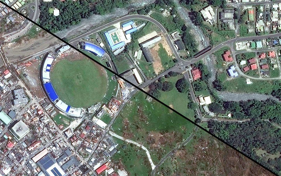
MDA Completes Acquisition of DigitalGlobe, Company Renamed Maxar Technologies
MacDonald, Dettwiler and Associates (MDA) completed its acquisition of DigitalGlobe. The newly combined company will offer a broader set of space-based solutions, increased scale and a more-diversified revenue base.
National Geospatial-Intelligence Agency Awards Leidos Prime Contract for Information Technology Management
RESTON, Va.- Leidos (NYSE: LDOS), a FORTUNE 500® science and technology company, was awarded a prime contract by the National Geospatial-Intelligence Agency (NGA) under the Information Technology Enterprise Management (ITEMS) User Facing Services (UFS) program. This...
DJI Unveils Technology To Identify And Track Airborne Drones
BRUSSELS - DJI, the world's leader in civilian drones and aerial imaging technology, today unveiled AeroScope, its new solution to identify and monitor airborne drones with existing technology that can address safety, security and privacy concerns. AeroScope uses the...
VRMesh V9.5 Available with New Advanced Features for LiDAR Strip Adjustment
Seattle, WA - VirtualGrid is pleased to announce the availability of VRMesh v9.5, the latest version of its powerful 3D point cloud and mesh processing software. This new release provides a simple and fast way for LiDAR strip adjustment with high accuracy. It adds a...
NavVis Partners with PrecisionPoint to Bring the American Indoors Online
NavVis, the global leader in indoor mapping, visualization, and navigation, announces a new partnership with PrecisionPoint, a leading reality capture solutions provider in the USA. PrecisionPoint is now an official NavVis technology service provider offering NavVis...
Less than 50 Booths Left and 4 Months to go until ILMF 2018
We have just four months to go until the 2018 International LiDAR Mapping Forum (ILMF) and the American Society for Photogrammetry & Remote Sensing (ASPRS) Annual Meeting will take place, February 5-7, 2018 in Denver, Colorado. There will be one combines exhibit...
