Des Plaines, Ill., April 1, 2014—URISA is pleased to announce the details for GIS-Pro 2014: URISA's 52nd Annual Conference taking place September 8-11, 2014 in New Orleans. Join us for exceptional education and discussions focused on Leveraging Spatial Technology in...
USGIF CEO Discusses Flight 370 on CNN
Herndon, Va., April 3, 2014—In the last week, USGIF CEO Keith Masback has appeared on CNN five times to discuss GEOINT's role in locating missing Malaysia Arlines Flight 370. Masback first appeared March 24 on CNN's The Lead after investigators concluded via...
DMCii Helps Dutch Company eLEAF Provide Crop Information to African Farmers
Guildford, United Kingdom, April 4, 2014—eLEAF, a Netherlands-based high-tech company that supplies reliable, quantitative data on water and vegetation in order to support sustainable water use, increase food production, and protect environmental systems have...
Earth Observation Competition Searching for Outstanding Application Ideas
Oberpfaffenhofen, Germany, April 3, 2014—Today marks the launch of Sentinel-1A, the first dedicated satellite in the European Earth observation programme Copernicus. The data it emits from space will open doors to countless potential applications along the entire...
European Space Imaging Partners with Skybox Imaging to Offer New Challenge for the Copernicus Masters¨
Munich, Germany, April 3, 2014—European Space Imaging has a new partner to support their High-Res Challenge which is now called “European Space Imaging & Skybox Imaging High-Res Challenge†and is open worldwide to participants. Their new partner, Skybox...
NASA Selects Orbital’s Pegasus Rocket to Launch 8 CYGNSS Science Satellites
DULLES, Va.—Orbital Sciences Corporation (NYSE: ORB), one of the world’s leading space technology companies, today announced that the National Aeronautics and Space Administration (NASA) has awarded the company a contract to launch the Cyclone Global Navigation...
RIEGL Opens New Sales Office in China
Horn, Austria, April 2, 2014—RIEGL Laser Measurement Systems proudly announces the opening of its new sales office in Beijing, China. RIEGL laser scanners have been sold successfully for several years in China through its distribution partners, Five Star Electronics...
UltraCam Eagle Purchased by TopGis in Czech Republic
Graz, Austria, April 3, 2014—TopGis, Ltd., has contracted to purchase an UltraCam Eagle digital aerial photogrammetric camera system with an 80mm lens from Microsoft’s UltraCam business unit and subsidiary. The primary focus of TopGis is photogrammetric aerial...
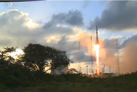
Europe Lofts First Copernicus Environmental Satellite
The ability of European citizens, policymakers and service providers to routinely access key environmental data took a major step forward with the launch of the European Space Agency's Sentinel-1A satellite on April 3, 2014.
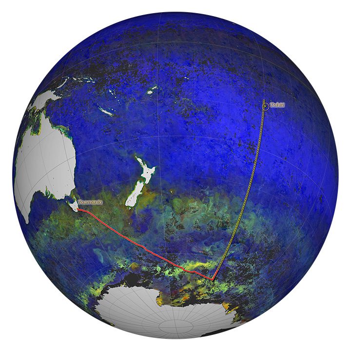
Keeping Satellite Sensors Honest
Satellite sensors start collecting data soon after launch, but it takes time”and work on the ground”to ensure those observations are accurate and meaningful.
